

NEW YORK (WABC) — A strengthening nor’easter is expected to bring another round of heavy rain, powerful wind gusts and significant coastal flooding to the New York City area through the weekend, creating hazardous travel conditions and the potential for downed trees, power outages and flooded roadways.
Rain intensified across Manhattan on Saturday night as low clouds and gusty northeast winds moved through the region. Conditions were especially challenging north and west of the city, where a persistent band of rain affected the Hudson Valley. Along the coast, some communities reported some of the strongest wind gusts of the day, with gusts approaching 50 mph on eastern Long Island and exceeding 30 mph in New York City.
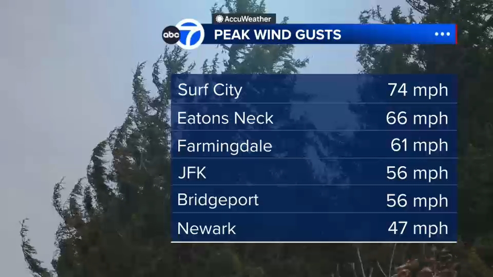
Reports of storm damage began to emerge, including downed trees in Orient and East Hampton on Long Island. In northern Westchester County, trees and wires were reported down on South Bedford Road, while a fallen tree blocked portions of U.S. Route 9 in Montrose. There were also concerns about tidal flooding along the Hudson River.
The storm is expected to pivot closer to the coast overnight, sending additional heavy rain back across the Tri-State area. The heaviest rain is expected to spread from eastern Long Island into New York City and the northern suburbs through the overnight hours. Rainfall totals of 1 to 2 inches had already fallen on eastern Long Island by Saturday evening, with more than a half-inch recorded in the city. An additional 1 to 3 inches of rain is possible, with isolated higher amounts.
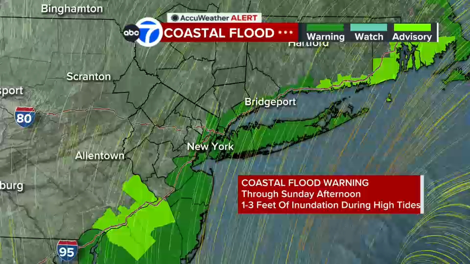
Coastal flooding remains a major concern, particularly during the next two high-tide cycles. Strong onshore winds are expected to continue pushing water toward the shoreline, preventing floodwaters from fully receding between tides. Areas including Freeport and Lindenhurst on Long Island are forecast to experience moderate to major flooding, while parts of Staten Island, the Jersey Shore and coastal Connecticut could also see flood impacts.
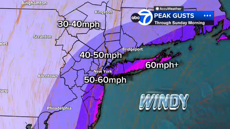
Wind gusts are expected to strengthen as the center of the storm approaches. Forecast models indicate gusts could exceed 50 mph near Islip and Bridgeport before daybreak, with gusts over 40 mph possible in New York City. The combination of saturated ground and strong winds raises the risk of additional downed trees and scattered power outages.
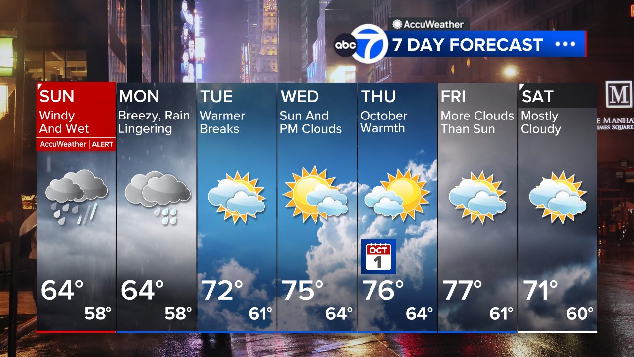
The storm is expected to gradually weaken Sunday, but periods of rain may continue through the day, including another round later Sunday evening. That could create additional travel delays and extend wet conditions into the Monday morning commute. While rainfall is expected to end by Monday evening, lingering clouds may persist into Tuesday before drier and brighter weather returns by midweek.
Residents should be prepared for flooded roadways, reduced visibility, strong crosswinds on bridges and overpasses, and slower travel throughout the weekend and into the start of next week.
Stay with the Eyewitness News AccuWeather team for continuing updates on the nor’easter.RELATED | Watches, warnings and advisories from the National Weather Service
Please fill out the form below to submit weather photos and videos.
MORE ACCUWEATHER RESOURCES
Check AccuTrack Radar
NWS Advisories, Watches and Warnings
School closings and delays
Follow chief meteorologist Lee Goldberg, Sam Champion, meteorologist Brittany Bell, meteorologist Jeff Smith, and meteorologist Dani Beckstrom on social media.