

As we have been mentioning for nearly a week, Syracuse and nearly all of Central New York just had its coldest low temperature and coldest high temperature in about 4 and a half months!
This were Syracuse’s observed temperatures Tuesday:
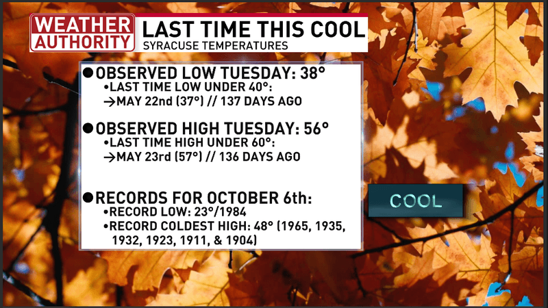
Syracuse just had its coldest low temperature & coldest high temperature since late May
Even though Syracuse had its coldest temperatures since the end of May, neither our low temperature nor our high temperature were anywhere near close to record levels. The record low of 23 degrees and record coldest high of 48 degrees for October 6th were much lower than what we received Tuesday.
After another chilly evening and night Tuesday night, temperatures should rebound to slightly above average levels by Wednesday afternoon.
It’s part of our next weather makers:
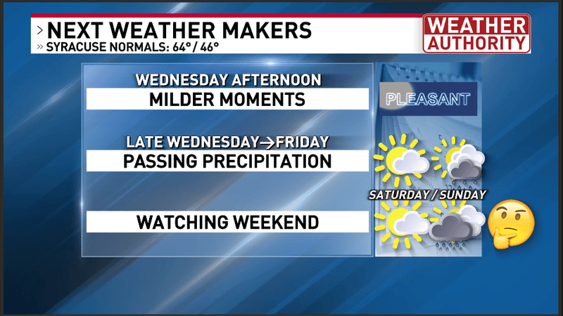
Central New York’s next weather makers
Expect sunshine to mix with increasing afternoon clouds on Wednesday. The best chance for a shower before sunset will be over and east of Lake Ontario and into the North Country. For Central New York, while a shower may occur late in the day, there is better chance for some passing scattered rain showers for Wednesday night.
Ahead for Thursday, Thursday night and Friday, we will be dealing with a couple of weak cold fronts and some lake enhanced moisture off of the Upper Great Lakes and Lake Ontario. The general wind flow is mostly westerly during this period. At times, we the wind flow will bend a bit further south into Central New York but will mainly cause extra lake enhanced clouds and showers mostly north of Route 31 and east of Lake Ontario.
The net result is that everyone will be at risk for on and off passing scattered rain showers at any time between Wednesday night through Friday. However, for Central New York my feeling is that it will probably be dry more often than wet. Otherwise, after a milder Wednesday afternoon, high temperatures will slowly return closer to cooler averages by Friday.
As we get into the weekend, there are a few things we are watching. First, as some milder weather tries to return by Saturday afternoon, we have a risk for some mid and high-level cloudiness with sunshine. We are somewhat uncertain how thick these clouds will be. However, I am hopeful that they will be thin enough to still allow for temperatures to rise into the upper 60s to lower 70s. Thereafter, I am watching a developing tropical system which will likely become Isaias and potentially a hurricane. Regardless, while we will not see any huge wind, there is an increasing risk that our area will see thickening cloud coverage and potentially some rain. As always with tropical systems, they are highly uncertain, so we will continue to watch this carefully for you.
For more specifics, watch my video forecast below:
Video forecast from NBC3 News Live at 5:00 PM Tuesday October 6th, 2026