
After making landfall Friday night on the Florida Panhandle, Isaias will weaken quickly as it drops moderate to heavy rain over the Southeast and East Coast this weekend.
Storm Team 4Storm Team 4
While it may be weaker, it will draw in deep atmospheric moisture and deliver potential flooding rainfall to areas of the Southeast and Mid-Atlantic States.
Storm Team 4Storm Team 4
The deepest atmospheric moisture associated with Isaias – fuel to produce heavy downpours – will stay south of New York City. Alabama, Georgia, the Carolinas and Virginia will pick up the most rain, but the Tri-State Area is still in for a good soaking.
Storm Team 4Storm Team 4
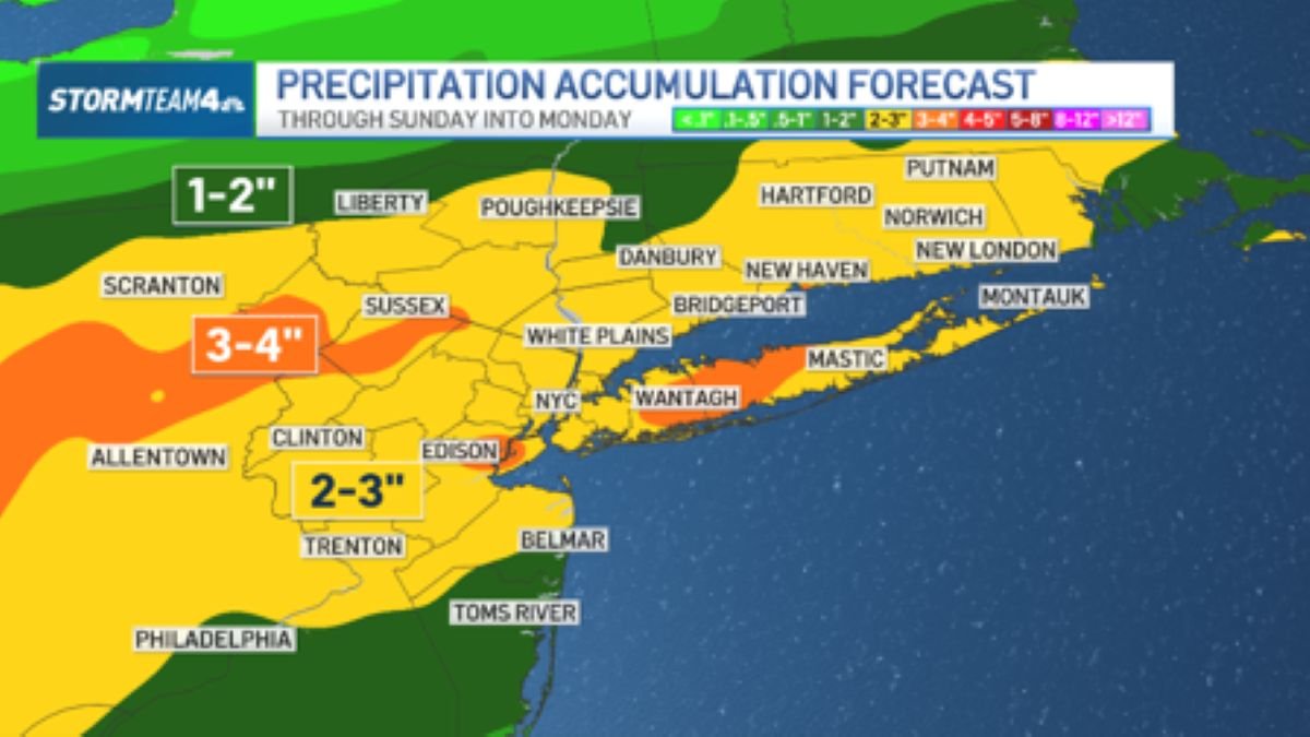
Two to three inches of rain from Sunday morning and Monday morning will be commonplace. Isolated four-inch totals will be possible in some spots.
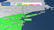
The Weather Prediction Center has placed parts of the East Coast under a slight risk for flash flooding Sunday and Sunday night. In the Tri-State Area, that includes areas from New York City southward.
Storm Team 4Storm Team 4
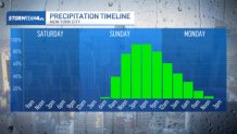
The rain will fall over a 24-hour period – ramping up early to mid-morning Sunday, continuing steadily through the afternoon and evening, then tapering off overnight. A few showers could hold on into early Monday morning before ending completely.
Storm Team 4Storm Team 4
Because the rain will be spread over an extended time, the flood threat will be low.
Stay with NBC New York on air, online and on social media for updates on this forecast that could impact your Columbus Day weekend plans.