
Today won’t be as harsh as yesterday.
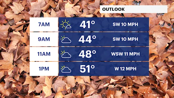
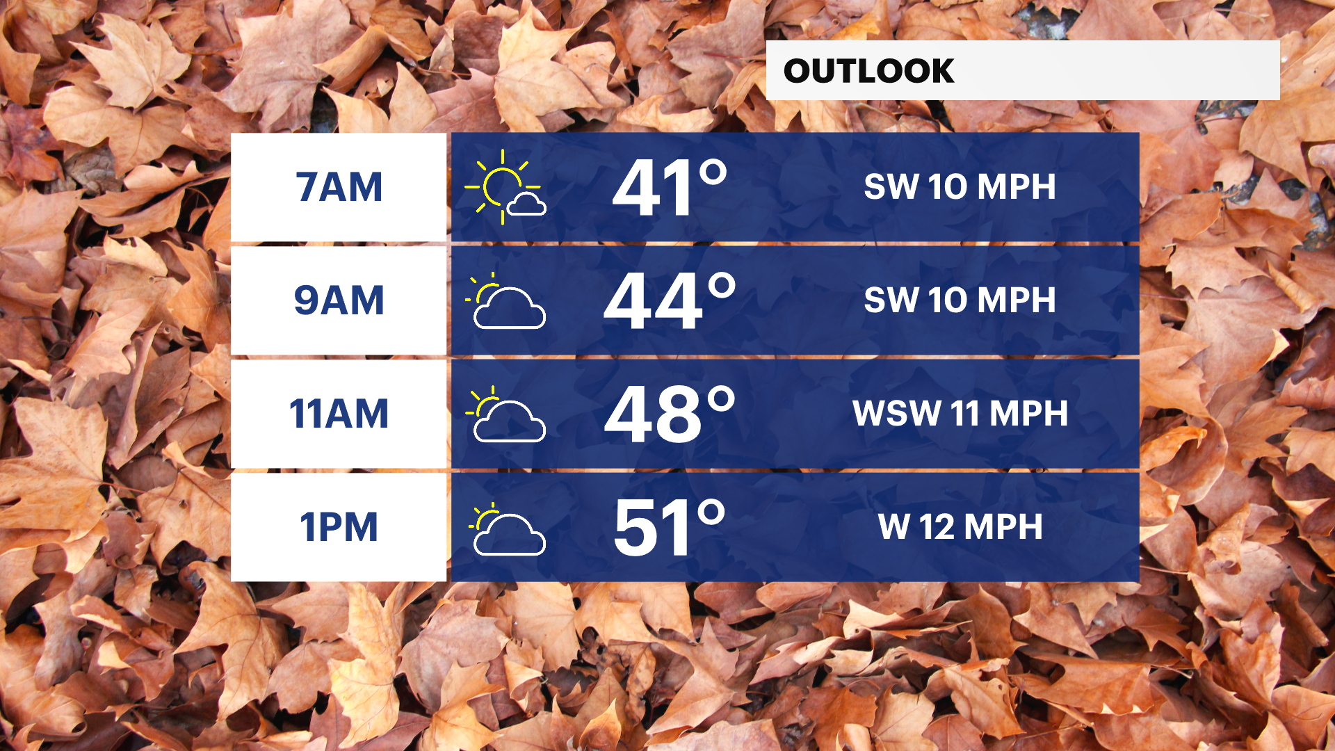
This morning is still cold, but the winds aren’t as intense. Temperatures are in the upper-30s with wind chills in the low-30s.
Clouds dominate our sky today with chilly temperatures in the upper-40s to low-50s and brisk winds gusting up to 30 mph. Feel-like temperatures will be in the low-40s.
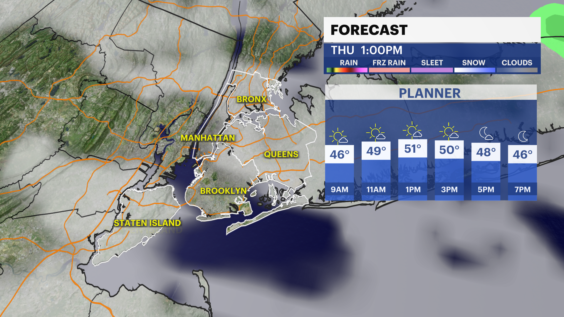
The sunshine returns over the next few days with temperatures moderating a bit to the 50s.
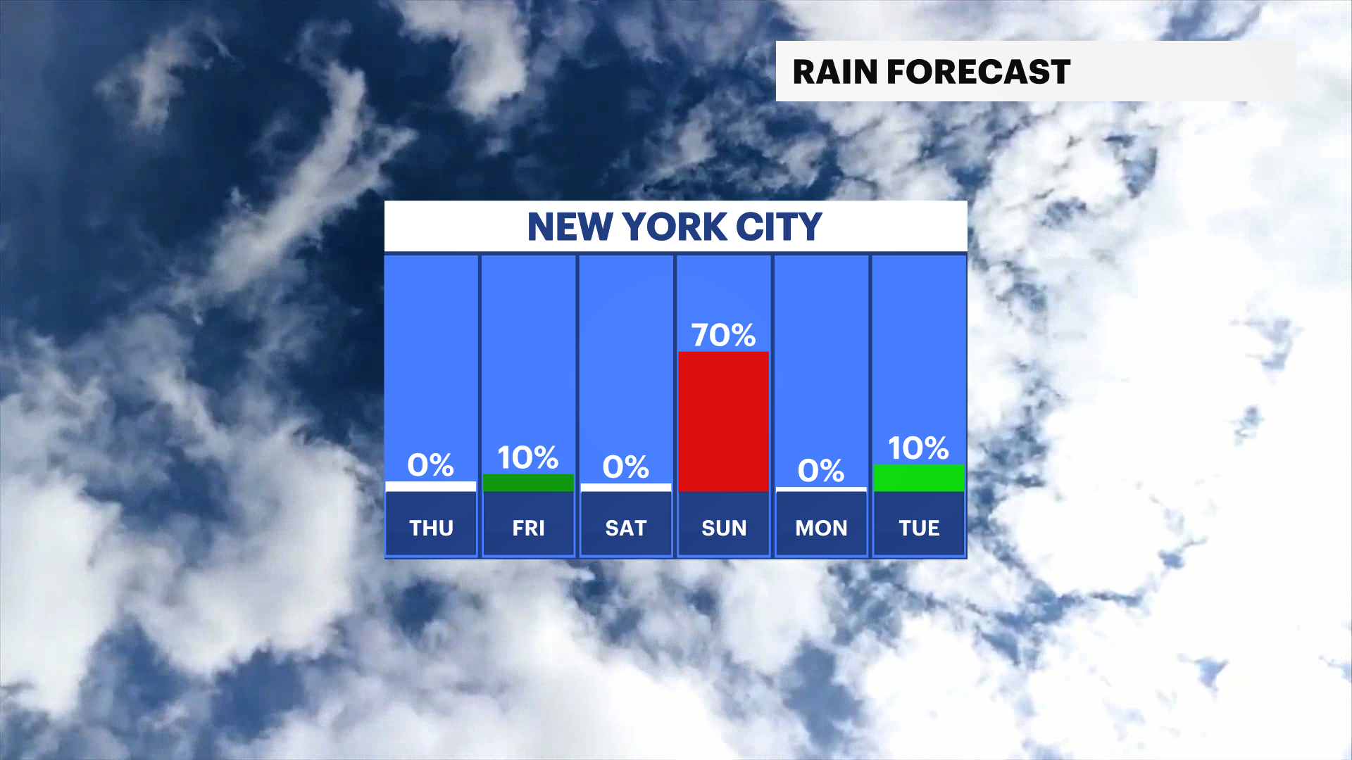
This weekend will be cool but mostly dry. Our next chance of rain is Saturday night into Sunday. The second half of Sunday could be drier. Stay tuned for updates!
TRACKING THE TROPICS: There are currently no tropical disturbances in the Atlantic over the next 7 days. Hurricane season doesn’t officially end until Nov. 30. Stay tuned for updates!
Today: Limited sun and a chilly breeze. Highs near 49.
Tonight: A few clouds, not as cold and still breezy. Lows near 42.
Thursday: Brighter, cool and breezy. Highs near 53. Lows near 38.
Friday: Cool and mostly sunny. Brisk breeze. Highs near 51. Lows near 35.
Saturday: Mostly sunny and chilly. Chance of PM rain. Highs near 48. Lows near 38.
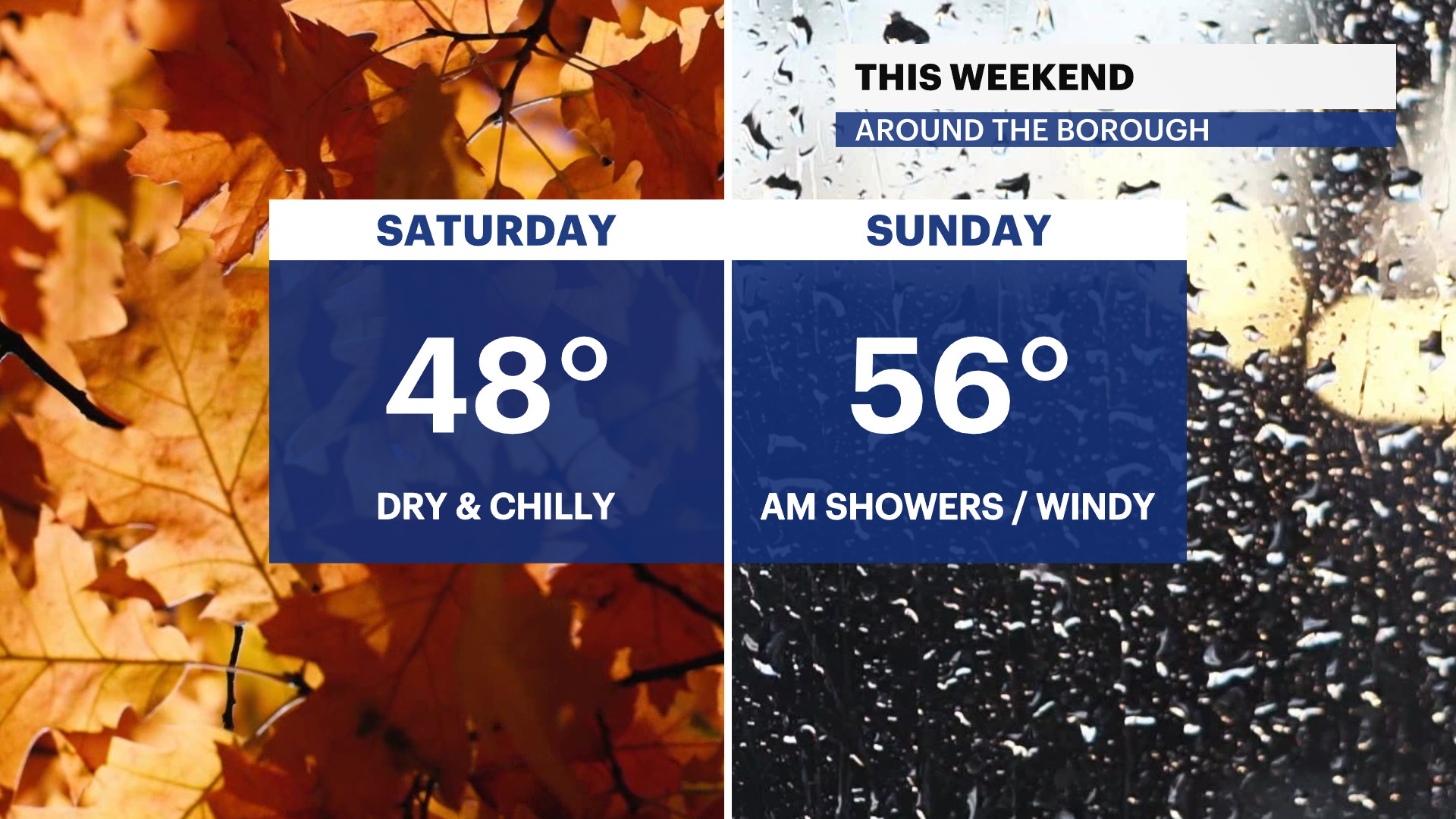
Sunday: Chance of AM rain. Cool and partly sunny. Turning windy. Highs near 56. Lows near 43.
Monday: Partly sunny, chilly and breezy. Highs near 51. Lows near 40.
Tuesday: Bright and unseasonably cool. Highs near. 49. Lows near 38.