
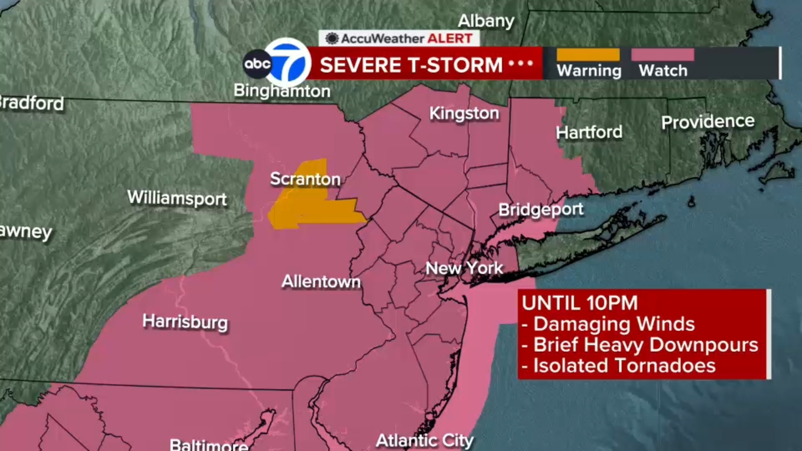
NEW YORK (WABC) — A Severe Thunderstorm Watch has been issued for the area as a strong line of thunderstorms is expected to bring damaging wind to the Tri-State.
The storm watch is in effect through 10 p.m. and brings a threat of hail, lightning and wind gusts up to 70 mph are possible.
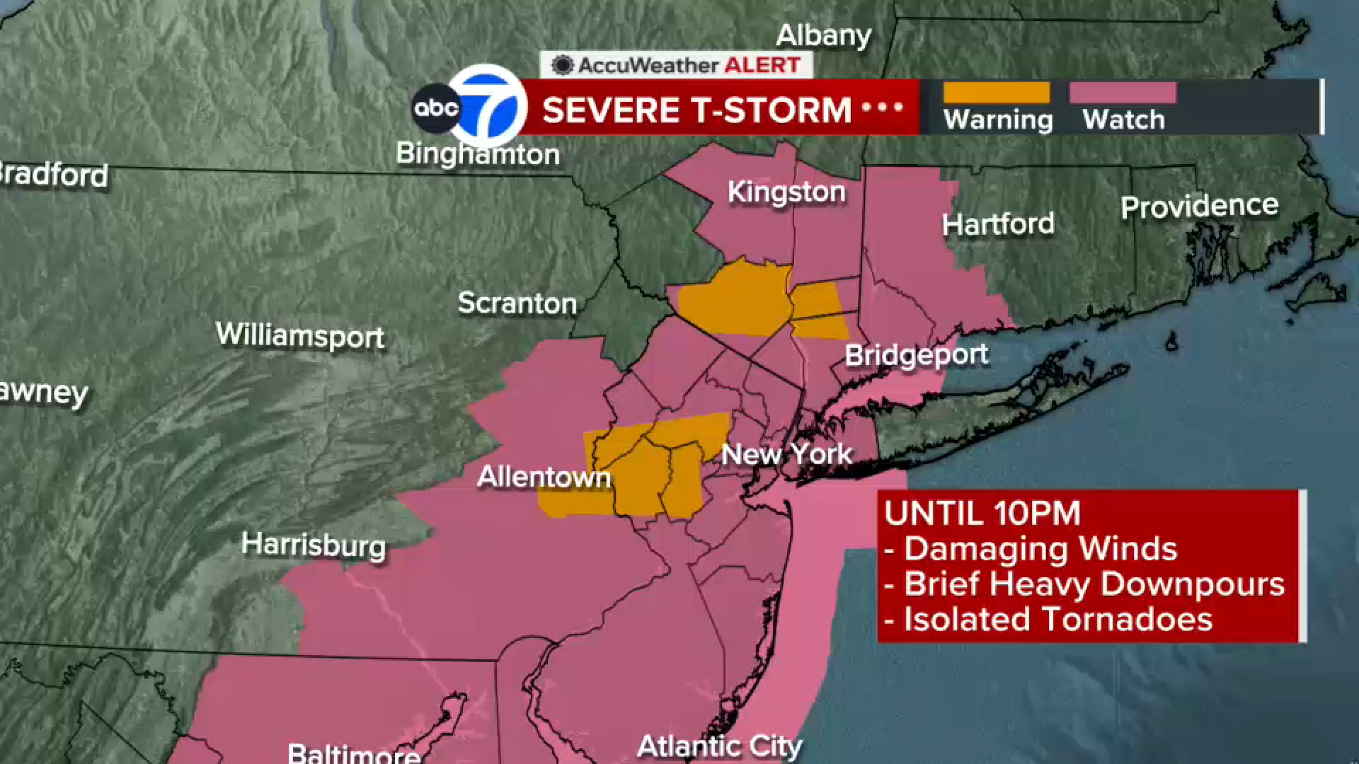
A Severe Thunderstorm Warning has also been issued for parts of the Hudson Valley region, and northwestern New Jersey.
Between roughly 6 p.m. and 9 p.m., a line of strong to potentially severe thunderstorms will develop and track through during the dinner hour.
RELATED | AccuTrack Radar | Watches, warnings and advisories from the National Weather Service
Most of the region remains under a Level 2 risk for severe weather, meaning some storms could become strong enough to produce damaging conditions.
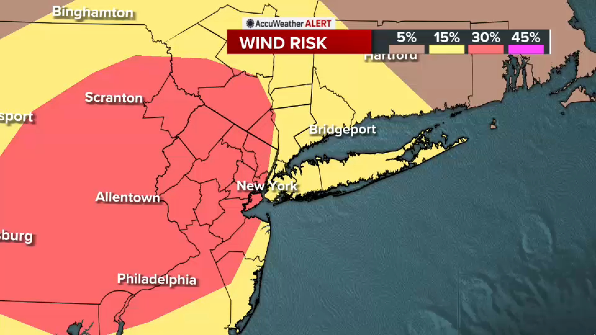
While heavy rain is also possible, damaging winds are expected to be the main hazard associated with the strongest storms.
As the front moves through, it will leave behind a dramatic change in temperatures. A Freeze Watch has been issued for northwest New Jersey late Saturday night and into Sunday.
Saturday will feel dramatically different, with temperatures struggling to rise out of the 50s. Highs are expected to be about 20 degrees lower than Friday’s, and persistent blustery winds will make it feel even colder. Wind chills could make temperatures feel more like the 40s during the morning hours.
The weekend remains cool, with highs staying in the 50s. Conditions will improve somewhat on Sunday as winds ease, making it feel less harsh despite the continued cool temperatures.
———-
* Download the abc7NY app for breaking news alerts
Submit Weather Photos and Videos
Have weather photos or videos to share? Send to Eyewitness News using this form. Terms of use apply.
Copyright © 2026 WABC-TV. All Rights Reserved.