
Here’s what you need to know:
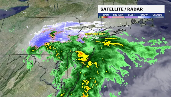
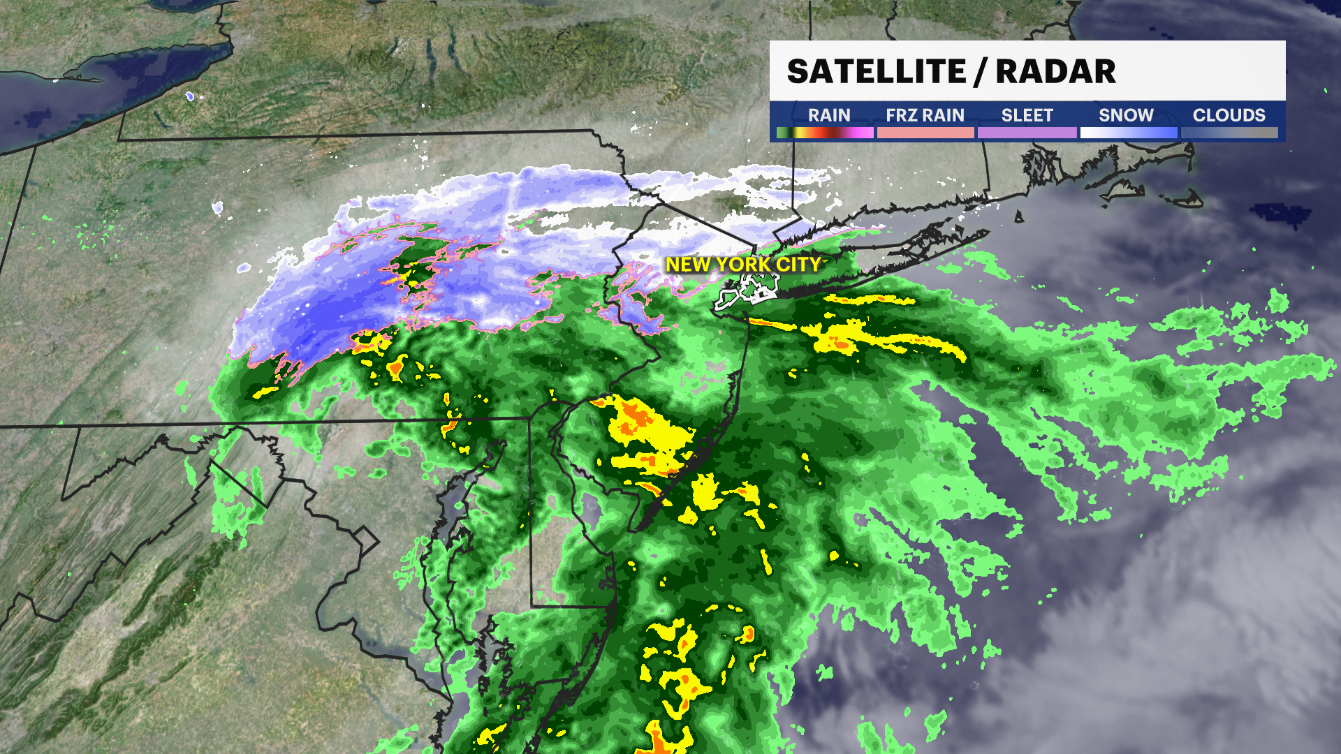
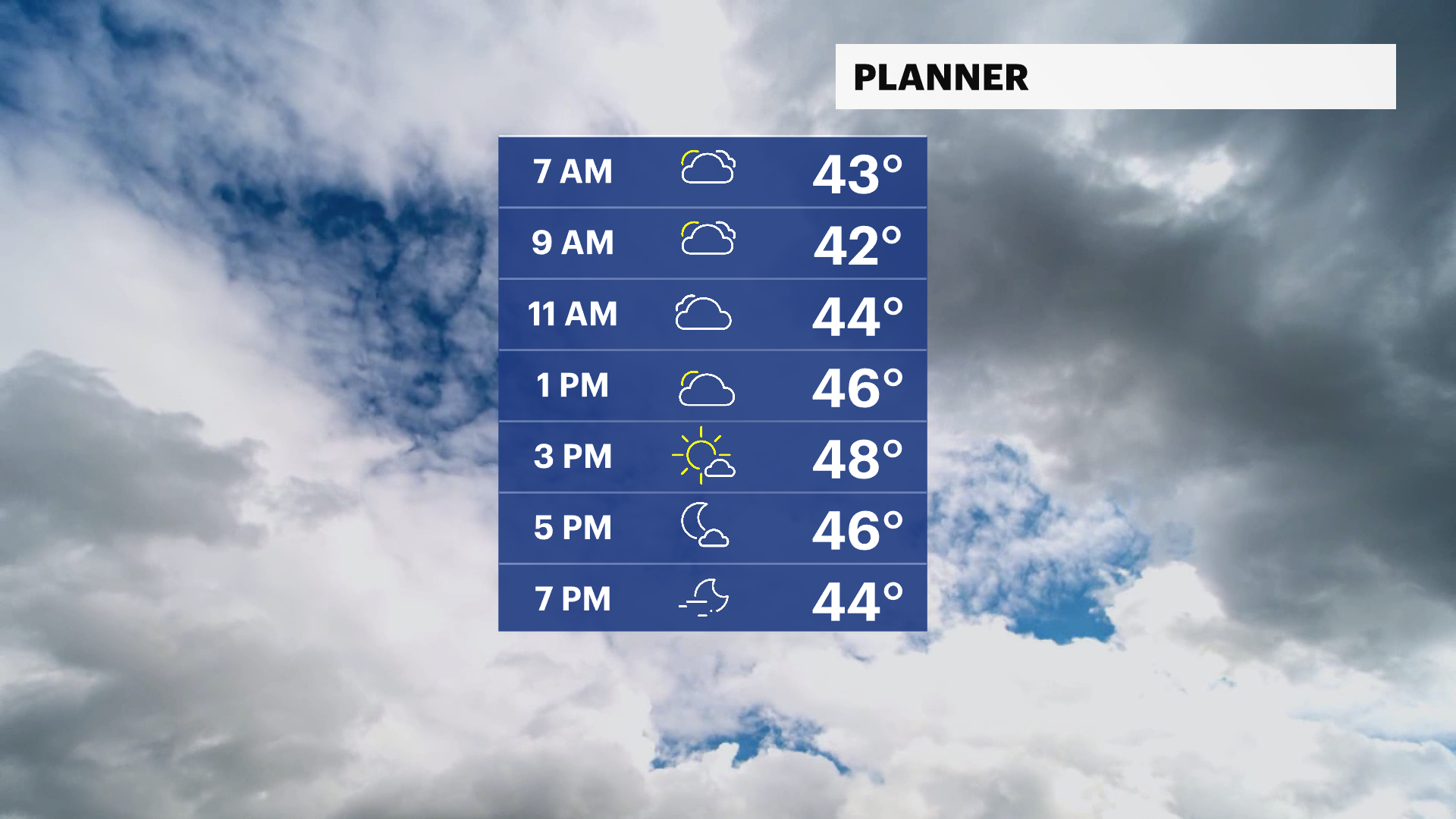
It’s a wet and cold start to the day with wake-up temperatures in the upper 30s, near 40.
Some light rain on the fallen leaves will bring some slick and slow travel for the morning rush.
Rain exits around 9 a.m., leaving behind stubborn clouds and chilly temperatures in the 40s this afternoon. Weather conditions will slowly improve through this evening with a few breaks in the clouds before sunset.
Temperatures will stay below normal in the 40s through Thursday. Above normal temperatures return on Friday with highs in the mid 50s. A cold front will move through the city bringing another chance of showers Friday night into early Saturday morning. Stay tuned the timing.
The weekend looks mainly dry with highs in the 50s with lots of sunshine. Weather conditions look milder with a chance of rain leading into the Thanksgiving holiday. Stay tuned for updates.
TRACKING THE TROPICS: There are currently no tropical disturbances in the Atlantic over the next 7 days. Hurricane season doesn’t officially end until November 30th. Stay tuned for updates!
Today: Morning light rain. Cloudy early with a few breaks in the evening, chilly and calm. Highs near 48.
Tonight: Mostly cloudy, not as cold, and light winds. Lows near 40.
Thursday: Sun, clouds, chilly with light winds. Highs near 48. Lows near 46.
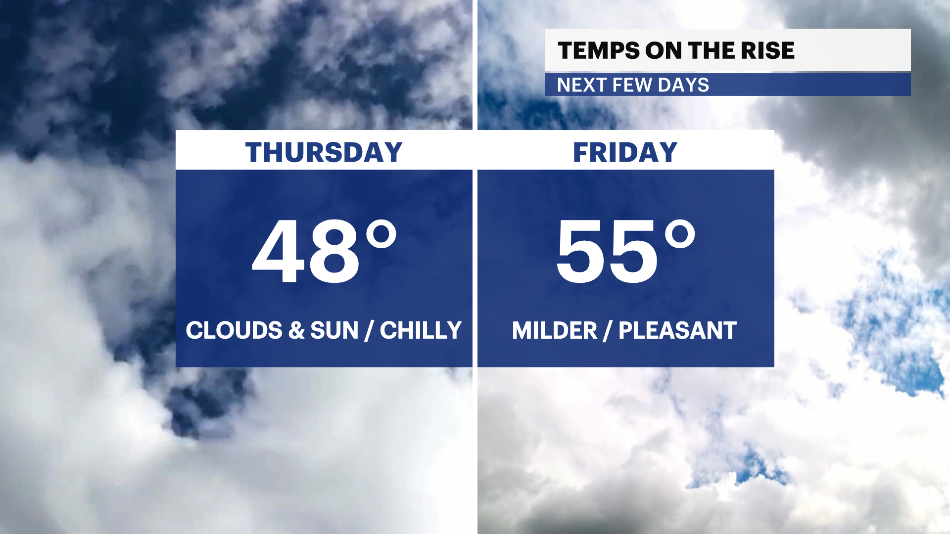
Friday: Hints of sun and slightly above seasonable. Chance of late rain. Highs near 55. Lows near 43.
Saturday: Chance of morning rain. Brighter and a bit cooler. Highs near 51. Lows near 39.
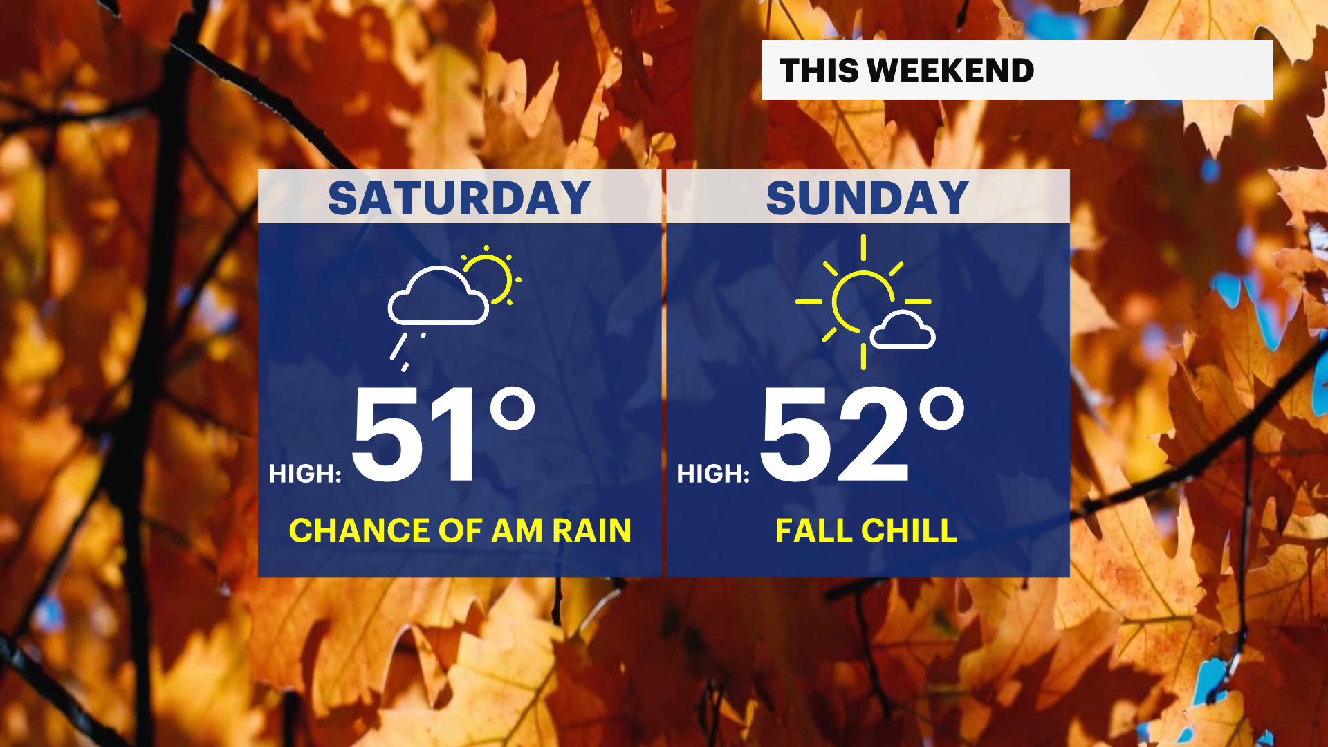
Sunday: Seasonable and mostly sunny. Breezy. Highs near 52. Lows near 42.
Monday: Bright and cool. Lighter winds. Highs near 54. Lows near 41.
Tuesday: Partly sunny, cool with a light breeze. Highs near 52. Lows near 39.