
The first nor’easter of the season is battering the Eastern Seaboard, already causing nearly 100 flood events and forcing coastal communities from Florida to Massachusetts to brace for more rain, strong winds and flooding.
Some of the nation’s most populated metro areas are directly in the storm’s path. New York City and Washington, D.C., along with other major cities along the coast, could face coastal flooding, travel disruptions, and power outages as the storm moves northward.
Governor Kathy Hochul declared a state of emergency late Sunday, Oct. 12, over New York City, Long Island and Westchester County
“As the Nor’easter continues making its way through New York, I’m declaring a State of Emergency across boroughs and counties most impacted by the storm,” Hochul said. “The safety of New Yorkers is my top priority, and I continue to urge extreme caution until the storm has passed through the state.”
Airport areas — including JFK, LaGuardia, Newark, and Teterboro — may see gusts of 29 to 40 mph this afternoon, gradually easing to between 23 and 29 mph by early Tuesday, Oct. 14, according to the National Weather Service area forecast discussion.
Winds could make outdoor activities hazardous and affect flights.
What is a Nor’easter?
A Nor’easter is a storm along the East Coast of North America that typically blow over coastal areas. These storms can occur at any time of year but are most frequent and most intense between September and April, according to the National Weather Service.
Nor’easters usually develop between Georgia and New Jersey, within about 100 miles of the coast, and generally move northeastward, reaching maximum intensity near New England and the Canadian Maritime Provinces. They often bring heavy precipitation — rain or snow — along with gale-force winds, rough seas and sometimes coastal flooding.
Potential impacts of the Nor’easter in New York
Heavy rain: 1–2 inches of rain are possible into Monday. Showers will increase in the morning and continue off and on throughout the day. Visibility may be reduced, and minor flooding could occur in low-lying, flood-prone areas.
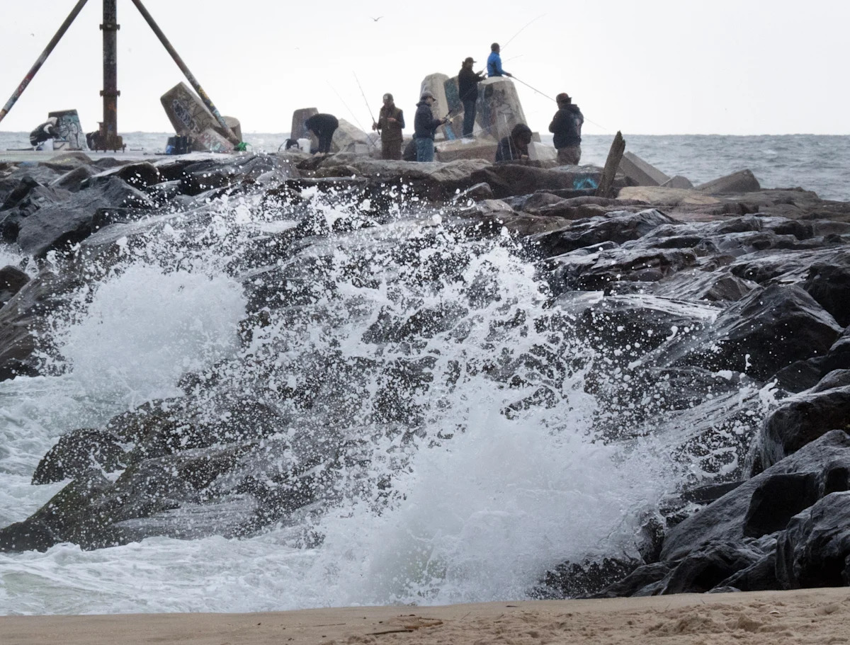
Strong winds: Gusts could reach 40–60 mph along exposed shorelines, including Long Island and the Connecticut coast. Winds will gradually ease later in the day.
Coastal flooding and storm surge: A Coastal Flood Warning is in effect through 6 p.m.. Water could rise 1½–2½ ft above ground level in vulnerable waterfront areas. Moderate flooding is likely in New York Harbor and tidal inlets, with locally major flooding possible in southern Nassau and southwestern Suffolk counties. Minor beach erosion and small overwashes are expected along the oceanfront.
Marine hazards: Gale-force winds and rough seas will make boating dangerous. Waves could reach 5–7 ft in Long Island Sound, with up to 12 ft in the eastern Sound. Conditions will gradually improve as the storm moves offshore, but rough seas may persist into Wednesday.
Travel and safety: Heavy rain and strong winds could make driving hazardous. Flooding may spread inland via tidal rivers and bays like the Hudson, Hackensack, and Passaic. Officials warn against driving through flooded roads and say barriers may close key streets near the waterfront. High tide cycles, especially midday, present the greatest risk.
How do Nor’easters develop?
The U.S. East Coast provides an ideal environment for Nor’easters. In winter, the polar jet stream pushes cold Arctic air south across Canada and the U.S., then east toward the Atlantic Ocean, according to the National Weather Service. At the same time, warm air from the Gulf of Mexico and the Atlantic moves northward. The contrast between the cold land air and relatively warm coastal waters — kept mild by the Gulf Stream — fuels these storms, creating the strong winds and precipitation that define a Nor’easter.
Do Nor’easters always have snow?
No. Whether a Nor’easter brings snow, rain, or a mix depends on the storm’s track and temperatures:
Snow: Most common in the northern Mid-Atlantic and New England when Arctic air dominates.
Rain: More likely in the Southeast and southern Mid-Atlantic, where temperatures are warmer.
Mixed precipitation: Possible in areas near the transition zone, with sleet or freezing rain.
Even without snow, Nor’easters can still produce strong winds, heavy rain, rough seas and coastal flooding, making them dangerous storms regardless of the type of precipitation.
Why is it called Nor’easter?
It’s called a Nor’easter because of the direction of the prevailing winds during the storm. In these systems, the winds along the coast usually blow from the northeast.
How do Nor’easters differ from tropical storms or hurricanes?
Nor’easters are typically associated with colder seasons and form from a temperature contrast between cold Arctic air and relatively warm Atlantic waters.
Tropical storms and hurricanes form over warm tropical or subtropical waters, and predominantly develop in warmer months.
Nor’easters also have a larger wind field, while tropical storms have a well-defined eye with the strongest winds near the center.
New York weather watches and warningsStay informed. Get weather alerts via text
Brandi D. Addison covers weather across the United States as the Weather Connect Reporter for the USA TODAY Network. She can be reached at baddison@gannett.com. Find her on Facebook here.
This article originally appeared on Rockland/Westchester Journal News: State of emergency declared in NY as nor’easter slams East Coast