
Here’s what you need to know:
It’s a clear, chilly and breezy start to the day. Temperatures are in the mid to upper 40s.
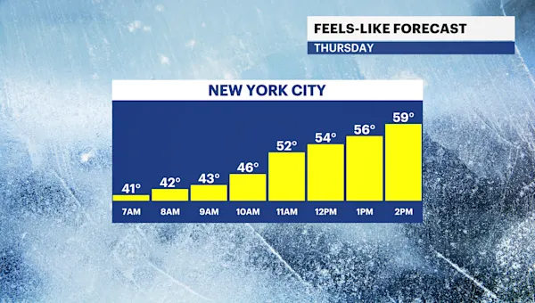
Today will be the coolest day this week with highs will be in the upper 50s. Expect loads of sunshine, windy conditions and feel-like temperatures in the mid-50s.
It stays chilly through tomorrow morning with wake-up temperatures in the low to mid 40s.
Temperatures rise this weekend to the mid-60s to low 70s. It stays nice and dry for any outdoor Fall activities.
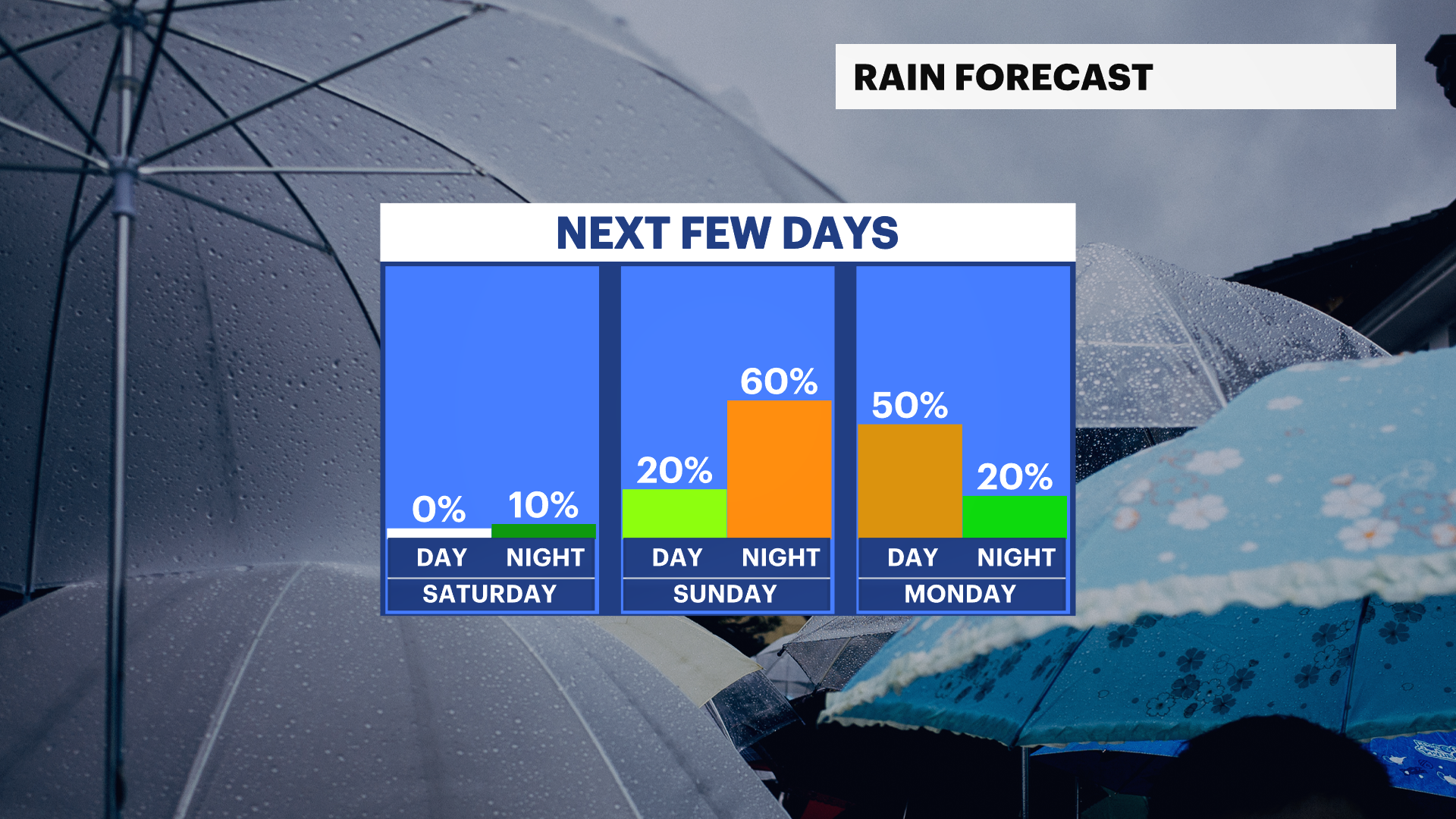
A cold front will bring a chance of rain and wind to our area on Sunday night Monday. The storm is trending weaker with lower impacts. Stay tuned for updates!
TRACKING THE TROPICS: There are currently no tropical waves or storms in the Atlantic. Even though we’ve passed the peak of hurricane season, it doesn’t officially end until Nov. 30.
Today: Sunny, cooler and windy. Highs near 59.

Tonight: Mostly clear and colder. Noticeably breezy. Lows near 44.
Friday: Bright, cool and pleasant. Highs near 62. Lows near 49.
Saturday: Sun with high thin clouds, nice and slightly milder. Highs near 65. Lows near 57.
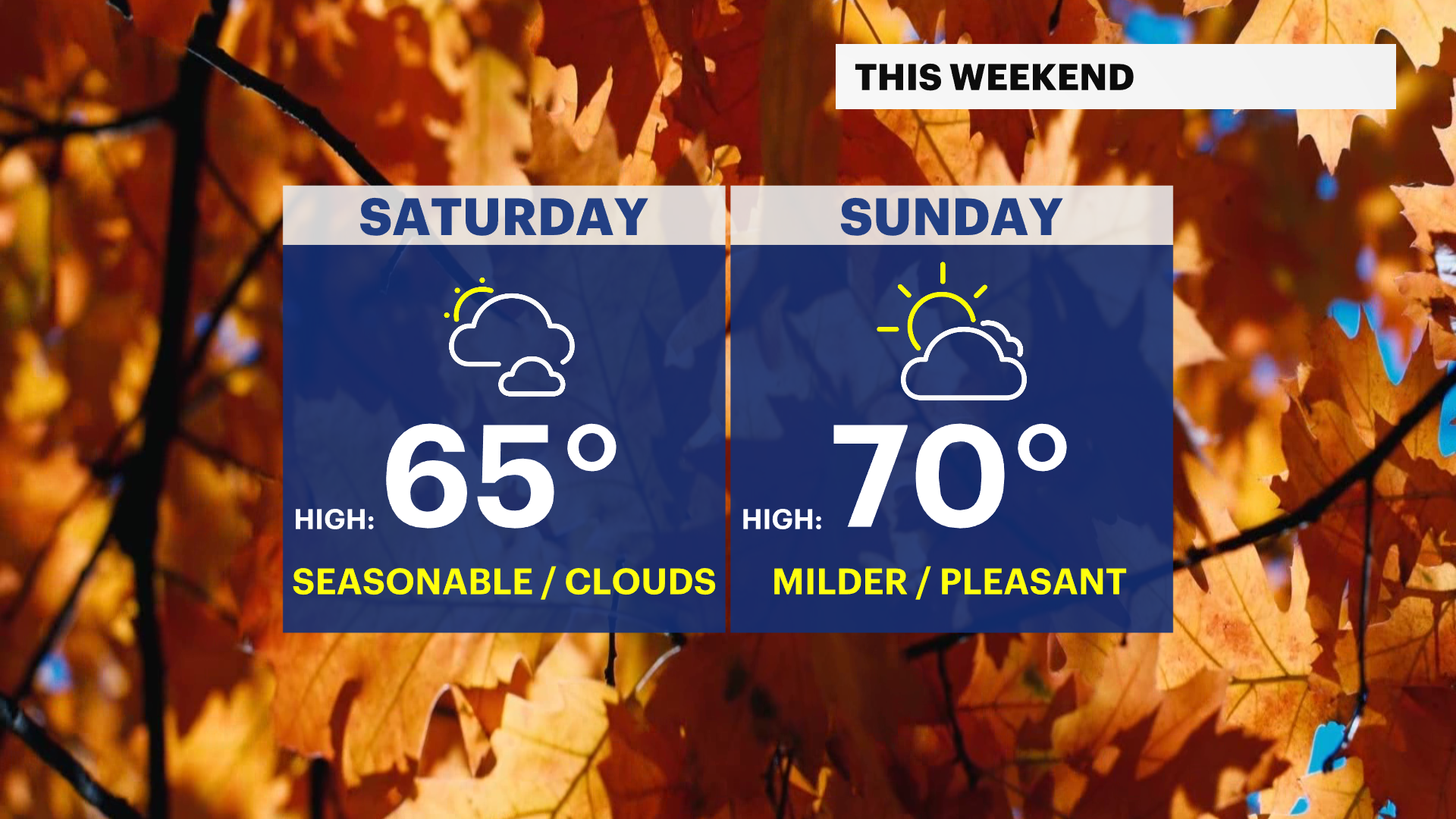
Sunday: Partly sunny, mild and pleasant. Chance of PM rain. Highs near 70. Lows near 58.
Monday: Partly sunny, a bit cooler and breezy. Chance of showers. Highs near 64. Lows near 54.
Tuesday: Brighter, seasonable and comfy. Chance of late rain. Highs near 65. Lows near 53.
Wednesday: Partly sunny, cool, and breezy. Chance of rain. Highs near 66. Lows near 52.