
A winter storm is coming to the Northeast starting on Saturday night and is set to blanket New York City and surrounding areas with the first measurable snowfall of the season.
Snow totals will be anywhere from one to three inches in the tri-state area, according to meteorologists.
Areas further north, including most of Connecticut, Massachusetts and Rhode Island, will likely see less than one inch of snow. In South Jersey, Delaware and Maryland, totals could range from three to five inches.
Precipitation will start as rain and move westward across the United States, NBC Weather reported. Across much of the region, Saturday temperatures will be above freezing before nightfall.
But by midnight, forecasters expect temperatures to drop to below freezing, which is when the rain will turn to snow.
Rain is expected to start at around 9pm ET and change over to snow by 12am. The storm will last for seven to eight hours and by 10am on Sunday, it will have likely moved over the Atlantic Ocean.
New York City, which usually gets its first major snowfall by this time of year, issued a weather alert through Sunday and has urged residents to be careful on the roads.
‘The winter season is in full swing, including all the winter weather that comes with it,’ Mayor Eric Adams said in a statement. ‘All New York City agencies are prepared for this system, and we continue to monitor conditions closely.’
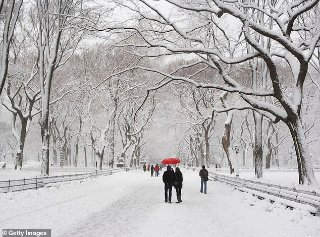
A winter storm is set to descend on the Northeast. The storm will from the western United States throughout Saturday. New York City is expected to get its first snowflakes by 9pm ET Pictured: Central Park after a snowfall
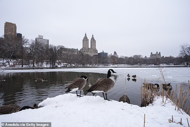
New York City is expected to get two to two-and-a-half inches of snow across all five boroughs A file photo shows birds on a patch of snow in Central Park on February 12, 2025

The fountain of the World War II Memorial in Washington, DC freezed over during a cold snap earlier this month
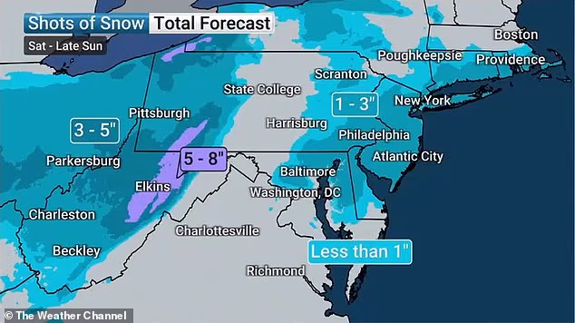
The snowfall expectations for various regions in the Northeast and Central US
‘New Yorkers should all prepare too – avoid driving and give yourself extra travel time with public transit if you do need to travel, stay alert to changing conditions, and sign up for Notify NYC for real-time information updates,’ the mayor added.
The National Weather Service said an advisory is in effect for New York from 10pm Saturday until 1pm on Sunday.
New York City is expected to get two to two-and-a-half inches of snow across all five boroughs, and neighboring New Jersey could see anywhere from one to five inches.
‘While the location of any 5+ inch amounts is less certain, the greatest chance for this is across the I-95 corridor and immediately to the southeast in southern N.J.,’ the NWS said.
The latest storm comes after the central and eastern US experienced a significant cold snap for the first two weeks of December.
States south of New Jersey and New York are gearing up for tough travel day on Sunday.
Northern West Virginia and areas bordering it could see snow accumulation of five to nine inches overnight, according to an NWS alert.
‘Persons should consider delaying all travel. If travel is absolutely necessary, drive with extreme caution. Consider taking a winter storm kit along with you, including such items as tire chains, booster cables, flashlight, shovel, blankets and extra clothing,’ the alert said.
‘Also take water, a first aid kit, and anything else that would help you survive in case you become stranded.’
Ohio and western Pennsylvania could see four to seven inches.
Lake-effect snow warnings are in effect for central and western New York through at least Sunday afternoon.
Share or comment on this article:
Quick-hitting storm to dump up to 3 inches of snow on NYC as weather warnings issued for East Coast