
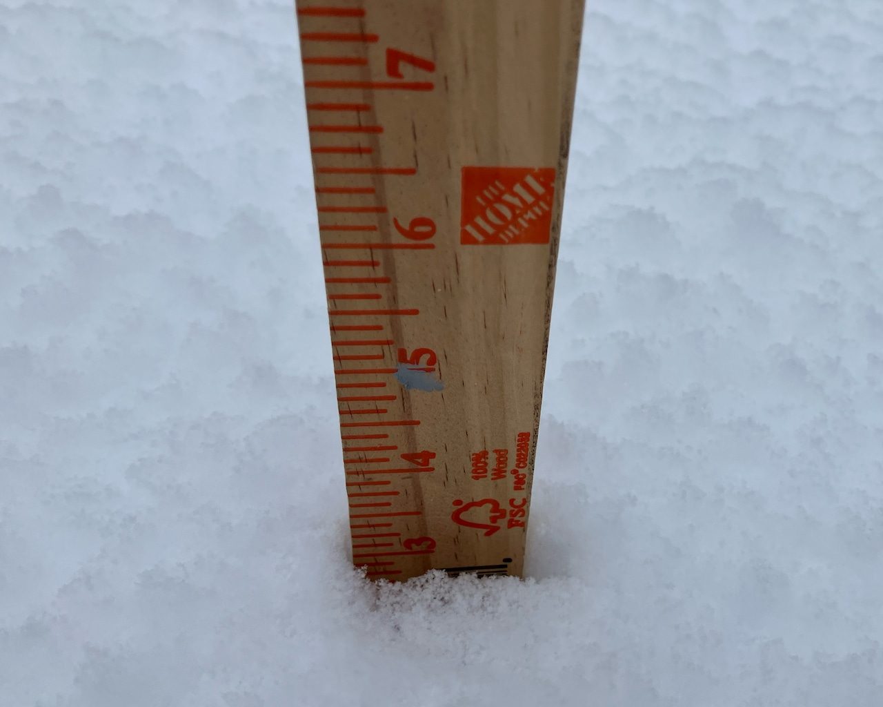
STATEN ISLAND, N.Y.— Staten Island saw about three inches of snow Saturday night into Sunday morning, according to reports from Advance/SILive.com staffers Sunday.
The staffers measured snow totals spanning the South Shore and Mid-Island. According to Advance/SILive.com measurements, both areas reported three inches of snowfall.
While a staffer in Midland beach reported 5.5 inches of snow.
Roads across Staten Island are relatively clear, according to security camera footage provided by 511ny.org.
While Staten Island saw consistent totals, snowfall totals varied significantly across the region, according to AccuWeather Meteorologist Tyler Royes.
Newark Airport recorded 2.4 inches, while areas further east saw much higher accumulations: Munchen received nearly five inches, Plainfield 4.7 inches and Cranford 4.5 inches.
To the east of Staten Island, John F. Kennedy Airport reported approximately 2.6 inches.
Royes said an additional half-inch to one inch of snow is expected to accumulate before the storm ends, increasing the final totals.
According to Royes, temperatures will steadily drop throughout Sunday from a high of 32 degrees to a low of around 20 degrees Sunday night.
Breezy conditions will create dangerous wind chills that will make it feel like the mid-teens in the afternoon and dropping to near-zero degrees Sunday evening.
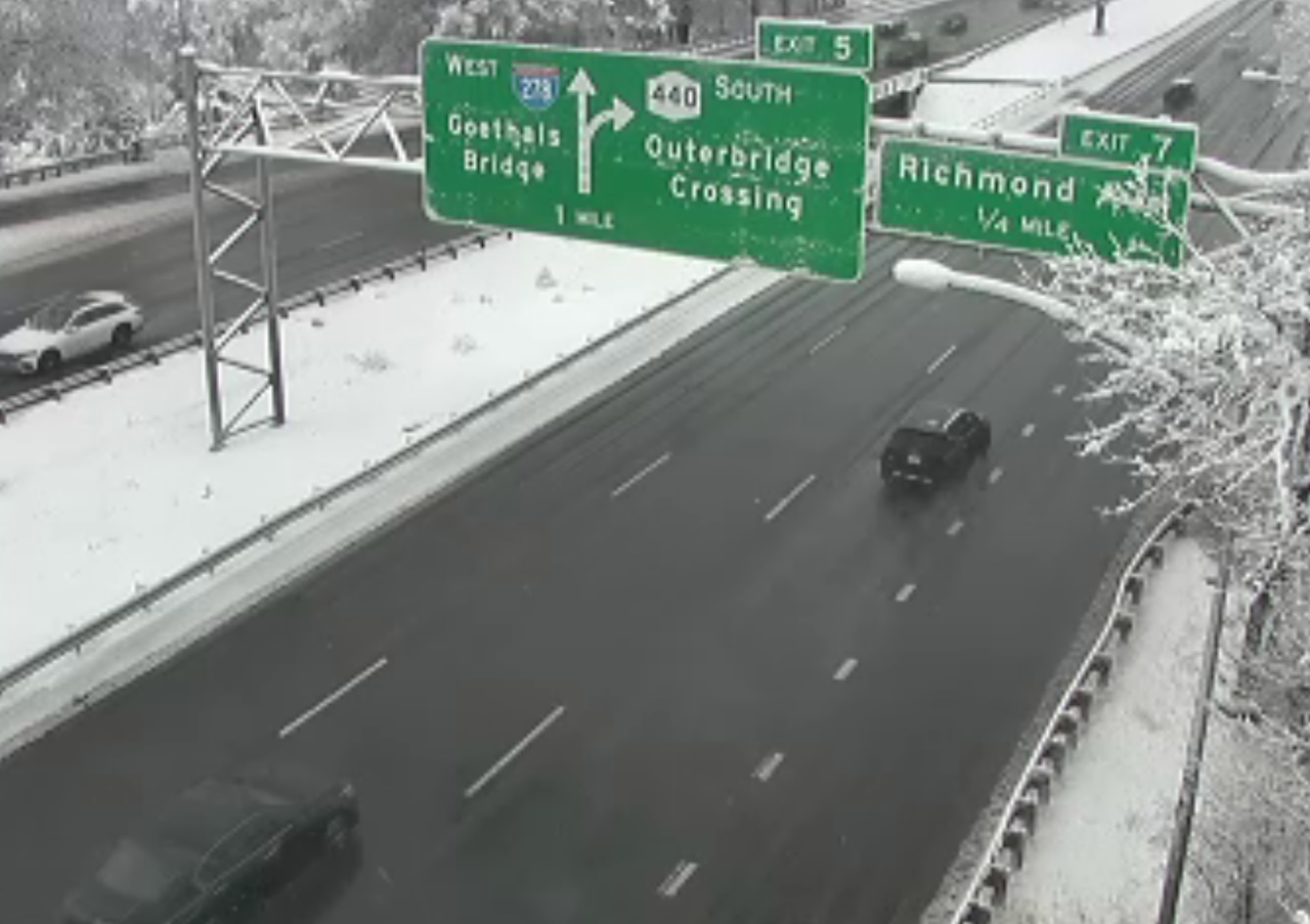 This image is of the clear roads of Staten Island Expressway on the morning of Dec. 14, 2025.511NYThis week’s forecast
While the actual air temperature is forecast to rise to about 30 degrees on Monday, the “real feel” temperature will remain dangerously low during the morning hours.
Monday is expected to be mostly dry but will become increasingly cloudy due to a separate storm system passing to the north.
The day will be mostly cloudy, particularly during the afternoon and evening hours, Royes said.
Monday morning will have a frigid “real feel” temperature of 3 to 5 degrees, requiring extra layers for warmth.
“Temperatures are going to be near zero as kids go out to the bus stop tomorrow,” Royes said.
Temperatures are forecast to climb into the mid-30s on Tuesday before a more significant warm-up midweek. Highs are projected to reach 44 degrees on Wednesday, 49 on Thursday, and 47 on Friday, according to Royes.
As temperatures warm up, another weather system will approach the area. Breezy conditions are expected to return Wednesday night through Friday, bringing rain Thursday night.
There is a high risk of black ice in the coming days due to a daily cycle of snow melting during the day and refreezing on untreated surfaces overnight.
“People definitely should be worrying about anything that melts Sunday,” Royes said. “We are worried about there being icy spots where area are not treated.”
Like when people shovel anything definitely that melts tomorrow or Tuesday.