
Editor’s Note, 6:18 p.m.: An updated forecast is available here.
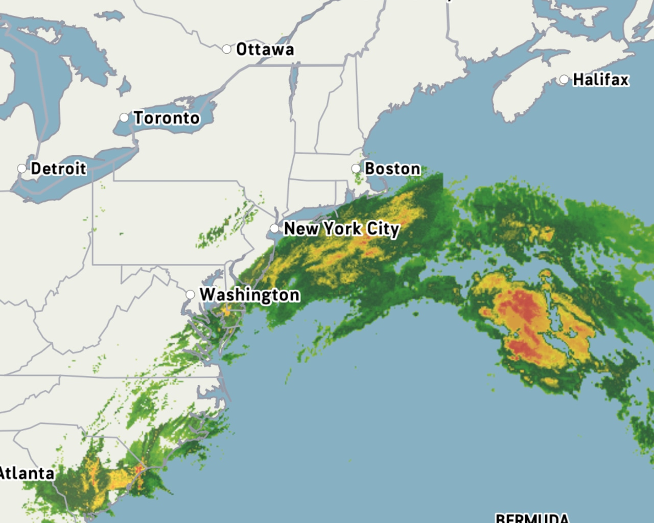
A slow-moving tropical wind and rainstorm is set to impact Staten Island with prolonged wind, rain, and coastal flooding concerns through Tuesday, according to AccuWeather forecasts.
Unlike typical fast-moving weather systems, this storm’s effects will last multiple days, with the most intense rainfall expected from late Sunday evening to early Monday afternoon.
“The worst of the rain is going to hold off till late Sunday night and last through the early afternoon on Monday. I would say something like 3 a.m. to noon is probably when the worst of the rain is going to hit,” Bob Larson, a senior meteorologist with AccuWeather, explained.
Wind conditions have already been significant across New York City and New Jersey. As of Sunday morning, LaGuardia Airport recorded a wind gust of 41 miles per hour, while JFK Airport experienced gusts of 39 miles per hour. The coastal nature of the storm means wind and rain will intensify along shoreline areas.
“Wind gusts in and around the city with this storm are going to be the magnitude of peaking of 45 miles per hour. Along eastern Long island and down along the Jersey shore, there could be gusts between 50 and 60,” Larson stated.
The slow movement of the storm system is causing particular concern for coastal areas, where repeated high tide cycles will bring flooding risks, according to AccuWeather.
“This is a very slow moving storm, which is part of the concern,” Larson noted. “We’re talking multiple high tide cycles in those coastal places, probably three separate high tide cycles that they have to brace for, where the coastal inundation could be fairly significant.”
Despite the extended duration of the storm, rainfall totals in New York City proper are expected to be moderate rather than extreme, with forecasts calling for between one and two inches, according to AccuWeather. Coastal areas will see higher precipitation amounts.
“We’re expecting totals of between an inch and two in the city. I think one is more likely than two, but somewhere between one and two. Eastern Long Island and down the Jersey shore can receive two to perhaps four inches of rain,” according to Larson.
The primary flooding threat from this system is coastal rather than from rainfall accumulation.
“Those onshore winds coming in off the ocean onto the coast raises the concern of beach erosion and coastal flooding, particularly around the times of high tide. All this talk of flooding that we’re hearing about, that’s primarily coastal centric from the on flow of an onshore flow of water, not necessarily flooding from the rain in and of itself,” Larson explained.
Unlike summer thunderstorms that can cause flash flooding, this system presents a different type of threat.
“Flash flooding is something that is more prevalent when you get those sudden, quick hitting thunderstorms in the summertime… That’s what leads to the flash flooding. This is kind of like a slow buildup to the flooding,” Larson said.
The storm’s center is currently situated off the coast of South Carolina and will move slowly northward while remaining offshore.
Weather conditions are expected to gradually improve by Tuesday evening, with clearing likely on Tuesday and sunshine returning by Wednesday.
“Clearing might begin late Tuesday afternoon. It should dry out and the clouds might begin to break and we can see some sun late Tuesday. We are much more confident that we’ll be back to sunshine and nice weather once we get to Wednesday,” according to Larson.
Temperatures during the storm will remain cool, with highs in the upper 50s Monday, rising to around 65 degrees by midweek as sunshine returns.
If you purchase a product or register for an account through a link on our site, we may receive compensation. By using this site, you consent to our User Agreement and agree that your clicks, interactions, and personal information may be collected, recorded, and/or stored by us and social media and other third-party partners in accordance with our Privacy Policy.