
STATEN ISLAND, N.Y. — For a new mayoral administration, it will be an old problem to solve: Staten Island traffic.
Aside from the everyday challenges of getting from place to place, safety for both pedestrians and vehicle occupants has been of grave concern.
With Mayor Zohran Mamdani’s new leadership taking the city reigns, the Advance/SILive.com talked to two of Staten Island’s councilmembers about what they see as their districts’ most worrisome streets—and their vision for governmental solutions.
(Councilmember Frank Morano was not available for an interview before publication.)
“We’ve seen some changes on streets like Van Duzer using traffic calming measures,” said Councilmember Kamillah Hanks. “But more needs to be done.”
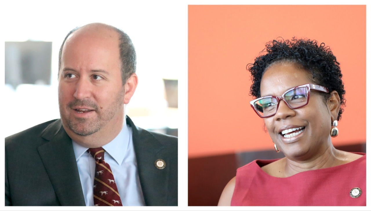 This composite shows Councilmember David Carr, left, and Councilmember Kamillah Hanks, right. (Advance/SILive.com | Jan Somma-Hammel)The most worrisome roads
Both Hanks, a Democrat representing the North Shore, and Councilmember David Carr, a Republican representing the Mid-Island, have districts that can be defined by some of the borough’s major roads: Richmond Terrace, Victory Boulevard, Forest Avenue and Hylan Boulevard among them.
However, when asked which streets felt the most dangerous, both pointed to smaller, more residential streets that connect major infrastructure.
Prospect Avenue and Henderson Avenue
Hanks named locations like Prospect Avenue in New Brighton and Henderson Avenue —which spans New Brighton, Randall Manor and West Brighton — as particularly concerning on the North Shore, as they see a high volume of traffic moving past areas with a significant number of pedestrians.
“These roads are bounded by senior housing, schools, rehabilitation centers and parks, and they serve as direct connections to and from the Staten Island Ferry Terminal,” Hanks explained.
“The combination of high speed, heavy traffic, and vulnerable populations makes pedestrian crossings especially dangerous,” she continued.
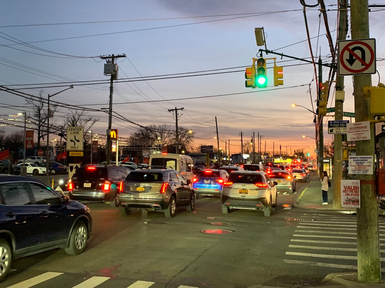 Traffic crawls through the intersection of Midland Avenue and Hylan Boulevard around 6 p.m. on Friday, Feb. 28, 2025. (Advance/SILive.com | Luke Peteley)Greeley Avenue
Similarly, Carr pointed out Greeley Avenue, which connects Hylan Boulevard and Father Capodanno Boulevard in Midland Beach, as a road that he believes needs to be changed.
The traffic circles on that road have not served their stated purpose of reducing driving speeds and have made it more difficult to see cars coming from side streets, Carr said.
The recent addition of a limited number of stop signs on that road is proof it needs to be improved, he continued.
This is not the first time Carr has raised concerns about Greeley Avenue, but a DOT spokesperson previously told the Advance/SILive.com that the traffic circles “are proven measures to slow speeds and turns, and to enhance safety on this corridor.”
Seaview Avenue
Carr also expressed frustration with the redesign of Seaview Avenue in Ocean Breeze, particularly the floating parking lanes because of the potential impact on emergency vehicle access in the area.
Each direction of the new Seaview Avenue now features a 12-foot travel lane, a 10-foot-wide parking lane, a new 5-foot buffer zone, and the Island’s first protected bike lanes bordering the curb.
Previously, Seaview Avenue had two lanes of travel in each direction and smaller, unprotected bike lanes.
At the unveiling of the changes, DOT Commissioner Ydanis Rodriguez addressed community concerns that ambulances would be stuck in additional traffic, emphasizing that his agency involved the FDNY with this project.
“The moving of ambulances or police vehicles is something that we don’t compromise in any project. And any project that we do in our city, including this one, has the feedback of the Fire Department and NYPD,” Rodriguez said at the time.
Hylan Boulevard
For years, Hylan Boulevard has been the site of dangerous crashes, gaining it the nickname “Boulevard of Death.” In 2025, five of the nine most dangerous intersections were at spots along the road.
When asked about Hylan Boulevard, which runs through his district, Carr recognized that something needs to be done, but said that the most useful changes wouldn’t come from the Department of Transportation.
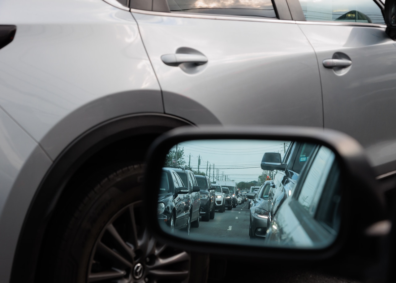 Traffic backs up along Hylan Boulevard near Bedford Avenue in Midland Beach.(Advance/SILive.com | Mike Matteo)
“I actually don’t think that it’s necessarily a solution that DOT would be able to bring to the table,” Carr said. “I think what we’re talking about is about transit.”
Carr explained that the best solution for Hylan Boulevard would involve giving Staten Islanders — particularly those on the South Shore — more transit options.
He also called expanded express bus service and a South Shore fast ferry “the only way, ultimately” to address congestion on Staten Island’s main thoroughfare.
What are the solutions?
For her district, Hanks spoke of better street safety education along with improvements in specific problematic areas to increase safety.
These “intersection-by-intersection redesigns” would feature infrastructure like raised crosswalks and smart traffic signals — which adjust traffic light timing — to slow traffic and enhance pedestrian safety, Hanks explained.
Carr said that there needs to be a balance of enhancing safety while also improving the flow of traffic.
To do so, Carr would like to see more left-turn signals installed at intersections in his Mid-Island district, along with increased pedestrian crossing times to accompany any signal changes.
“The nice thing about that is that it helps the traffic flow better and it actually protects pedestrians who might be trying to cross the street,” Carr explained.
In addition, both Carr and Hanks pointed to legislation they say would lead to tangible changes for traffic safety in the borough.
Hanks pushed two bills, one of which would create a pilot program where pedal-assist bicycles would be confiscated from operators with three or more moving violations until they complete a defensive biking course.
The other, Intro 1106, would have the DOT remove speed cameras from areas where the nearby school has closed, which Hanks said she believes would “[keep] enforcement focused on safety rather than revenue.”
Similarly, Carr stressed a speed-camera related bill as an important step forward for traffic safety in the borough.
His legislation, Intro 161, would require DOT to study 100 camera locations a year for the feasibility of a speed bump, with the option to remove cameras from locations with successful speed bumps installed.
“Because if you really want to slow people down, no better way than one of those,” Carr said.
In response to these concerns, a spokesperson from the DOT issued the following statement:
“In 2025 the city reduced traffic deaths to historic lows citywide and installed several critical safety projects on Staten Island. We look forward to building on that success in the new year.”
The spokesperson also pointed out that DOT already deactivates speed cameras near closed schools as outlined by state law and highlighted the agency’s street changes on Richmond Terrace and Seaview Avenue.
Also causing a lot of buzz is legislation that would bar parking within 20 feet of a crosswalk or “daylighting.” Supported by Councilmember Frank Morano, discussion of the safety proposal has been heated.
“Look, no one loves their cars more than Staten Islanders — I get that, I live it. But even in a car-loving district like mine, people want to be able to see when they’re turning, and they don’t want their kid or their neighbor getting hit at an intersection because a van was blocking the crosswalk,“ Morano previously told the Advance/SILive.com.
However, some Staten Island officials have rallied against daylighting universally, pushing for an intersection-by-intersection approach.
A new mayor to take on traffic
Both lawmakers were also asked if working with the new mayoral administration would be any different from those of years past.
Hanks said she is ready to work with the administration on improving streets, but stressed that the city needs to make sure that policies reflect the realities of Staten Island.
“It remains to be seen how the new administration will approach Staten Island traffic conditions,” Hanks said.
“Our borough’s streets face unique challenges, winding streets with hills, limited mass transit, and vulnerable populations that require tailored solutions,” she continued.
Carr, for his part, recognized that ideological differences would be inevitable but remained confident that there could be a “positive working relationship” as long as there was a spirit of collaboration.
“If you come to the table with a sense of ‘alright you guys have been thinking about your intersections for years, what do you think are good places for us to start’ then I think what we can find a way to have some really good results for the borough,” Carr said.
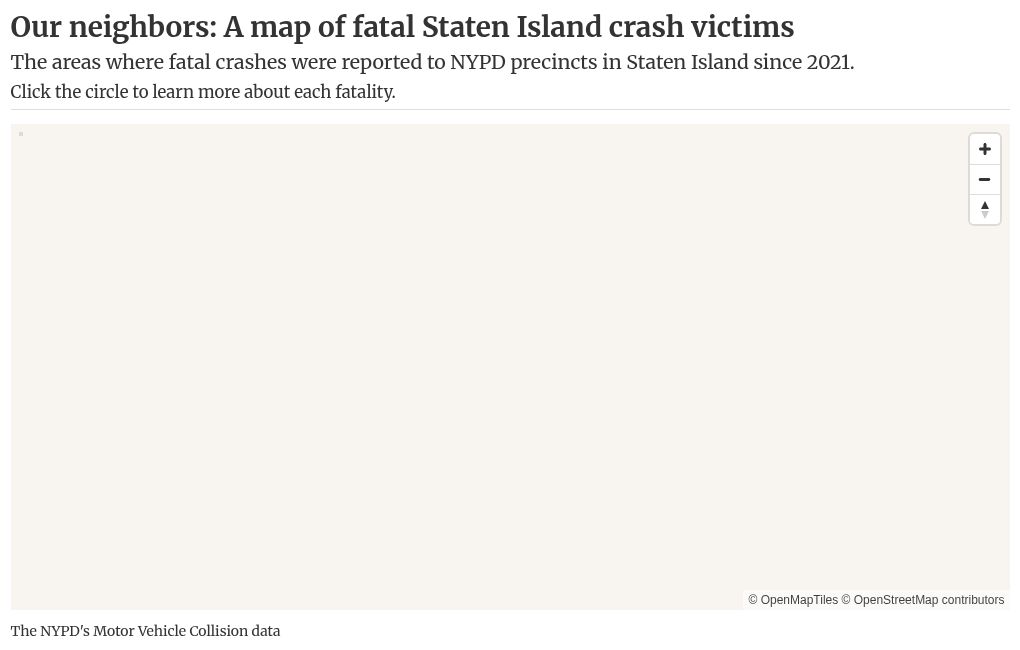
Staten Island lives depend on it
From October 2024 through March 2025, there were a disturbing seven pedestrian fatalities on Staten Island.
Since March, at least three more Staten Islanders have been struck and killed by cars: Meiyun Chen, 66, of Charleston in October; Robert Farina, 60, of Port Richmond later that month; and Nilsa Cruz , 66, of Mariners Harbor as recently as Dec. 18.
During 2025, Staten Island recorded 13 overall traffic fatalities, the only borough to not see a decrease from the year prior, according to new DOT data.
In total, more than 55 lives —pedestrians, passengers and motorists — have been lost on the borough’s roads and sidewalks since 2021.
Along with documenting this harrowing trend, the Advance/SILive.com has looked at New York City’s approach to traffic enforcement and the growing congestion on the borough’s roads.
In a project titled Staten Island Traffic SOS, the Advance/SILive.com detailed Vision Zero data trends, described traffic conditions and documented personal stories on Staten Island’s Boulevard of Death.