
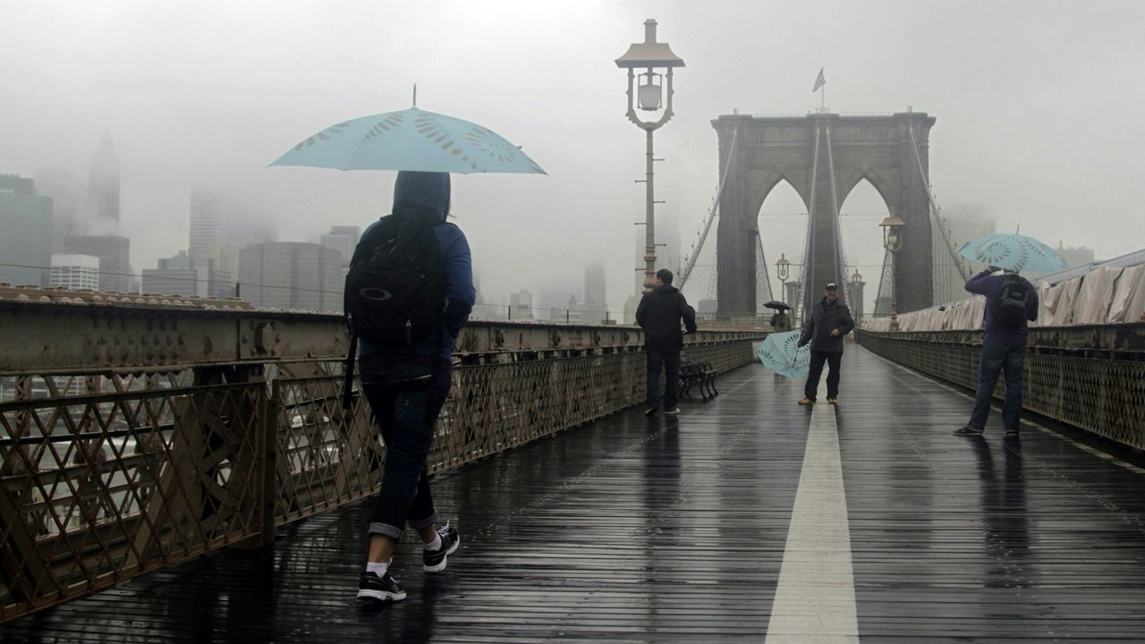
A nor’easter that arrived in New York City on Sunday continued to lash the area on Monday with heavy rain, damaging winds and the threat of coastal flooding.
What You Need To Know
Hochul declared a state of emergency Sunday evening for New York City, Long Island and Westchester County
The storm, which began around 3 p.m. Sunday, is expected to linger through Monday evening, according to the National Weather Service
Coastal Flood Warnings have also been issued through Monday evening for New York City, Long Island and southern Westchester County
Con Edison is urging residents to report downed wires, avoid flooded areas and keep phones charged in case of power outages
Gov. Kathy Hochul declared a state of emergency Sunday evening for New York City, Long Island and Westchester County as the storm intensified along the coast.
“As the Nor’easter continues making its way through New York, I’m declaring a State of Emergency across boroughs and counties most impacted by the storm,” Hochul said in a statement. “The safety of New Yorkers is my top priority, and I continue to urge extreme caution until the storm has passed through the state.”
Due to the ongoing nor’easter, I’m declaring a State of Emergency for NYC, Long Island, & Westchester.
We’re ready to assist local partners as damaging winds & heavy rain move in, with the potential for flooding & power outages.
Stay vigilant & take steps now to prepare.
— Governor Kathy Hochul (@GovKathyHochul) October 12, 2025
The state of emergency covers eight counties — the Bronx, Kings, Nassau, New York, Queens, Richmond, Suffolk and Westchester — as well as neighboring areas. The governor’s office said more than 1,600 utility workers were added across the region to assist with storm response, bringing the statewide total to more than 7,000 workers.
The storm, which began around 3 p.m. Sunday, is expected to linger through Monday evening, according to the National Weather Service. Coastal areas are bearing the brunt, with wind gusts of 40 to 60 mph and rainfall totals between 1.5 and 3 inches.
Early Monday reports from the National Weather Service showed 1.44 inches of rain at John F. Kennedy International Airport, 1.34 inches at LaGuardia Airport and 1.17 inches in Central Park.
Moderate rainfall is continuing to move onshore into the area as the coastal low develops well to our south. Expect this trend to persist into the night with increasing E/NE winds, especially for coastal areas. #NYwx #CTwx #NJwx pic.twitter.com/ny3zcOtetL
— NWS New York NY (@NWSNewYorkNY) October 12, 2025
Coastal Flood Warnings have also been issued through Monday evening for New York City, Long Island and southern Westchester County.
MTA Bridges and Tunnels have banned empty tractor-trailers and tandem trucks on its seven bridges until at least 6 p.m. Monday due to hazardous wind conditions.
Emergency response teams across the city have been on high alert since the weekend.
“We’re watching the weather closely, we’re monitoring the wind speeds and the rain, and we’re mobilizing, getting our staffing levels up. And we’ve augmented our own staff with 900 outside workers to prepare for emergency response,” Con Edison spokesperson Jamie McShane said Saturday.
Con Edison is urging residents to report downed wires, avoid flooded areas and keep phones charged in case of power outages. Customers can report outages at conEd.com/reportoutage or by texting “notify” to 692-692 for updates through NotifyNYC.