
Here’s what you need to know:
It’s a new year with a new weather pattern. We’re getting a much-needed break from the bitter cold as temperatures soar in the 50s by the end of this week with chances of rain.
It’s still cold and cloudy this morning. Temperatures are in the mid to upper 30s.
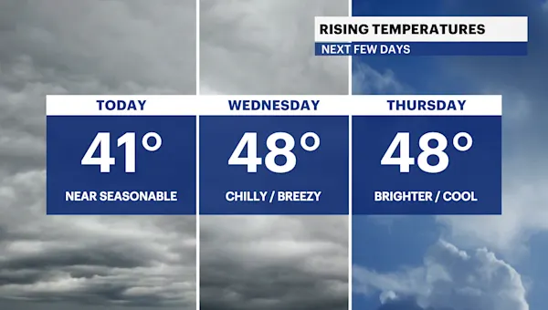
Today won’t be as cold as yesterday. Temperatures will be above freezing for the first time since December 29th. Highs are near 41 degrees.
A weak storm system will bring some spotty drizzle tonight into the predawn hours on Wednesday. It turns breezy Wednesday afternoon with increasing sunshine. Highs will climb into the upper 40s.
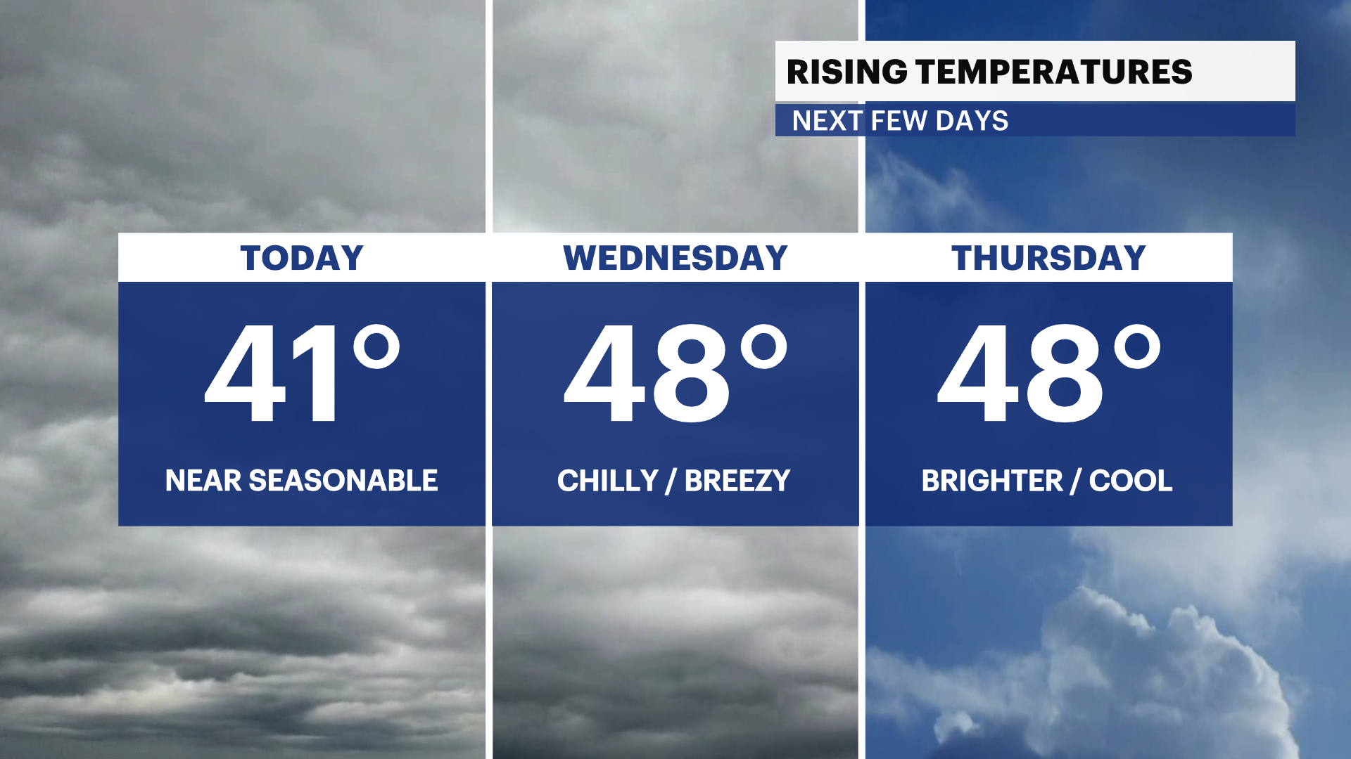
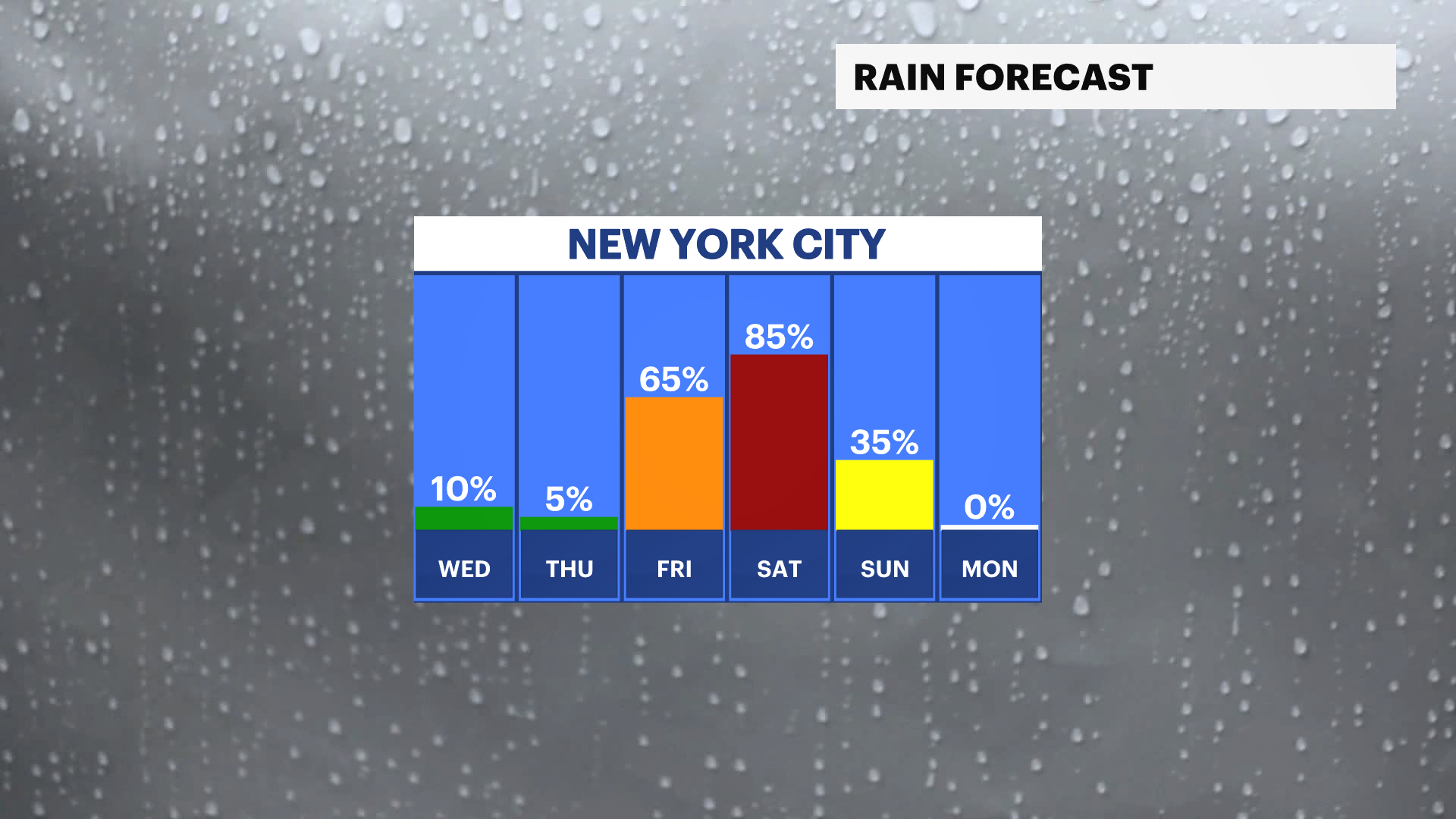
It gets even milder by the end of the week with highs reaching the 50s with a chance of rain into the weekend. Up to an inch of rainfall is possible Friday into the first half of Sunday. Stay tuned for updates.
Behind this storm system, temperatures cool down to the 40s but still remaining above freezing through early next week.
Today: Mostly cloudy, not as cold. Overnight spotty drizzle. Highs near 41.
Tonight: Mostly cloudy, cold, and damp. Lows near 39.
Wednesday: Damp start. Chilly with a gradual clearing sky. Breezy. Highs near 48. Lows near 36.

Thursday: Mostly sunny and cool. Less breezy. Highs near 48. Lows near 40.

Friday: Cloudy and cool. Chance of rain. Highs near 50. Lows near 45.
Saturday: Milder and cloudy. Rain likely. Highs near 53. Lows near 38.
Sunday: Chance of morning rain. Partly sunny and colder. Breezy. Highs near 46. Lows near 32.
Monday: Mostly sunny, chilly and windy. Highs near 41. Lows near 33.