Be ready for some wet weather this weekend – especially Saturday.
After dealing with a few light, scattered showers Friday evening, Saturday is the day we could pick up more steady rainfall that will clear sidewalks and streets of any leftover salt from our last snow.
Keep an umbrella handy, especially Saturday afternoon and early evening.
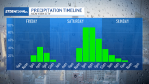
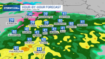
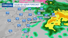
Skies will be dry in the morning, so if you need to get things done outside on Saturday, plan to do them early in the day. A low-pressure system will move through during the second half of the day, which will keep the area soggy for most of the afternoon.
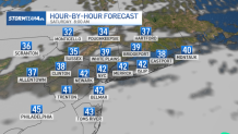
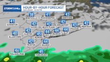
Expect a steady, light to moderate rainfall to move in near or shortly after lunchtime and linger into early evening. Pockets of heavier rain, even a rumble of thunder or two, will be possible south of the New York City metro area by late afternoon.
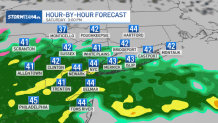
By evening, rain will begin tapering off, with the heaviest and steadiest wet weather isolated to Long Island. Lighter, more scattered showers will linger in the Hudson Valley, the city and down the Jersey Shore, but most areas will experience improving conditions through the course of Saturday evening.
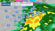
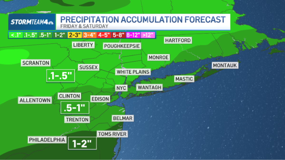
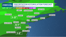
Rainfall totals will be under an inch in the city, with areas south and east picking up over an inch. Flooding is not a concern, but ponding on area roads Saturday afternoon and evening could slow you down.
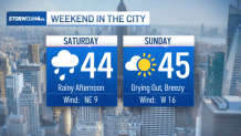
Temperatures on Saturday will hold in the low- to mid-40s all day – a touch chillier than Thursday and Friday.
Sunday will be chilly and breezy, with wind gusts as high as 25 miles per hour. But it will also be much brighter and drier than Saturday. For planning purposes, Sunday will be the better half for outdoor plans.