
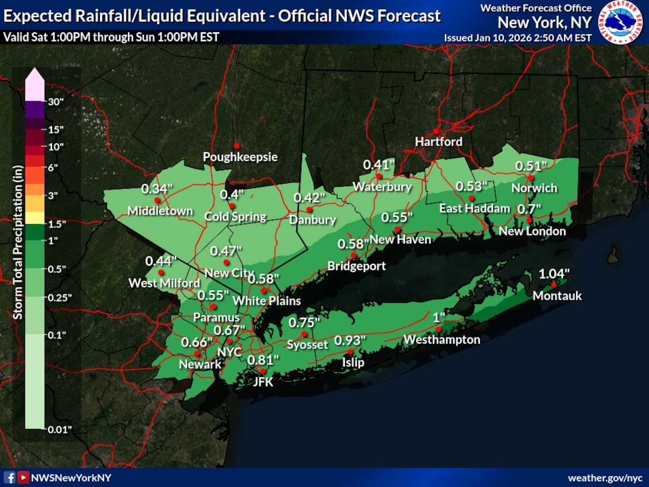
Rain will develop across Staten Island Saturday afternoon and continue through the evening hours, with the heaviest rainfall expected between sunset and 10 p.m., according to the National Weather Service.
The precipitation will move from south to north Saturday afternoon, bringing up to an inch of rain to the area. The weather service indicates the rain will taper off before midnight Saturday, with most rainfall occurring during a 9-10 hour period. No flooding impacts are anticipated despite moderate rainfall intensity during the peak evening hours.
Temperatures will remain above freezing throughout Saturday night, eliminating concerns about black ice formation. The rain is associated with a low pressure system along an approaching warm front passing to the south of the region tonight.
Sunday will see improving conditions with winds shifting to the west and increasing to 25-30 mph by the afternoon. According to the weather service, this marks the beginning of a warming trend that will continue into the early part of next week.
Monday and Tuesday will feature above-normal temperatures across Staten Island and the rest of New York City as a Pacific air mass remains in place. Tuesday and Wednesday will see temperatures well above seasonal averages with only a slight chance of rain showers.
Looking ahead to the extended forecast, a cold front representing the leading edge of a polar air mass will approach the region by Wednesday night into early Thursday. This will bring a return to seasonably cold conditions for Staten Island. The weather service notes high forecast uncertainty for Wednesday night through Friday regarding potential coastal low development, with precipitation type and timing still uncertain.
A draft of this story was generated using AI. It was reviewed, edited and approved by Advance/SILive.com staff.