
LIVE UPDATES: Check out our latest live updates on the winter storm.
STATEN ISLAND, N.Y. — The powerful winter storm that has been battering the southern states with ice and snow all week is now unleashing blizzard-like conditions across the New York City area, with AccuWeather forecasters expecting accumulations of around eight inches before the system moves offshore Monday.
According to AccuWeather meteorologist Tom Kines, the storm’s northward trajectory is a factor in determining the type and amount of precipitation falling across New York City.
“It’s the same storm that’s brought ice and snow to the southern states all week. The question mark was kind of how far north this storm was going to track. Obviously it tracked fairly far north,” Kines explained.
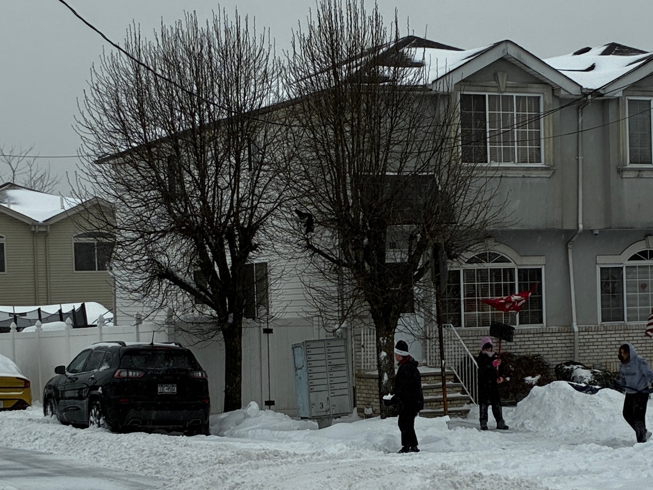
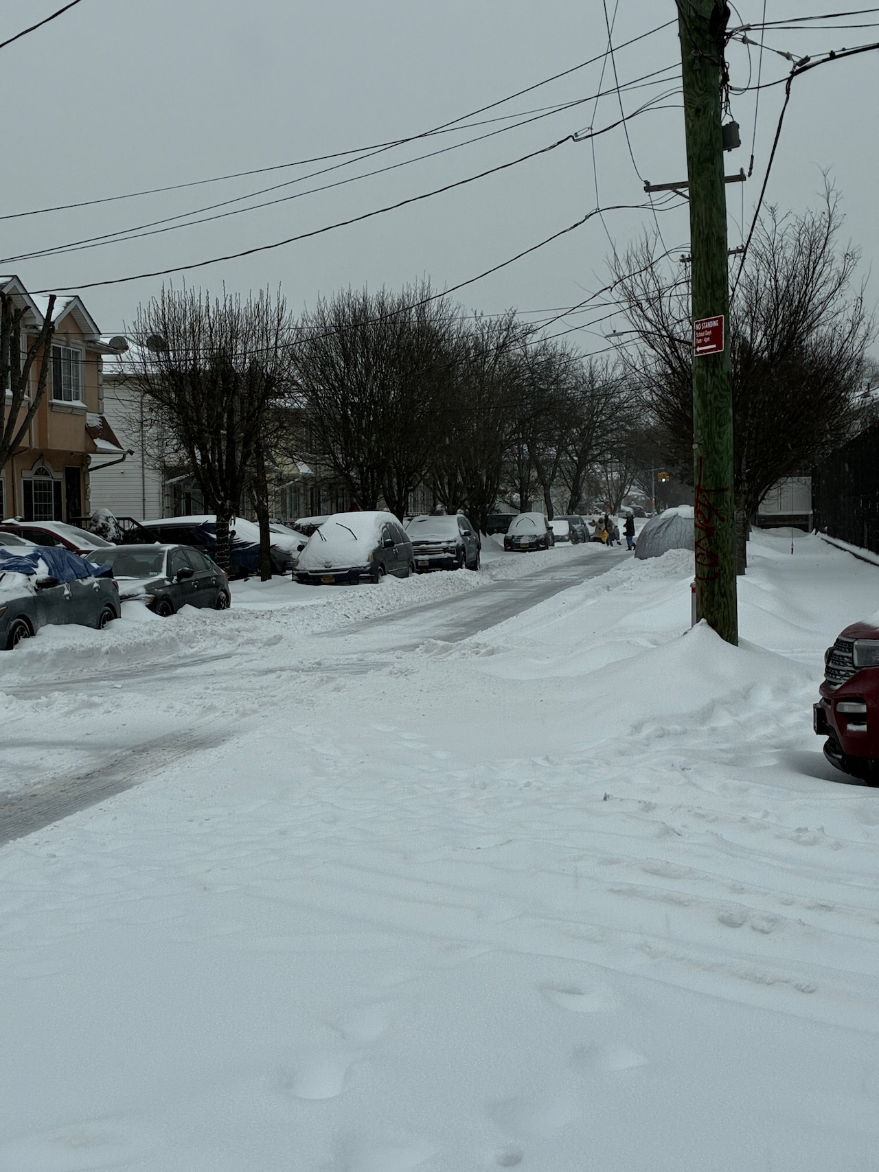
 Nearly 1 foot of snowfall has piled up as of 2 p.m. on Staten Island’s south shore.Advance/SILive.com | Shaina McLawrence
The storm’s arrival is creating hazardous conditions that are expected to persist through the afternoon, with snow falling at a rate of about an inch per hour. By mid-morning, three to four inches had already accumulated, with several more hours of steady snowfall expected.
“Most of the accumulation is probably going to be before 2 p.m. and then we’ll get some sleet thrown in, maybe even freezing rain,” Kines said. “Once you start getting that sleet, it’s more difficult to accumulate.”
Kines noted that the storm’s specific northern track has actually moderated what could have been even heavier snowfall totals locally. The system’s path is bringing in warmer air, which is causing the transition from snow to sleet.
“If you’re one of those people that loves snow and everything, the storm actually tracked too far north because it’s bringing some warmer air in. The precipitation will change to sleet,” Kines noted. Other areas are expected to receive significantly more snow than Staten Island. “There’s going to be places across and up into the Hudson Valley or across Pennsylvania that pick up a foot and a half of snow out of this.”
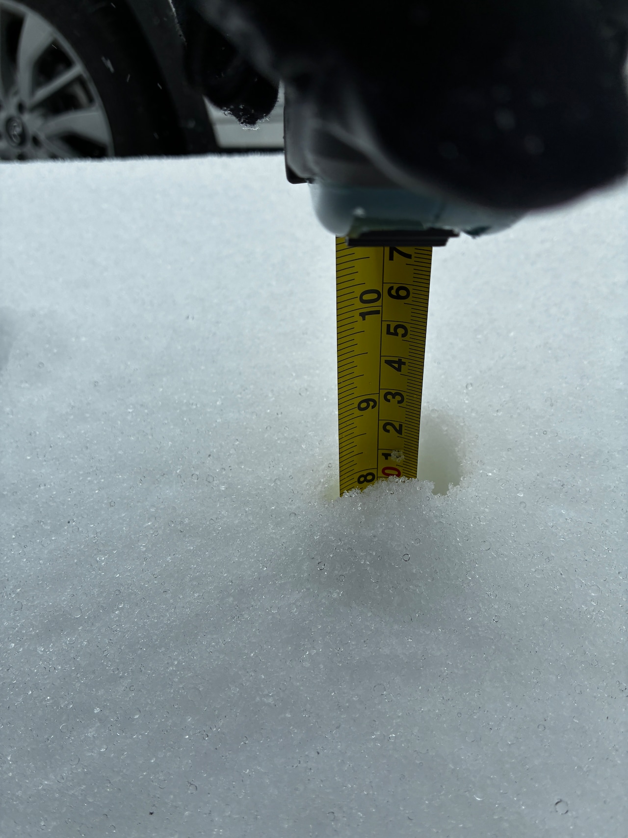
 Snow measurement, ~4 inches, Richmond, near Richmondtown Library branch, Sunday, Jan. 25, 2026. Advance/SILive.com|Mike MatteoMike Matteo
Kines described travel as “a no-go today” due to the dangerous conditions. He urged residents to stay home if possible until road crews can clear accumulated snow and ice.
The forecaster indicated that as the storm begins to pull away this evening, the precipitation may change back to snow for a short period.
“I think as the storm pulls away, the sleet will probably change back to snow at least for a time tonight. I don’t think there’s a whole lot more accumulation with that,” Kines said.
By Monday morning, there might still be some snow in the air, but the main system will have moved on.
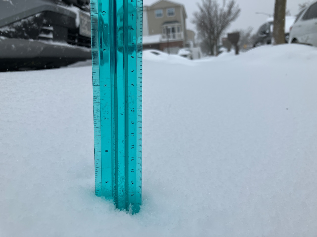
 Nearly 1 foot of snowfall has piled up as of 2 p.m. on Staten Island’s south shore.Advance/SILive.com | Shaina McLawrence
“By tomorrow morning, it’s going to be probably southeast of New England, moving out away from the coast,” Tom explained. “It’ll just be bothering the fish early in the week and not affecting us.”
Once the storm departs, residents should prepare for even colder temperatures. While highs tomorrow will reach the mid to upper twenties — “a taste of spring compared to what the rest of the week is going to feel like,” according to Tom — the days following will bring much colder conditions with high temperatures only reaching the teens.
Wind will remain a factor, making the cold even more uncomfortable. “When it’s this cold and you get the slightest wind, it’s very noticeable,” Tom said, adding that the wind chill could make temperatures feel “10 to maybe at times 20 degrees” colder than the actual readings.
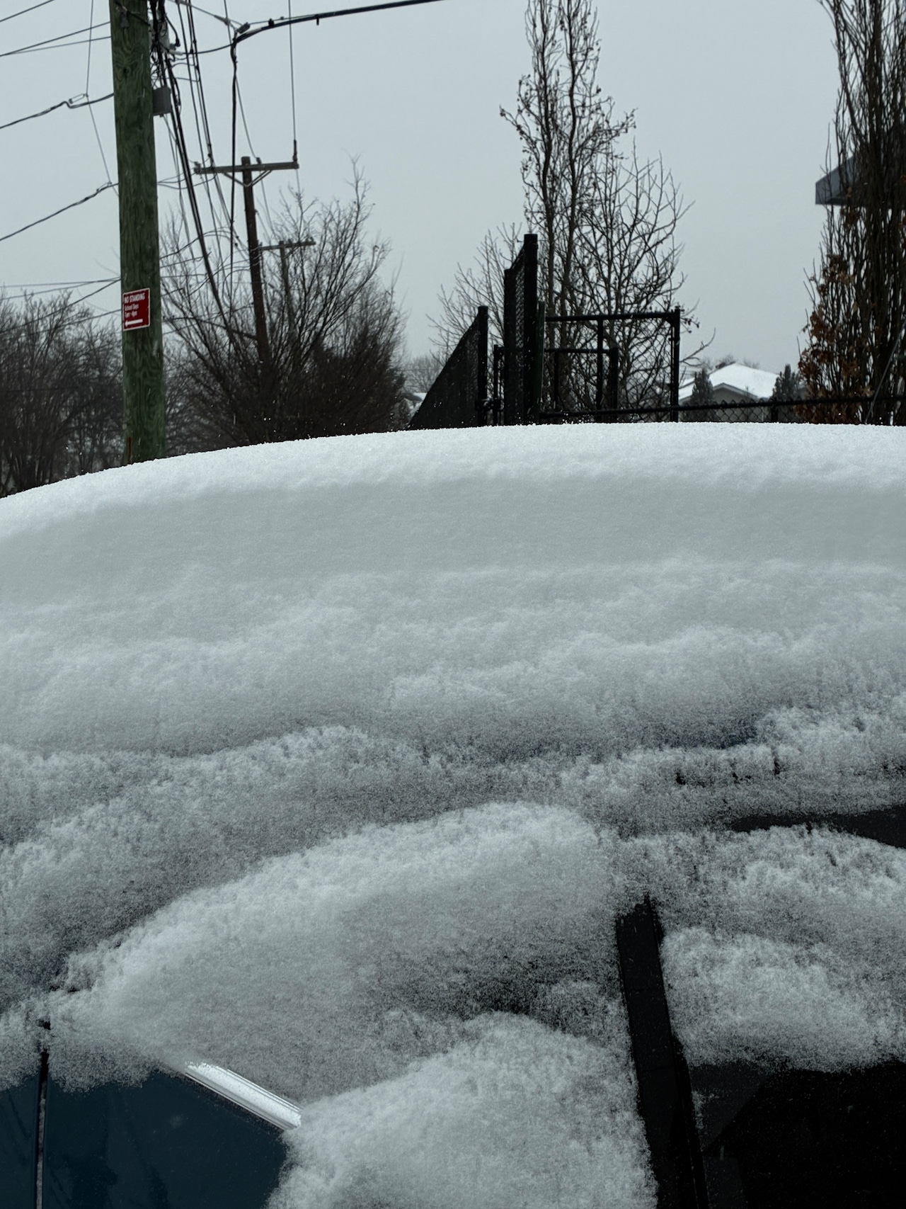
 Nearly 1 foot of snowfall has piled up as of 2 p.m. on Staten Island’s south shore.Advance/SILive.com | Shaina McLawrence
The good news is that once this system moves offshore, there are no additional major storms on the horizon.
“Once you get rid of the storm, other than the cold, there’s not a whole lot of weather going on in our neck of the woods for the next several days,” Tom said. “Maybe at some point there’s a weak front that comes through and gives us some flurries, but there’s no storms to be worried about after Monday morning, at least through the end of the week.”
Travel disruptions
Commuters should be prepared for delays and adjusted service on the water today, according to the NYC Ferry.
The Staten Island Ferry is running on a modified hourly schedule today due to the inclement weather.
Due to low visibility, all NYC Ferry service has been suspended since 11 a.m. until further notice. Travelers are advised to consider alternate routes and allow extra travel time.