
NEW YORK (WABC) — The deep freeze gripping New York City and the Tri-State is only halfway through, with even more dangerous cold arriving Thursday and Friday.
An AccuWeather Alert is in effect Thursday through Saturday for dangerously cold wind chills.
Wind chills will plunge well below zero, and frostbite can develop in as little as 15 to 30 minutes.
Friday may be the coldest morning yet, with subzero readings across much of the area.
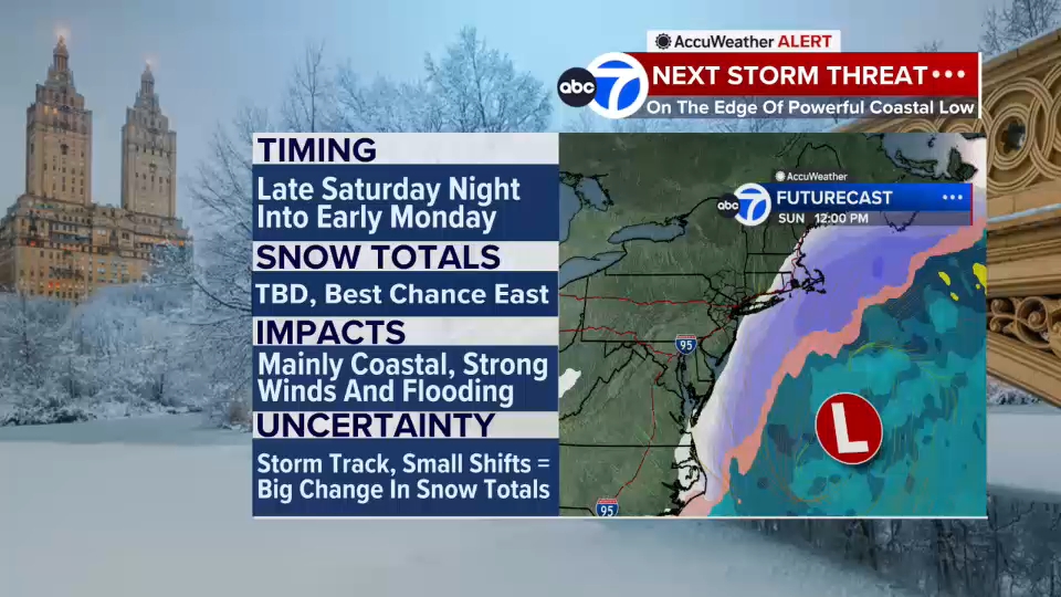
As for the potential for another snowstorm this weekend, the developing coastal storm will track up the East Coast Saturday into Sunday, but current trends keep the heaviest snow well to the south, targeting Virginia and the Carolinas. The Tri State sits on the far western edge of the system.
That means:
Light accumulations possible near the coast
Stronger winds and minor coastal flooding risks for shoreline communities
Lower impacts the farther west you go
While it’s still too early for finalized snowfall maps, early probabilities suggest a wide range depending on location.
The extended forecast offers little relief. New York City may not reach the freezing mark until Tuesday, keeping the region in a days-long deep freeze.
Stay with Eyewitness News and the AccuWeather team for live updates on the dangerous cold and potential weekend winter storm.
Click here for the latest advisories, watches and warnings from the National Weather Service