
STATEN ISLAND, N.Y. — Those hoping to keep their snow shovels in storage for the remainder of the year will need to wait a bit longer.
A major nor’easter is forecast to bury New York City in over a foot of snow Sunday into Monday. City residents will need to clear walkways to avoid getting snowed in.
Although the task ahead will require some manual labor, there’s a way residents can work smarter and not harder.
Snow is forecast to begin Sunday around lunchtime, initially mixing with some rain. It will eventually get heavier in the evening hours and taper off Monday morning.
“The first few inches of the storm, the snow is going to be wet. So that bottom layer is going to be tough to shovel because of the weight of the snow,” Tom Kines, a senior meteorologist with AccuWeather, explained to the Advance/SILive.com.
As such, if the opportunity presents itself, Kines suggests residents get out in the early evening hours Sunday to clear pathways of the wet snow.
By doing so, the subsequent rounds of shoveling will hopefully be lighter, as drier, more fluffy snow is anticipated later Sunday and early Monday.
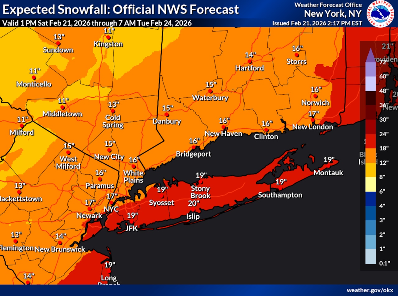
As of Saturday morning, Kines explained that the snowfall forecast for the city is a general 6-12 inches. While there is confidence there will be at least 6 inches, he said there is “certainly potential” for the five boroughs to receive over a foot of accumulation.
The National Weather Service forecasts that the city will receive upwards of 18 inches of snow. There is a 10% chance snowfall exceeds 30 inches on Staten Island and a 90% chance the borough gets at least an inch of accumulation, according to the National Weather Service.
When will snow melt?
In January, Arctic air prevented the melting of snow from Winter Storm Fern for a prolonged period of time.
Fortunately, this time around the city will see some relief in the form of relatively milder temperatures following this storm. However, the sheer amount of snow will ensure some lingering accumulation.
“With that melting, thawing cycle during the day, temperatures at night can get down below freezing, so you got to watch out for those wet spots or slushy spots freezing up during the nighttime hours,” Kines explained.
In addition to snow, Kines foresees wind gusts of up to 50 mph Sunday night. The National Weather Service forecasts sustained winds of 25-35 mph with gusts of 45-55 mph Sunday night.
“It’s not out of the question that there’s some power outages that take place,” said Kines.
Minor to moderate coastal flooding is also possible Sunday night into Monday morning with the high tide.
Given these anticipated conditions, the National Weather Service has issued a blizzard warning for the city. The warning will go into effect at 6 a.m. Sunday and remain in place until about 6 p.m. Monday.
Staten Island stocks up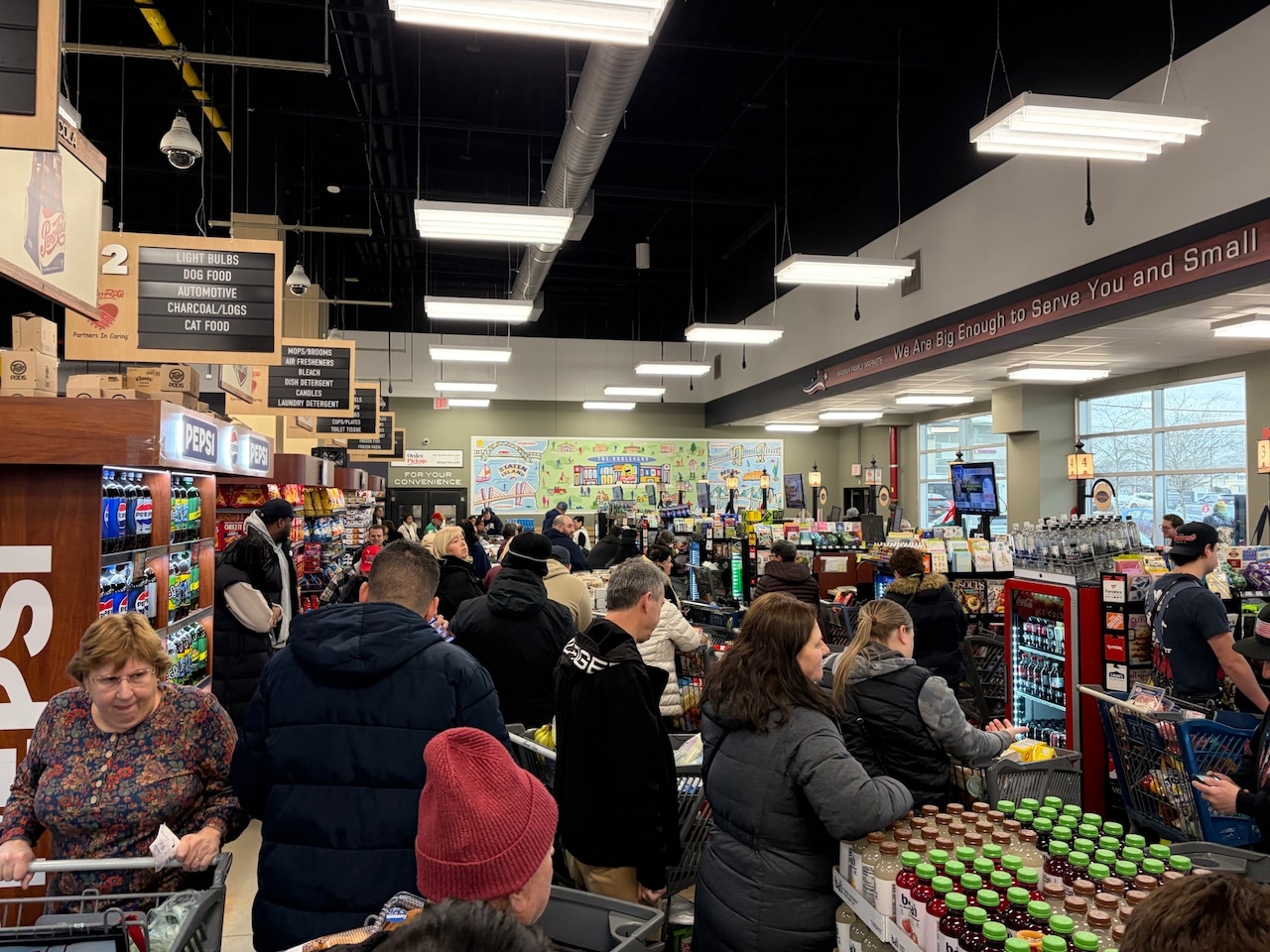 Staten Island residents line up to pay for goods at the ShopRite in New Dorp on Saturday, Feb. 21, 2026.(Advance/SILive.com | Ken Paulsen)
Ahead of the storm, Staten Island residents were seen stocking up on goods at ShopRite in New Dorp on Saturday.
A resident at the supermarket noted there was plenty of milk but the self checkout line was about 15 people deep during the morning. He described the scene as “controlled chaos.”
The main parking lot for the market at The Boulevard was nearly at capacity and vehicles were seen circling the lot in hopes of finding one of the few remaining parking spaces.
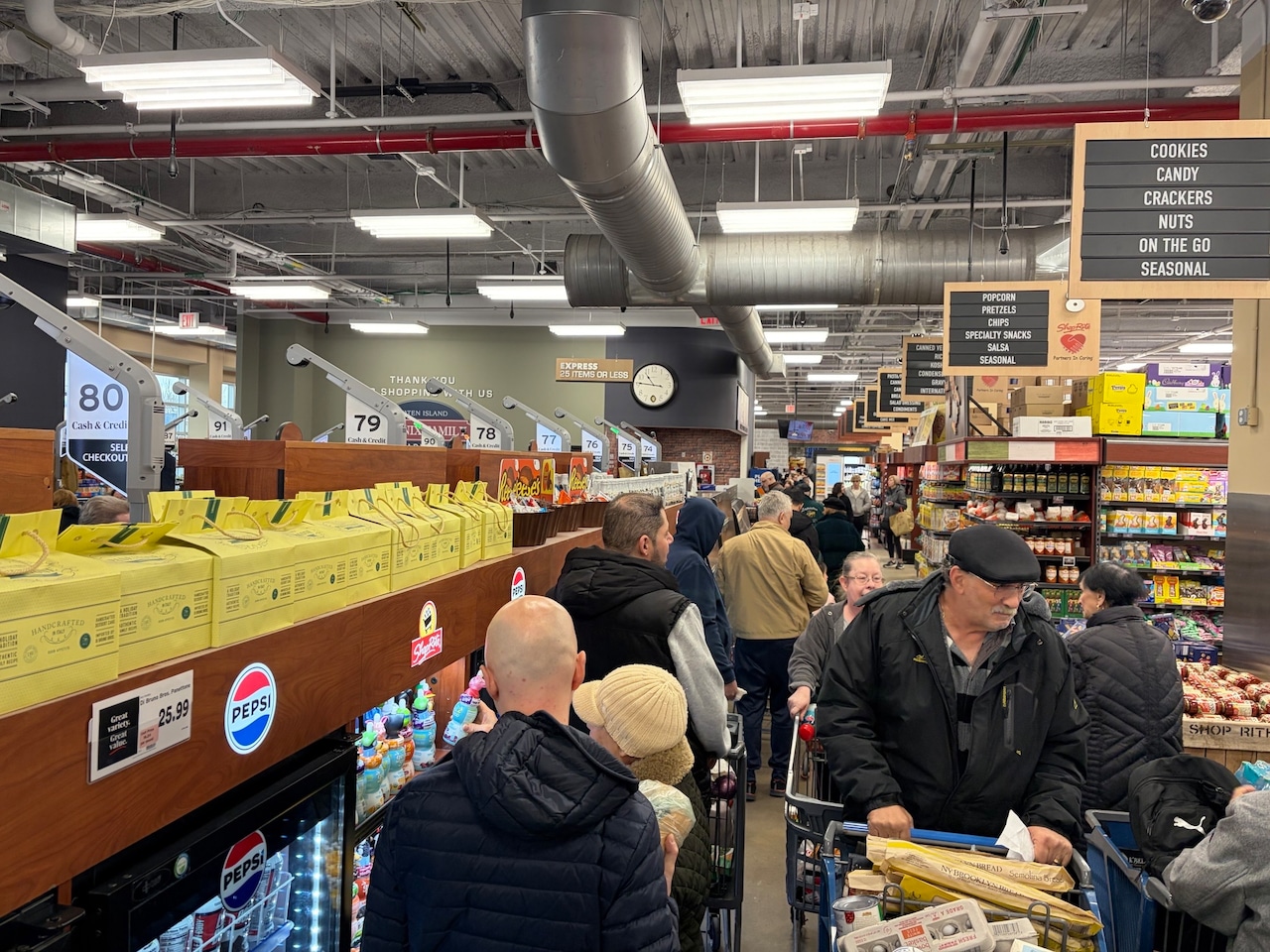 Staten Island residents line up to pay for goods at the Shop Rite in New Dorp on Saturday, Feb. 21, 2026.(Advance/SILive.com | Ken Paulsen)