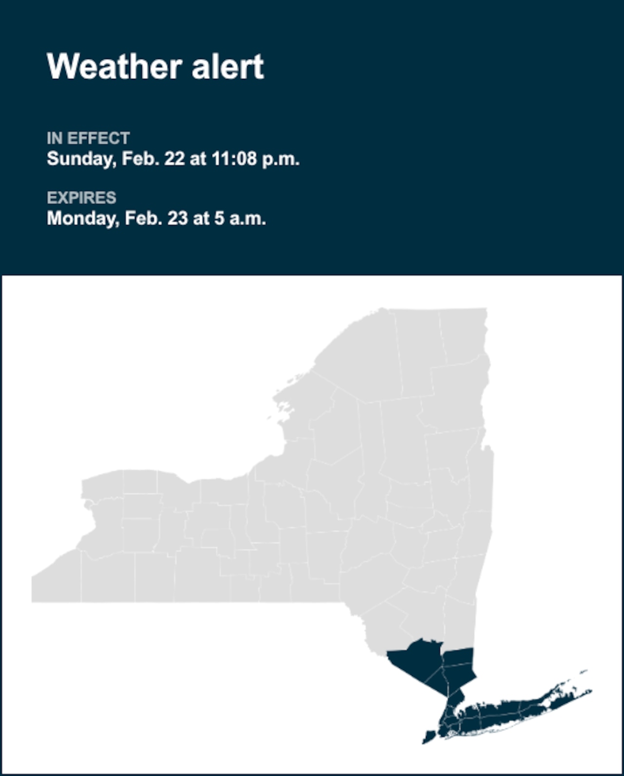
The National Weather Service released a special weather statement at 11:08 p.m. on Sunday until Monday at 5 a.m. for Manhattan, the Bronx, Staten Island, Brooklyn and Queens as well as Orange, Putnam, Rockland, Westchester, Suffolk and Nassau counties.
“**Multiple Bands of Heavy Snow to Impact the Area Overnight*** Bands of heavy snow will move across the area through the overnight as low pressure rapidly intensifies to the south. Some of these bands will produce 2 to 3 inches per hour rates. However, in between bands, snowfall rates may drop off to about an inch per hour. Farther to the west, across western portions of the Lower Hudson Valley and interior portions of northeast New Jersey there will be a sharp back edge to the heavy snow and some uncertainty as to how far these bands get. This could impact snowfall totals across this area. Additionally, winds will become a factor as the night progresses. Blizzard conditions are expected and will make travel treacherous and potentially life-threatening,” explains the weather service.