
STATEN ISLAND, N.Y. — A blizzard warning remains in effect for Staten Island through 6 p.m. Monday as a major winter storm continues to pound the borough with heavy snow, powerful winds and near-zero visibility.
According to the National Weather Service, residents should expect some of the most intense snowfall of the storm during the early morning hours, with conditions gradually improving through the afternoon.
The National Weather Service warns that the heaviest snowfall will occur during the next six to nine hours, with hourly snow rates of two to three inches likely through approximately 9 a.m. Monday.
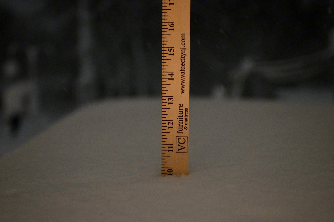
Snow is expected to taper off from west to east through the afternoon, with any lingering snow bands dissipating by early evening. Total snowfall for the New York City metro area, including Staten Island, is forecast at 18 to 22 inches for the storm.
Wind gusts of 40 to 60 mph are expected through Monday morning, with conditions gradually diminishing through the afternoon and evening.
High temperatures Monday will reach near 32 degrees, though wind chill values will make it feel like the teens to around 20 degrees. The blizzard warning covers all of Staten Island and the broader New York City metro region, including New Jersey zones.
Additional minor coastal flooding is possible with Monday afternoon’s high tide cycle along the southern bays. A coastal flood advisory is in effect from 11 a.m. to 6 p.m. Monday for portions of the New York coastline.
For New York City overall, the National Weather Service forecasts total storm snowfall accumulations of 18 to 22 inches at Newark Liberty International Airport and LaGuardia Airport, with similar amounts expected across the five boroughs.
High temperatures Tuesday will range from the upper 20s to lower 30s degrees, with gradual snow melt expected each day and re-freezing of snowmelt likely each night.
Looking ahead, a clipper system passing to the north Wednesday will bring light snow and rain to the New York City area. Accumulations Wednesday are expected to be less than an inch across the city.
A stronger low-pressure system moving through Thursday could bring additional wintry precipitation, with light snow accumulations of no more than one to two inches possible and a light glaze of ice possible at some locations. Weather advisories may be needed for parts of the area for the Thursday system.
Temperatures are expected to trend closer to seasonal norms through the remainder of the week. The series of storm systems passing through Wednesday and Thursday, combined with sub-freezing overnight temperatures refreezing daytime snowmelt from the current storm, may create hazardous travel conditions that persist through the week.
The National Weather Service notes that snowfall records set in 2008 for Feb. 22 and 23 may be broken at multiple climate sites, including Central Park, LaGuardia and John F. Kennedy airports, and Newark.