
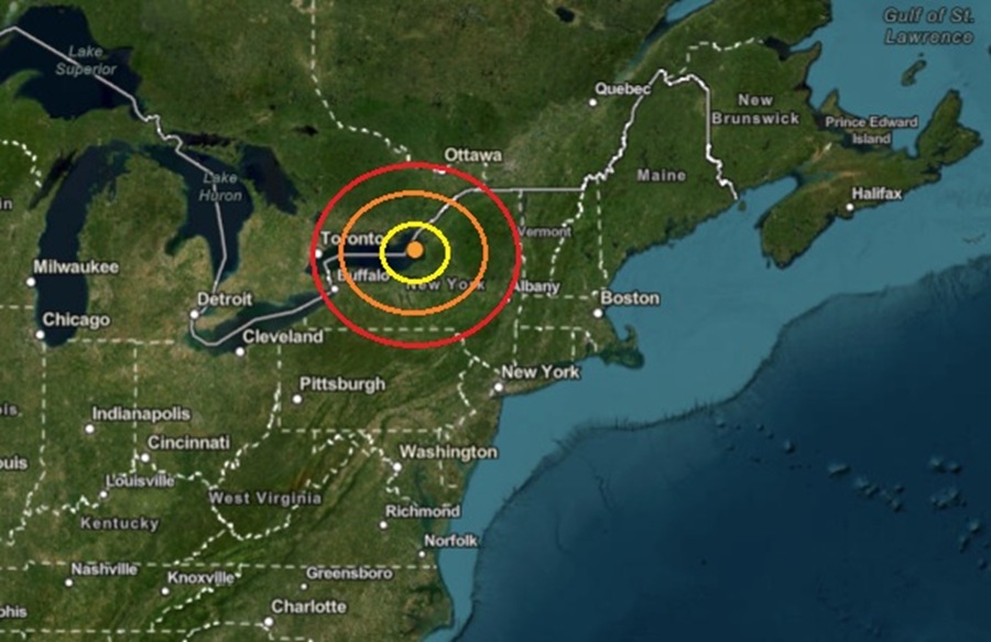
 The epicenter of the earthquake was at the orange dot inside the colored concentric circles on this map. Image: USGS
A morning earthquake rattled Upstate New York today, with some shaking reported by residents outside of Syracuse. USGS reported that at 9:08 am, from a depth of 5 km, an earthquake struck southwest of Watertown, northwest of Syracuse, and northeast of Rochester with a magnitude of 2.8. The epicenter of the earthquake was actually under water in the eastern part of Lake Ontario.
According to USGS, earthquakes with a magnitude of 2.0 or less are rarely felt or heard by people, but once they exceed 2.0 , more and more people can feel them. While damage is possible with magnitude 3.0 events or greater, significant damage and casualties usually don’t occur until the magnitude of a seismic event rises to a 5.5 or greater rated event.
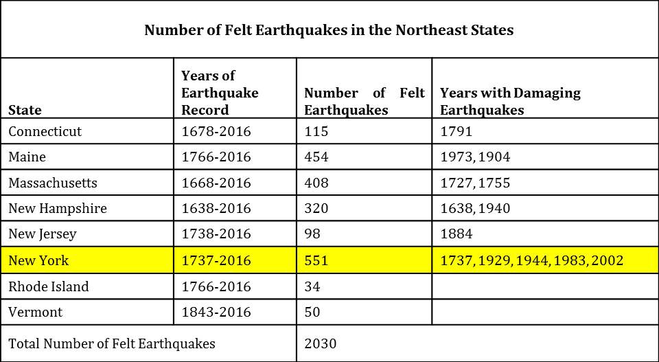 New York has seen the most number of damaging earthquakes in the northeast in the period 1678-2016. Image: NESEC
According to the Northeast States Emergency Consortium (NESEC), New York is a state with a very long history of earthquake activity that has touched all parts of the state. Since the first earthquake that was recorded in December 19, 1737, New York has had over 550 earthquakes centered within its state boundaries through 2016. It also has experienced strong ground shaking from earthquakes centered in nearby U.S. states and Canadian provinces. Most of the quakes in New York have taken place in the greater New York City area, in the Adirondack Mountains region, and in the western part of the state.
While many of the earthquakes to hit New York are weak like today’s, some have been damaging. Of the 551 earthquakes recorded between 1737 and 2016, 5 were considered “damaging”: 1737, 1929, 1944, 1983, and 2002.
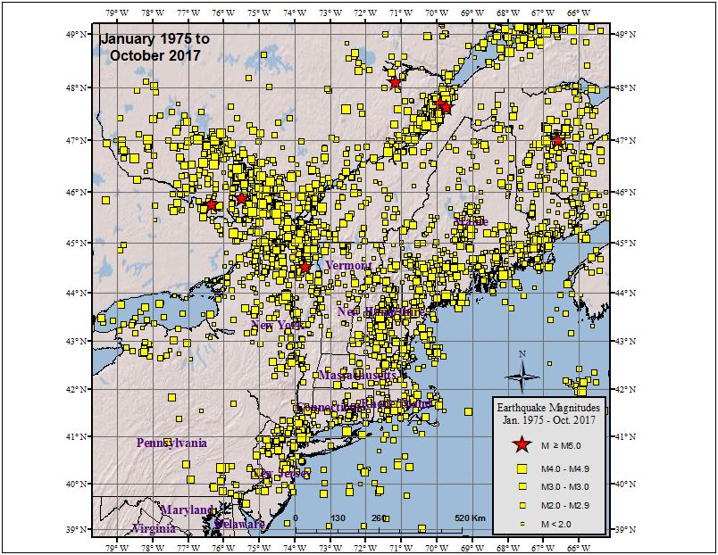 New York is no stranger to earthquakes; this map shows the epicenter of every earthquake from 1975 to 2017. Image: NESEC
While most of New York’s earthquakes have been in the Upstate, New York City has also seen damaging earthquakes over the years. At about 10:30 pm on December 18, 1737, an earthquake with an unknown epicenter hit New York with an estimated magnitude of 5.2. That quake damaged some chimneys in the city. On August 10, 1884, another 5.2 earthquake struck; this quake cracked chimneys and plaster, broke windows, and objects were thrown from shelves throughout not only New York City, but surrounding towns in New York and New Jersey too. The shaking from the 1884 earthquake was felt as far west as Toledo, Ohio and as far east as Penobscot Bay, Maine. It was also reported felt by some in Baltimore, Maryland.
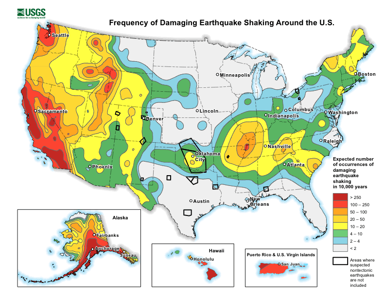 While the U.S. West Coast is best known for their earthquakes, there is considerable earthquake risk elsewhere in the country. Image: USGS