
New York is experiencing an early start to winter as new forecast models show that the state is set to be hit by a three-day snowstorm in weeks following the first snowfall of the year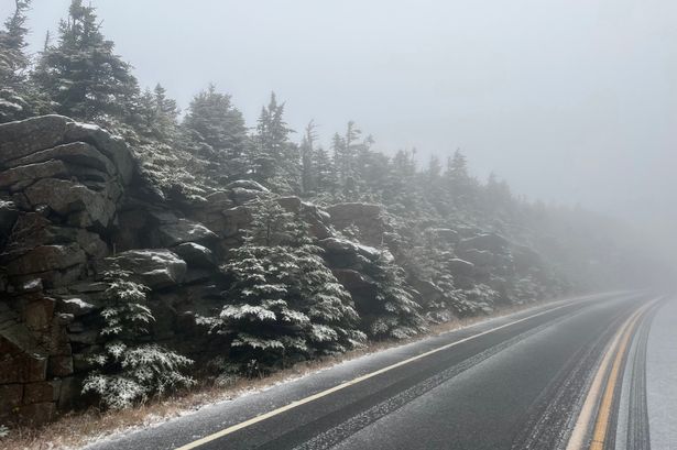 New York has already had its first snowfall of the year in Essex County (Image: New York State Department of Transportation/Facebook)
New York is set to be hit by an early-season snowstorm that will last three days, according to new weather charts.
Winter doesn’t officially begin until December 21, but the chill is arriving early across New York. The first snowfall of the year has already happened, with the Whiteface Veterans Memorial Highway in Essex County blanketed in white earlier this week.
Forecasters had predicted that the Empire State could “flirt with early snow” as soon as this month and that trend of early snow is set to continue. While the heaviest snowfall isn’t expected until we get well into winter, more snow is already on the way.
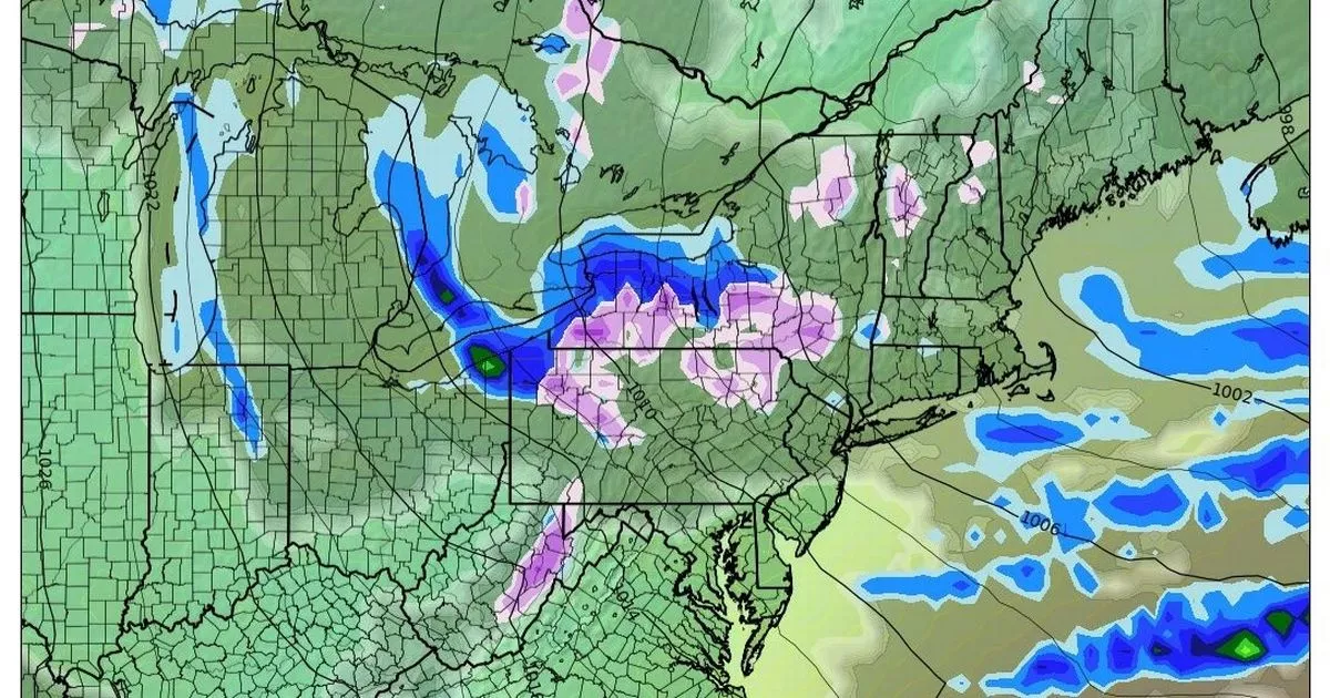
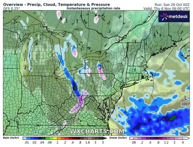
READ MORE: 13 states including New York sent back to the Ice Age as temperatures plummetREAD MORE: New York set for wild snowmageddon season as polar vortex alert issued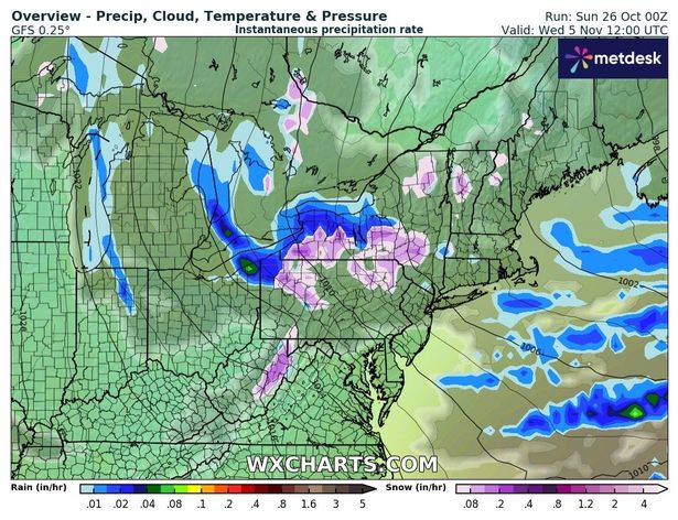 Most of the snow will fall on November 5(Image: WX Charts)Three-day snowstorm to hit New York in weeks
It won’t be long until New York experiences its next flurry of snow. Snowfall is forecast across three days in early November according to weather forecast model data viewer WX Charts.
Snow will arrive in central New York on November 4, charts show, with the heaviest snowfall set to fall west of Albany. November 5 will see the most snowfall coverage across the state.
Snowfall will be lighter, but is forecast to fall across much of the southern region of New York. Snow will stick around until November 6, but rain will also move into the region.
 New York has experienced early snowfall this year(Image: WX Charts)
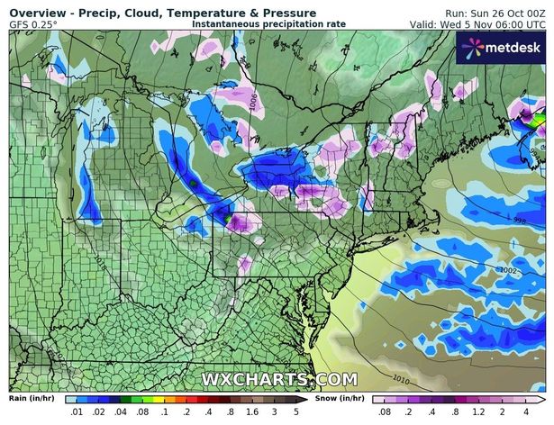
By November 7, conditions are set to have cleared up as the entire state is set to experience a couple of days of dry weather.
How much snow will New York get his year?
New York is expected to witness much more snow this year than last winter. However, despite the early snowfall, amounts will still fall below historical averages.
This year’s winter forecast has called for milder stretches as well as sudden cold snaps and heavy snow in some areas. Parts of New York could see as much as 100 inches of snow, while other regions are likely to witness a messier mix of rain and slush.
New York City is set to experience between 17 and 21 inches of snow this winter, according to AccuWeather. This is a significant increase from last winter’s total of just 12.9 inches, but still falls short of the historical average of 29.8 inches.
 Snow will stick around until November 7(Image: WX Charts)
Meanwhile, in western New York, Buffalo is bracing for much higher snow totals, with forecasters predicting 90 to 100 inches.
The Old Farmer’s Almanac has predicted that the Northeast will be a “very cold and snow-filled” zone this fall.
“By Halloween, trick-or-treaters in the North may need to bundle up, as chilly air and scattered showers are likely,” they said. “Throughout the season, the coldest conditions will settle into the North Central states and the interior Northeast, especially by late October and into November,” the almanac adds.