An intensifying low pressure system will deliver a wet and windy Thursday to the tri-state.
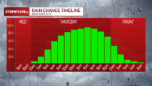
Light rain will move in for the morning commute, which could slow traffic down. But it’s the afternoon rain – and the potential for heavier downpours, thunder and lightning – that will make a bigger impact on afternoon and evening commuters.
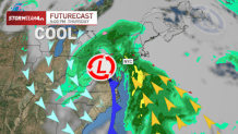
The storms will be most likely from mid-afternoon through early evening before the system lifts out of the area and drier skies prevail overnight Thursday night.
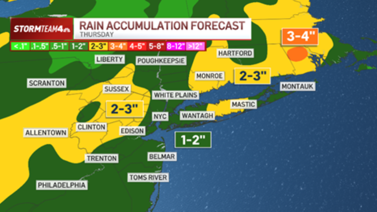
One to three inches of rain are likely through most of the area. It will come over the course of the entire day, so flash flooding is not likely.

However, ponding and minor roadway flooding where the heaviest downpours set up Thursday afternoon will lead to hazardous driving conditions.
In addition to the rain, strong east winds will develop Thursday. Expect 30 – 40 mile per hour gusts inland with coastal gusts as high as 50.

Minor coastal flooding is expected at high tide Thursday in low-lying areas.
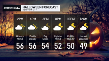
The good news is that this storm will pull away from the region Thursday night, leaving strong westerly winds in its wake for Halloween, but also guaranteeing a dry day and evening for Halloween festivities.