
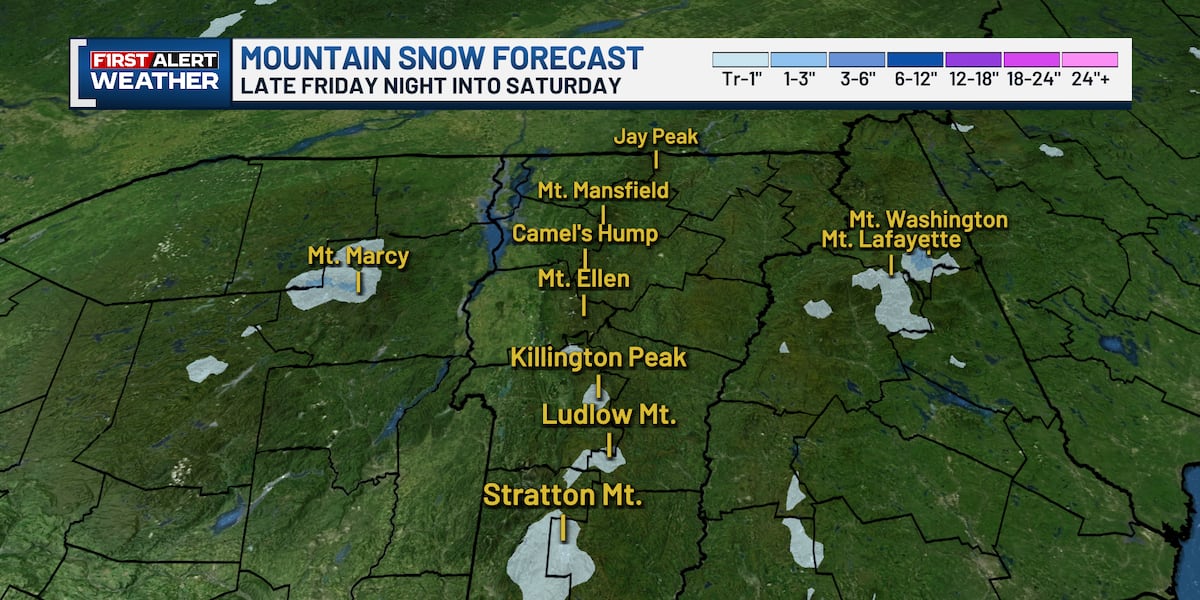
BURLINGTON, Vt. (WCAX) – Despite the fact that we’re nearing the end of meteorological spring (March – May) and start of meteorological summer (June – August), we’re still talking about the potential for snow chances! Nothing in the valleys, but light accumulations of wet snow are possible in the higher elevations. An unusually cold upper-level storm system dives south from well north of Hudson Bay will bring freezing temperatures to the higher elevations late Friday night into Saturday — cold enough for snow on those higher peaks.
WHY IT’S HAPPENING
The air mass arriving this weekend is more characteristic of early spring or mid-fall than the last week of May. Temperatures aloft will rank in the bottom 10th percentile for this time of year, and while valley locations will see lows only in the mid-to-upper 40s — the freezing level will drop to around 4,000 feet. That puts the summits of the High Peaks well within range of wet snow.
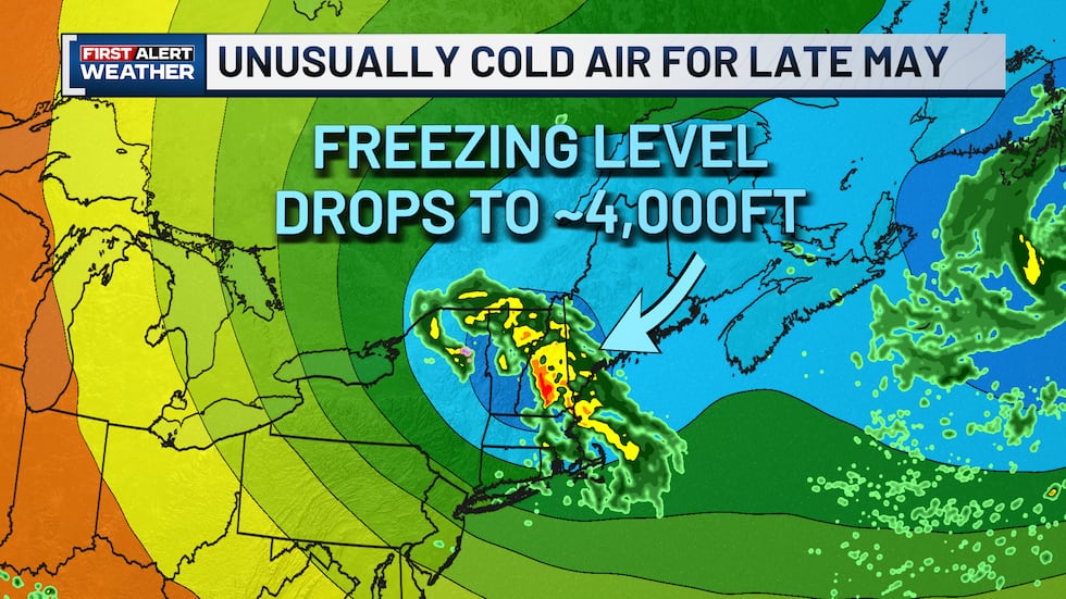 Freezing level over NY, NH, and VT to drop below 4,000 feet(Gunnar Consol)
MOUNTAIN SNOW FORECAST — LATE FRIDAY NIGHT INTO SATURDAY
Snow will be confined strictly to the highest elevations. Here’s what’s expected by mountain range:
Adirondack High Peaks
Above 5,000′ — 1-2″; Above 4,000′ — Trace to 1″
Green Mountains
Above 4,000′ — Trace to 1″
White Mountains
Above 6,000′ — 2-4″; Above 5,000′ — 1-2″; Above 4,000′ — Trace to 1″
Mt. Washington, sitting at 6,288 feet, stands to see the most significant accumulation of any summit in the region at 2-4 inches.
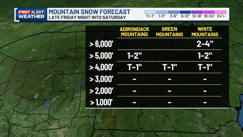 Late Friday Night into Early Saturday Morning(Gunnar Consol)
IS THIS UNUSUAL?
Late May snow on the high peaks is rare — but not unprecedented. Vermont, New Hampshire, and New York’s highest summits have seen measurable snow in late May before. Some mountains have even seen a trace of snow as late as mid June before! Below 4,000 feet, this weekend will bring just rain, not snow.
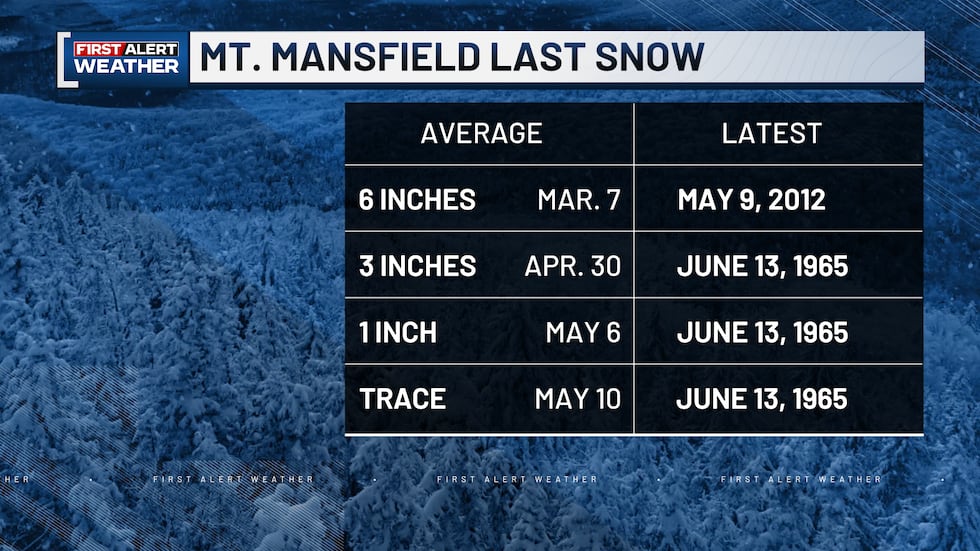 Average and Latest Dates(Gunnar Consol)
A NOTE FOR HIKERS AND OUTDOOR ENTHUSIASTS
If you have plans in the High Peaks this weekend, be prepared for conditions that feel more like early spring than early summer. Wet snow above 4,000 feet, rain below, temperatures in the 40s, and winds gusting to 10-15 mph will make for raw, slippery conditions on exposed terrain. Trails at elevation will be wet and potentially icy near the summits Saturday morning. Dress in layers, bring rain gear, and check conditions before heading out. Fortunately, precipitation chances diminish during the late morning and afternoon Saturday.
HOW TO GET WEATHER ALERTS ON YOUR PHONE
Make sure you have the WCAX First Alert Weather App — not the WCAX News app. From there:
Tap the three lines in the top right cornerTap SettingsTurn notifications onTap Weather Notification Types to choose your alerts
The First Alert Weather Team is continuing to monitor this weekend’s unusually cold air and any changes to snow levels, accumulations, and timing. Stay with us on air, online, and on our app for the latest updates.
Copyright 2026 WCAX. All rights reserved.