
Downpours and strong storms possible Sunday in Vermont, New York
Storms contain a risk for damaging wind gusts and areas of localized flooding
be daily chances for scattered showers. Looking ahead, another storm system is forecast to move into the region on Thursday and is expected to bring widespread rainfall. Forecast details, including the exact timing and intensity of storms and rainfall amounts, may continue to be refined as conditions develop. Strong to severe thunderstorms are possible today and tonight, with some areas also at risk for localized flooding from heavy rainfall. Conditions are expected to become more typical for this time of year early next week, although there will still be daily chances for scattered showers. Looking ahead, another storm system is forecast to move into the region on Thursday and is expected to bring widespread rainfall. Forecast details, including the exact timing and intensity of storms and rainfall amounts, may continue to be refined as conditions develop. Strong to severe thunderstorms are possible today and tonight, with some areas also at risk for localized flooding from heavy rainfall. Conditions are expected to become more typical for this time of year early next week, although there will still be daily chances for scattered showers. Looking ahead, another storm system is forecast to move into the region on Thursday and is expected to bring widespread rainfall. Forecast details, including the exact timing and intensity of storms and rainfall amounts, may continue to be refined as conditions develop. Strong to severe thunderstorms are possible today and tonight, with some areas also at risk for localized flooding from heavy rainfall. Conditions are expected to become more typical for this time of year early next week, although there will stil
NBC5 First Warning Meteorologist
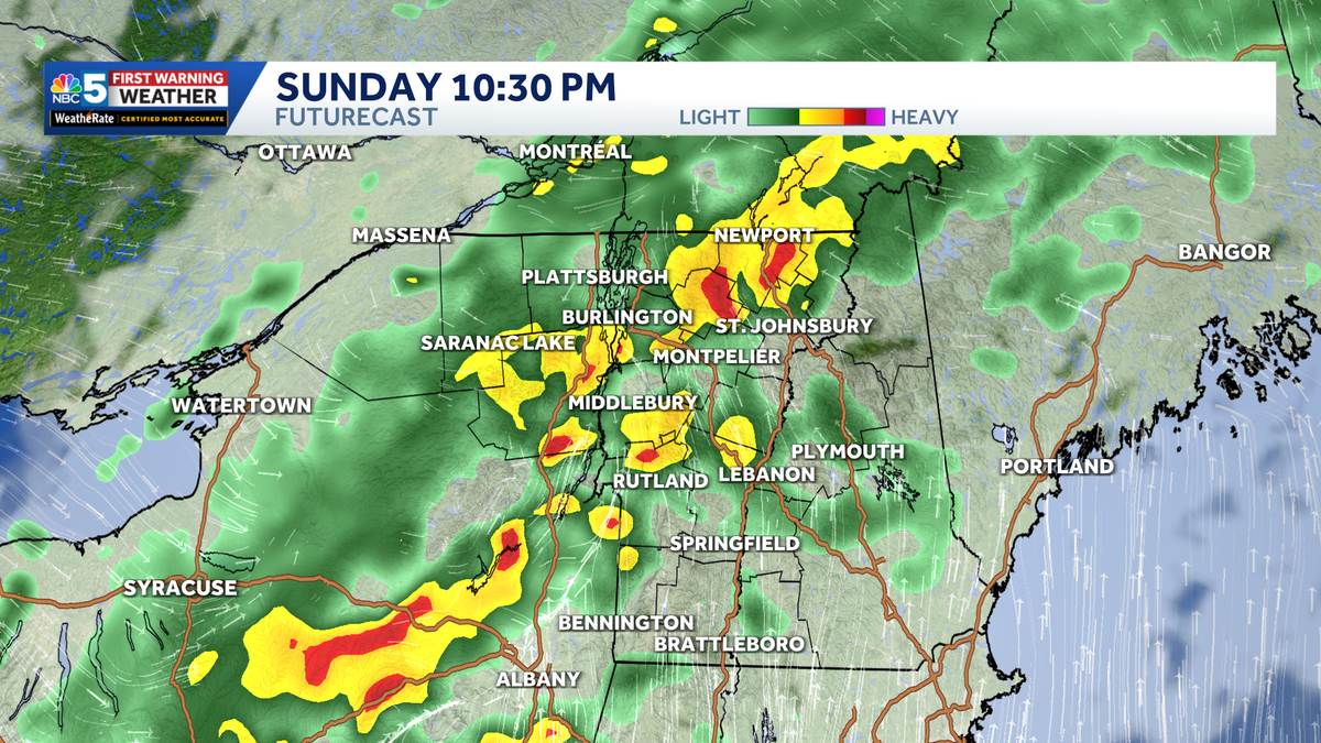
A strong cold front will bring rounds of showers and embedded thunderstorms to Vermont and northern New York. It will not rain everywhere all day, but some towns could see heavy downpours, especially if multiple showers move over the same area.The main concern is localized flooding from heavy rain. Parts of the Green Mountains and southern Vermont are areas to watch closely.Gusty winds are also possible Sunday afternoon, even outside of thunderstorms. Any stronger storm could briefly produce heavier rain and stronger gusts.Outdoor plans should have a backup, especially later in the day. Drivers may also run into quick drops in visibility, ponding, or poor drainage flooding during heavier downpours.Behind the front, cooler and more comfortable air returns Monday and Tuesday, with highs mainly in the 70s. A few light showers remain possible, especially in the mountains.
A strong cold front will bring rounds of showers and embedded thunderstorms to Vermont and northern New York. It will not rain everywhere all day, but some towns could see heavy downpours, especially if multiple showers move over the same area.
NBC5 News
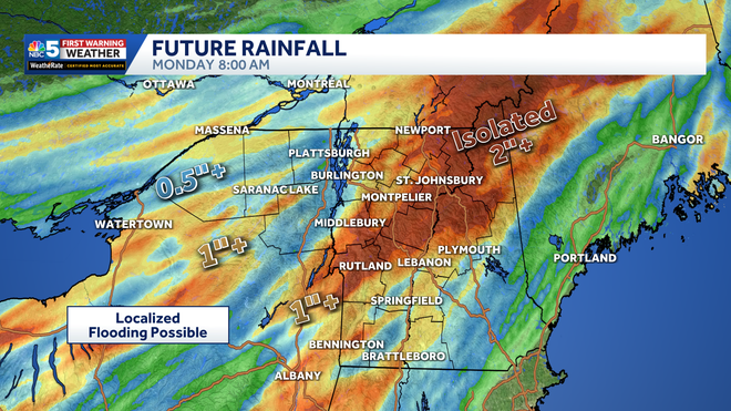
Rainfall forecast through Monday morning.
The main concern is localized flooding from heavy rain. Parts of the Green Mountains and southern Vermont are areas to watch closely.
Hearst OwnedNBC5 WPTZ-TV
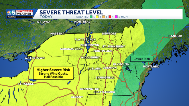
Storm Risk Sunday 06-14-26
Gusty winds are also possible Sunday afternoon, even outside of thunderstorms. Any stronger storm could briefly produce heavier rain and stronger gusts.
Outdoor plans should have a backup, especially later in the day. Drivers may also run into quick drops in visibility, ponding, or poor drainage flooding during heavier downpours.
Hearst Owned
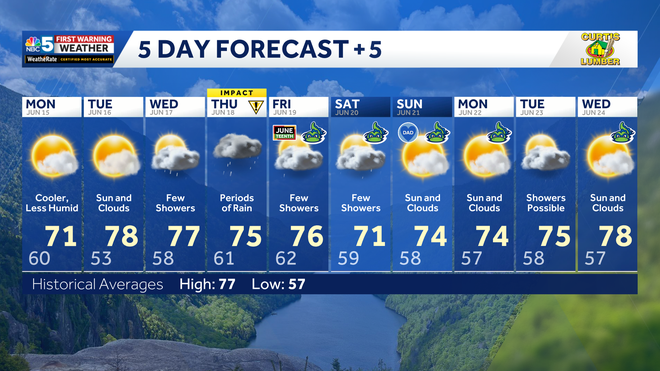
Our latest extended forecast.
Behind the front, cooler and more comfortable air returns Monday and Tuesday, with highs mainly in the 70s. A few light showers remain possible, especially in the mountains.