
In commemoration of the 250th anniversary of the United State, we’re launching Step into Brooklyn, an immersive tour and 10-video series exploring how the borough still doubles as a living archive of American history.
Before Brooklyn was brownstones, baristas and selfie-worthy bridge views, it was battlegrounds, shorelines, and hills that shaped the history of Kings County and beyond — especially as the home of the Battle of Brooklyn, the first clash between American and British soldiers after the signing of the Declaration of Independence.
Soldiers arrived in southern Brooklyn on Aug. 22, 1776, and surged across the borough over the course of several days, forcing American troops to retreat further and further north. Though the battle left the American forces in shambles and allowed the British to capture New York City, there was still a victory: General George Washington and thousands of troops successfully fled to Manhattan and lived to see and fight another day.
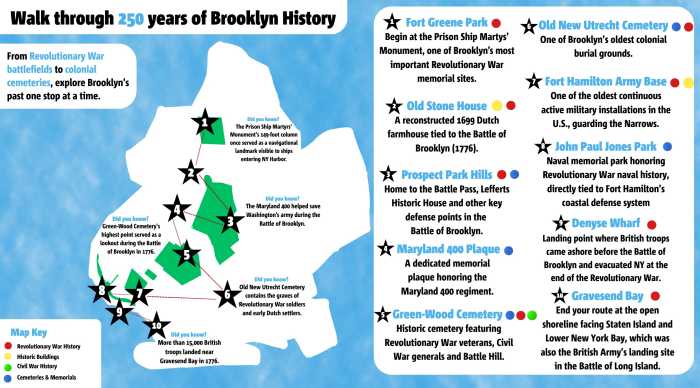 Step into Brooklyn’s history with Brooklyn Paper’s walking tour! Image by Olivia Seaman
The British started in southern Brooklyn, but this tour starts at the north end of the borough, in Fort Greene Park. You’ll work your way south, on streets and sidewalks that used to be treacherous wetlands and marshes, and end at the Gravesend Bay, where thousands of British troops landed 250 years ago.
We’re calling this a walking tour, but you’ll still be mixing in some public transit between stretches. Set aside a full day or break it in two, stay hydrated, take detours when something catches your eye and move at your own pace (and at the will of the MTA, of course), starting at …
Stop 1: Prison Ship Martyrs Monument, Fort Greene Park
Getting there:
Subway: Take the 2/3, 4/5, N/Q/R/W, or B/D/N/Q/R to Atlantic Avenue–Barclays Center
Walk ~10-15 minutes up Flatbush Avenue/Fulton Street to Fort Greene Park
Before it was Fort Greene Park, it was high ground for war. So we begin on the hill.
Towering above the park, the Prison Ship Martyrs Monument stands as one of Brooklyn’s most significant Revolutionary War memorials. Designed by famed architect Stanford White and dedicated in 1908, the monument honors more than 11,500 American prisoners who died aboard British prison ships anchored in Wallabout Bay during the Revolutionary War.
In 1776, Major General Nathanael Greene built Fort Putnam here as part of Brooklyn’s defensive line during the battle. The position fell as the Continental Army retreated, and the fight shifted to the waters below.
Just offshore, British prison ships held thousands of American captives in brutal conditions. Overcrowding, disease, and starvation claimed more than 11,500 lives, and the dead were hastily buried along the shoreline.
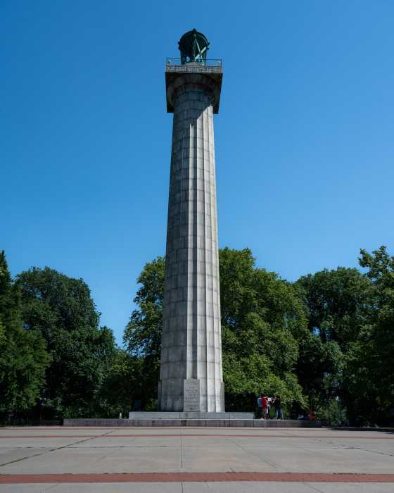 In Fort Greene Park, a towering granite monument marks one of the most overlooked chapters of the Revolutionary War.Photo by Gabriele Holtermann
 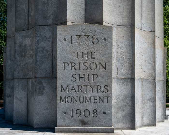 The Prison Ship Martyrs Monument honors more than 11,000 Americans who died in British captivity.Photo by Gabriele Holtermann
In 1808, those remains were moved inland, setting in motion decades of civic effort to honor them. Walt Whitman later championed the site as public space, followed by Frederick Law Olmsted and Calvert Vaux, who helped reshape it into a park.
The remains of the prison ship martyrs were eventually reinterred here, placed in a crypt beneath the monument plaza that still serves as their final resting place. The current monument — designed by McKim, Mead & White in the early 1900s — is a granite staircase rising to a 149-foot Doric column overlooking the site. Following a major restoration completed in 2008, it continues to stand as a lasting tribute to the prisoners who died in British captivity.
Stop 2: Old Stone House
Getting there:
Walk ~25-30 minutes through Park Slope or
Subway: 2/3 to Grand Army Plaza, then walk ~10 minutes south
In Park Slope, a small building carries a much larger history.
Built in 1699, the Old Stone House sits at Fifth Avenue and Third Street. Kim Maier, its executive director, calls it “an adorable little country Dutch home,” but it also marks one of the central sites of the Battle of Brooklyn (also referred to as the Battle of Long Island, and a recurring character on this tour).
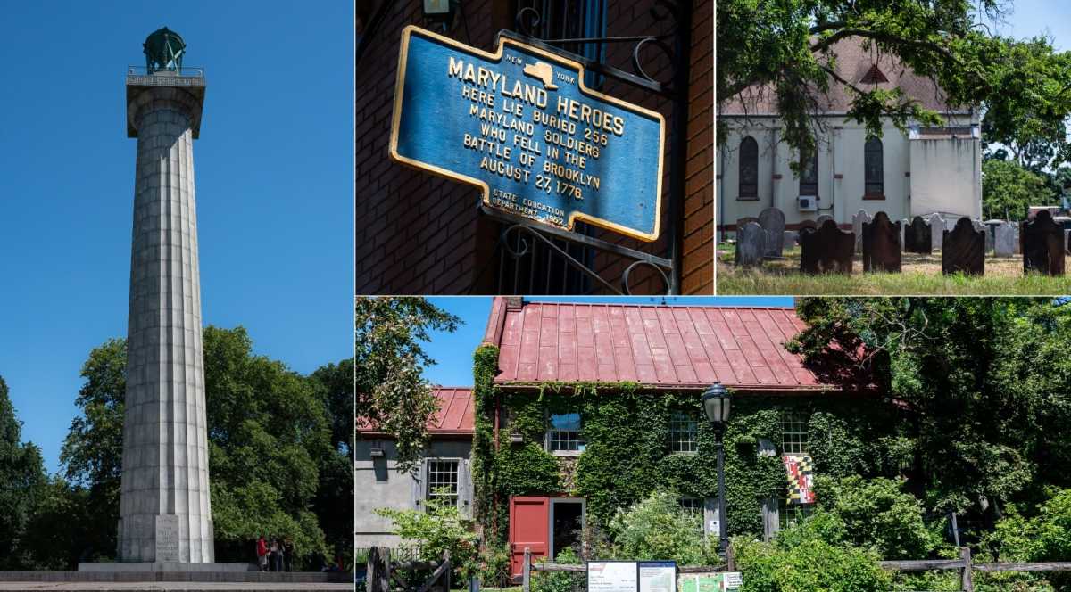
On August 27, 1776, Maryland troops made a last stand here during the largest battle of the Revolutionary War. Their defense allowed Washington’s army to retreat across the marshes toward Brooklyn Heights.
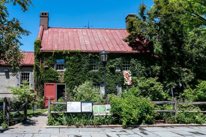 At the edge of Park Slope, the Old Stone House stands as a rare surviving witness to the Battle of Brooklyn. Photo by Gabriele Holtermann
“This is where the Marylanders held the line to allow the rest of the American army to escape,” Maier told Brooklyn Paper. The action helped cement Maryland’s “Old Line State” nickname.
The retreat worked, but barely. And the scale of the battle still shapes how Brooklyn remembers the Revolution. Maier also resists treating the site as finished history.
“We have been having many of the same arguments for 250 years,” she said. The Revolution’s debates over democracy and equality, she added, are still ongoing.
After the war, the battlefield became farmland, then city blocks. Even early baseball games tied into the area’s layered past, including connections to what would become the Brooklyn Dodgers.
Today, the reconstructed house functions as a community space, hosting programs, gardens, and school visits — a place where Maier says “life, liberty, and the pursuit of happiness is happening on a daily basis.” A battlefield turned classroom, still asking the same questions it did in 1776.
Stop 3: Prospect Park
Getting there:
Walk ~10-15 minutes south from Old Stone House
Prospect Park’s landscape still carries the shape of the 1776 battle.
Lookout Hill and Battle Pass were key defensive points during the British advance. American troops tried to hold the narrow corridors leading into Brooklyn, but the lines collapsed quickly.
Dylan Yeats, Director of Museum Programs and Operations at Prospect Park, said the terrain dictated everything. At Flatbush Pass — also known as Battle Pass — American forces under General John Sullivan attempted to block British movement along a key road connecting Flatbush and Brooklyn. They chopped down the massive Dongan Oak tree to block the path, and even burned nearby homes to slow British forces.
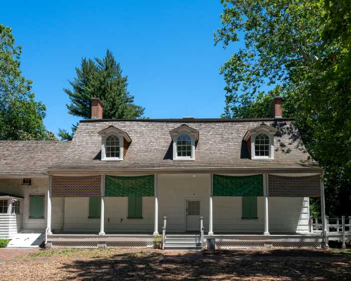 At the edge of Prospect Park, the Lefferts Historic House preserves a surviving fragment of 18th-century Flatbush — land that once sat just behind the Battle of Brooklyn’s front lines.Photo by Gabriele Holtermann
“The idea being they would prevent the British from going through the hills from Flatbush into Brooklyn,” he told Brooklyn Paper.
But the defenses didn’t hold. By the morning of Aug. 27, American forces realized they were being surrounded. As Yeats recounts, “once they realized they’re surrounded, they all flee across the park … down to what is basically Third Street … and to the Old Stone House.”
That retreat cut through what is now Long Meadow and nearby paths.
At Lookout Hill, a monument now marks where the Maryland 400 made their famous last stand, buying crucial time for Washington’s army to escape. But the entire park tells the story, according to Yeats.
“We have two-pound cannon here… aimed down at the Flatbush Road to stop the British from coming,” he said.
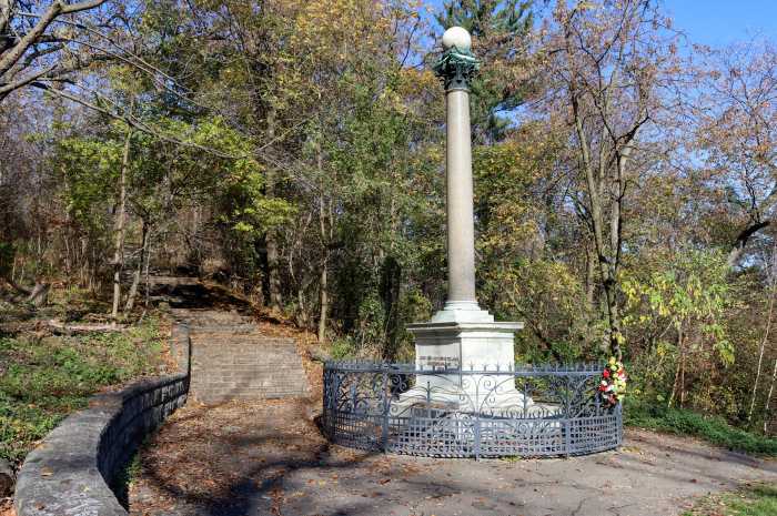 At Lookout Hill in Prospect Park, a monument marks one of the key high points of the 1776 Battle of Brooklyn. Photo by Susan De Vries
He also pointed to the deeper memory embedded in the ground. Local accounts, he said, long held that “a lot of Flatbush residents wouldn’t come to this area for decades because they thought it was haunted.” The British had left American soldiers unburied in the woods as a warning against rebellion.
Today, these are walking paths and shaded clearings. In 1776, they were escape routes under fire.
Stop 4: Maryland 400 Plaque, Gowanus
Getting there:
Walk ~20 minutes north or
Subway: F/G to Carroll Street, then walk ~10 minutes
Outside the park, the story becomes harder to pin down.
The Maryland 400 plaque outside American Legion Post 1636 in Gowanus has long drawn onlookers. At first glance, the site reads as a quiet neighborhood gathering place for veterans — and it is — but it also anchors one of the Revolution’s lingering, unsolved mysteries.
The plaque at 193 9th Street commemorates the First Maryland Regiment — the same Maryland 400 who fought in Prospect Park — who, outnumbered and overwhelmed, made a last stand that helped cover Washington’s retreat.
The cost was staggering. Roughly 400 soldiers went into the fight; fewer than a dozen returned. The rest were killed, captured, or lost in the chaos that followed the collapse of American lines. Washington himself watched the fighting from Cobble Hill Fort in what’s now Cobble Hill, where he realized how grave the situation had become and lamented, “Good God, what brave fellows I must this day lose.”
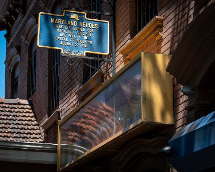 In Gowanus, a modest roadside plaque marks a disputed burial landscape tied to one of the Revolution’s most devastating losses.Photo by Gabriele Holtermann
In the years after, local lore placed their burial ground nearby along the marshy edges of Gowanus Canal — generally around present-day Third Avenue between 7th and 9th Streets, where the American Legion now stands. But no graves have ever been confirmed. Archaeological and forensic investigations in the area have not uncovered human remains.
That absence is often explained in two overlapping ways: the improvised nature of Revolutionary War burials, likely unmarked mass graves in wetlands that were never formally documented, and the drastic reshaping of the landscape in the 19th century, when industrial development buried much of old Gowanus under factories, housing and infrastructure.
Whether or not it’s truly where the bodies are buried, the plaque has become a focal point for remembrance.
Stop 5: Green-Wood Cemetery
Getting there:
Walk ~20-25 minutes west or
Subway: F/G to 15 Street–Prospect Park, then walk ~10 minutes
At Green-Wood Cemetery, Brooklyn’s past is never far from the surface.
That’s especially true at Battle Hill, the highest natural point in the borough. The cemetery itself was designed in 1838 as part of the rural cemetery movement, blending burial ground, public green space, and an open-air archive.
Long before that time, during the Battle of Brooklyn, American soldiers rushed to secure the high ground but realized the British had already beaten them to it. Undeterred, they re-claimed the hill and held their position against multiple British-counter attacks, inflicting some of the highest British casualties of the battle before most were ultimately captured by the invading forces.
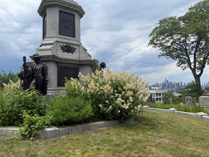 Green-Wood Cemetery’s historic Battle Hill.Photo by Olivia Seaman
Today, Battle Hill is a quiet overlook with a loud past, holding one of the key moments of Brooklyn’s Revolutionary War history. It sits within Green-Wood Cemetery’s broader landscape — and some of its most famous permanent residents, including Jean-Michel Basquiat, Leonard Bernstein, Boss Tweed and Louis Comfort Tiffany.
Stop 6: Old New Utrecht Cemetery
Getting there:
Subway: D train to 18th Ave or 20th Ave, then walk ~5-10 minutes
This cemetery reaches even further back than the Revolution itself.
The New Utrecht Reformed Dutch Church Cemetery, established around 1653-1654, predates the church that would eventually stand next to it. That first church came later, in 1700, but the burial ground was already in use — making it one of the oldest continuous colonial sites in Brooklyn. It sits in what was once the town of New Utrecht, an early Dutch settlement that later became part of modern-day Bensonhurst.
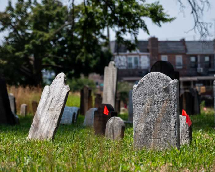 American Revolutionary War soldiers are buried at the Old New Utrecht Cemetery.Photo by Gabriele Holtermann
 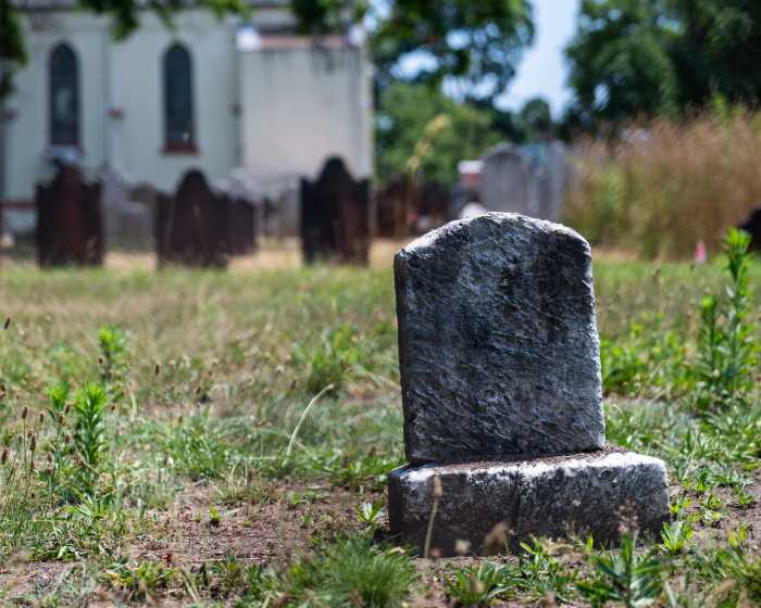 The Old New Utrecht Reformed Dutch Church Cemetery, established around 1653, is one of Brooklyn’s oldest surviving colonial burial grounds.Photo by Gabriele Holtermann
What you see today is essentially a layered record of that entire history. A lot of the earliest families from the area are buried here — names like the Van Brunts, Cortelyous, Cowenhovens, Cropseys and Bennetts. These were some of the people who helped put the original settlement together.
But it’s not just old family plots. There’s also a shared, unmarked grave for Revolutionary War soldiers who were buried after fighting came through the area. And there are sections where members of the local community of African descent — both enslaved and free — were laid to rest, often without names or markers.
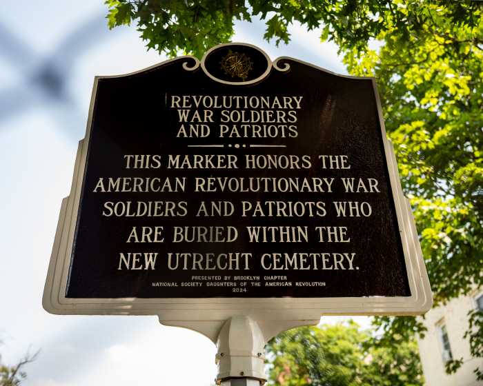 The Old New Utrecht Reformed Dutch Church Cemetery, established around 1653, is one of Brooklyn’s oldest surviving colonial burial grounds.Photo by Gabriele Holtermann
Altogether, roughly 1,300 people have been interred here over the past three centuries. While the cemetery isn’t open for daily walk-ins, it does open to the public during special events and guided tours hosted by the Friends of Historic New Utrecht, including the group’s annual Liberty Weekend in early summer.
Stop 7: Fort Hamilton
Getting there:
Subway: R train to Bay Ridge-95th Street, then walk ~10-15 minutes
At the Narrows, the story shifts from memory to continuity.
Fort Hamilton sits beside a strategic choke point of the New York Harbor. The current fort, named for Alexander Hamilton, dates to the early 1800s. Its cornerstone was laid in 1825, and it was completed in 1831 as part of a larger system of coastal defenses built to protect New York from naval attack. Today it’s the fourth oldest active U.S. Army installation in the country.
But the site’s military importance goes back even further than the fort itself. In the summer of 1776, hundreds of British ships gathered in the New York Harbor, and some settled in on Staten Island, right across the Narrows from Bay Ridge and what’s now Fort Hamilton.
“This is the largest naval advance in the history of the world until World War II. It’s just huge,” said Brooklyn borough historian Asad Dandia. “One patriot wrote that he thought that all of London was afloat on the water.”
At the time, the site was home to the much-smaller Narrows Fort, where Americans fired at a British ship — the HMS Asia — but couldn’t do much damage. Ultimately, the unprotected southern coast of Brooklyn couldn’t defend the borough against British forces.
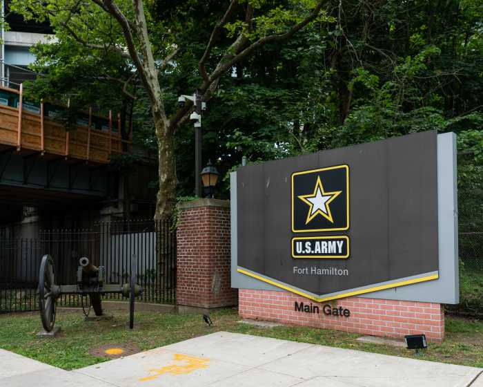 At the Narrows, Fort Hamilton represents both the legacy and continuation of coastal defense in New York Harbor.Photo by Gabriele Holtermann
After the war, Americans shored up their defenses. Coastal protections during the War of 1812 — including Fort Diamond, which sat a few hundred yards from Fort Hamilton — helped protect the city, and construction on the much-larger Fort Hamilton began in 1825.
Over time, Fort Hamilton expanded and adapted with every major conflict. During the Civil War, it served as a training and recruitment center, including headquarters activity for the 3rd U.S. Infantry. In both World Wars, it became a major staging point for troops shipping out through the Port of Embarkation in New York.
Its history is also tied to some familiar military names. Robert E. Lee and Abner Doubleday both served here early in their careers, long before the Civil War put them on opposite sides of American memory.
Today, Fort Hamilton is still active in a very literal sense. It’s home to Army active duty, Reserve, and National Guard units. It also plays a role in more recent history. After 9/11, National Guard units like Joint Task Force Empire Shield were activated here to help secure transit and critical infrastructure. During Hurricane Sandy and COVID-19, personnel from the installation supported emergency response efforts across the city, including coordination at places like the Javits Center.
Unlike most historic sites in Brooklyn (and on our walking tour), Fort Hamilton is less about “what happened here” and more about what’s still happening here.
Stop 8: John Paul Jones Park
Getting there:
Walk ~10 minutes north along Shore Road
Just north of Fort Hamilton is a quiet park with a lot of military history — and the kids call it “Cannonball Park.”
At John Paul Jones Park, a Civil War-era Rodman cannon sits out in the open, still aimed toward the harbor, with old cannon balls lined up in front of it. A few steps away is the Dover Patrol memorial — a granite column designed by Sir Ashton Webb and gifted by England after World War I.
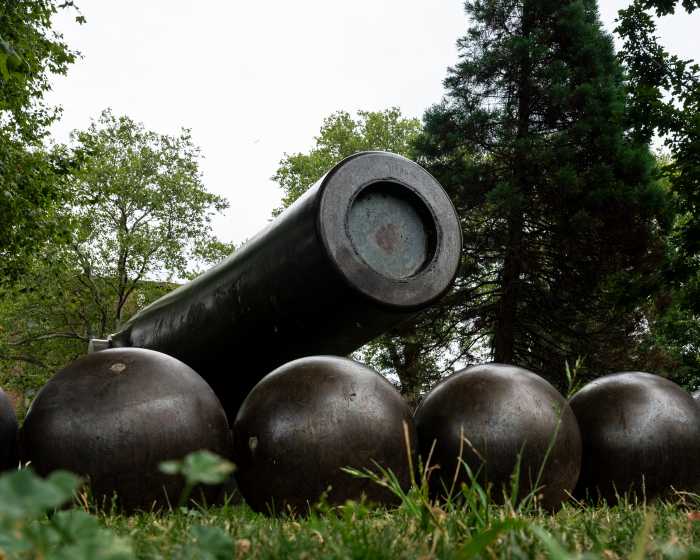 The Rodman Gun at John Paul Jones Park is the largest smoothbore, muzzle-loading coastal defense cannon ever produced in the United States. Cast during the Civil War, it remains one of the park’s most striking reminders of Brooklyn’s military past.Photo by Gabriele Holtermann
The park is named for John Paul Jones, the Revolutionary War naval commander known as the “father of the Navy.” He rose from merchant to Continental Navy captain, and fought his most famous battle in 1779, when his squadron engaged with two British warships that had been protecting a fleet of merchant vessels. Jones’ ship, the Bonhomme Richard, was heavily damaged, but he famously refused to surrender, shouting, “I have not yet begun to fight!” and eventually forcing a win over the British and taking over one of their ships.
What was then the City of Brooklyn acquired the parkland in the late 1800s. The Civil War memorial was installed in 1900, a Revolutionary War memorial in 1916, and, more recently, a 70-foot flagpole, installed in 1980 and dedicated to Jones himself.
Stops 9 and 10: Denyse Wharf & Gravesend Bay
Getting there:
Walk ~20-25 minutes south along Shore Road/Belt Parkway path or
Subway + walk: R train to Bay Ridge-95th Street, then walk south
Our journey ends at Gravesend Bay, which is pretty hard to miss, and Denyse Wharf, where history is hidden away.
The bay is wide, sheltered stretch of the harbor just off the Verrazzano-Narrows Bridge, and is still an integral part of the city’s busy waterways.
Tucked along the shore, just below the bridge, is Denyse Wharf. In colonial Brooklyn, the Denyse family ran a ferry to Staten Island from here, and nearby homesteads belonged to some of the area’s earliest settlers.
The Denyse family home was damaged by British forces before the battle even began. In July 1776, after Americans fired at the British ship HMS Asia, the ship fired back, launching cannon balls that damaged the family’s barn and garden — narrowly missing the kitchen, where many of them were reportedly sitting at the time.
A month later, the area became strategic almost overnight. Thousands of British soldiers landed on the unprotected shores of Gravesend Bay and at Denyse Wharf on Aug. 22, 1776. From there, they split up and moved inland along routes the Americans hadn’t fully secured, planning to approach them from two directions.
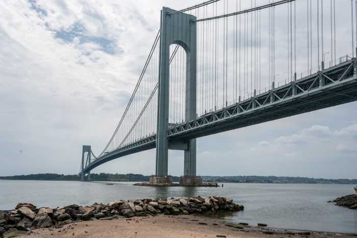 Today, Gravesend Bay (seen here off of Denyse Wharf) is a quiet stretch of New York Harbor. In 1776, it served as one of the entry points for British forces launching the Battle of Brooklyn. Photo by Gabriele Holtermann
Their plan was successful – leading to everything you’ve read about from Prospect Park to Fort Greene and Brooklyn Heights, where Washington fled on his way to Manhattan.
Years later, the British may have used Denyse Wharf as they evacuated New York City once the Revolutionary war was done.
Since then, the wharf has faded. The Belt Parkway eventually cut through the area in the 20th century, and what’s left now is mostly a concrete jetty and fragments of the old landing, sitting quietly under the Verrazzano, mostly blocked off from public access. The shoreline, once the landing of a massive military operation, now offers views of the harbor and the bridge from the beloved Shore Road greenway.
Community groups and local volunteers also organize occasional cleanup efforts at Denyse Wharf, clearing debris from the shoreline and jetty — small but steady work that helps keep the site maintained and visible from the promenade, even though direct access to the wharf itself remains restricted to the public.
After the battle
So, what happened after the battle? Days after the massacre in Gowanus and Park Slope, Washington managed to evacuate 9,000 troops across the East River to Manhattan before the British could capture Brooklyn Heights. The Americans had taken a lot of damage, but they learned from the battle and from their failed preparations.
“The Battle of Brooklyn was a loss, it was not a win. But it was the first battle of the war, it was the largest battle of the war, and it was the battle that allowed Washington and the patriots to really re-assess where they needed to recalibrate and rework their strategies and their positions,” Dandia said. “So, as the phrase goes, they lost the battle, but they won the war.”
Meanwhile, the British were left to govern New York City. They had won the military battle, Dandia said, but not the battle for hearts and minds.
In the beginning, Brooklynites didn’t have particularly strong feelings toward the British Loyalists or the American Patriots, he said. But as the war continued, people grew frustrated. The economy sagged, food prices skyrocketed, and they wanted the fighting to end.
“As the war drags on, Brooklynites start to become much more sympathetic — not necessarily to the Patriot cause, but to the war coming to an end,” he said. “And if that means telling the Red Coats to get out, then that’s what we’re going to do. In a very New York way, it’s like, get the hell out of my way, I got work to do.”
The Americans officially claimed victory at the Battle of Yorktown in 1781, but the Treaty of Paris wasn’t signed for two more years. Washington returned to New York City on Nov. 25, 1783 and rode through the city as British soldiers departed, officially ending the occupation of the city.