
Here’s what you need to know:
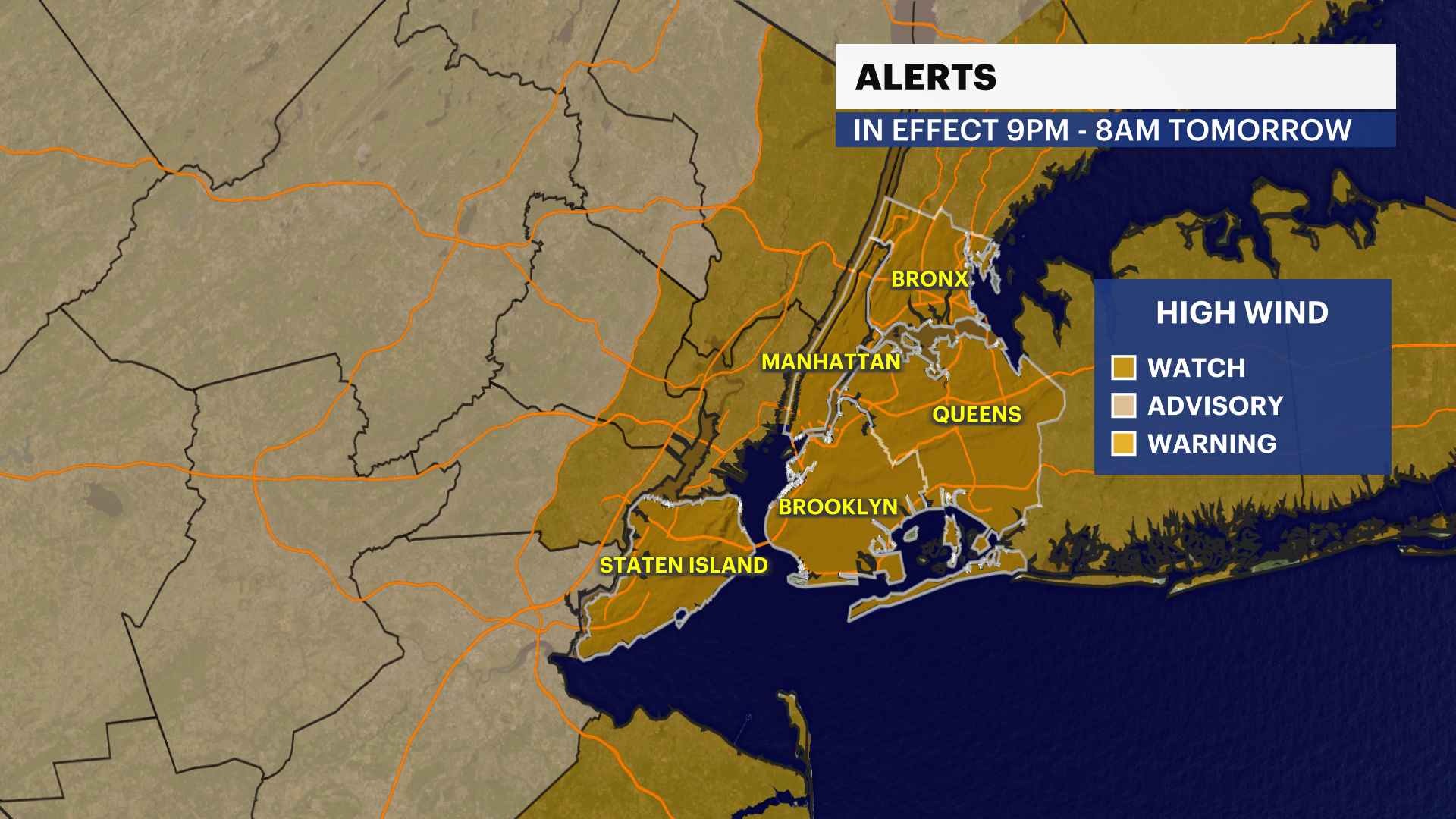
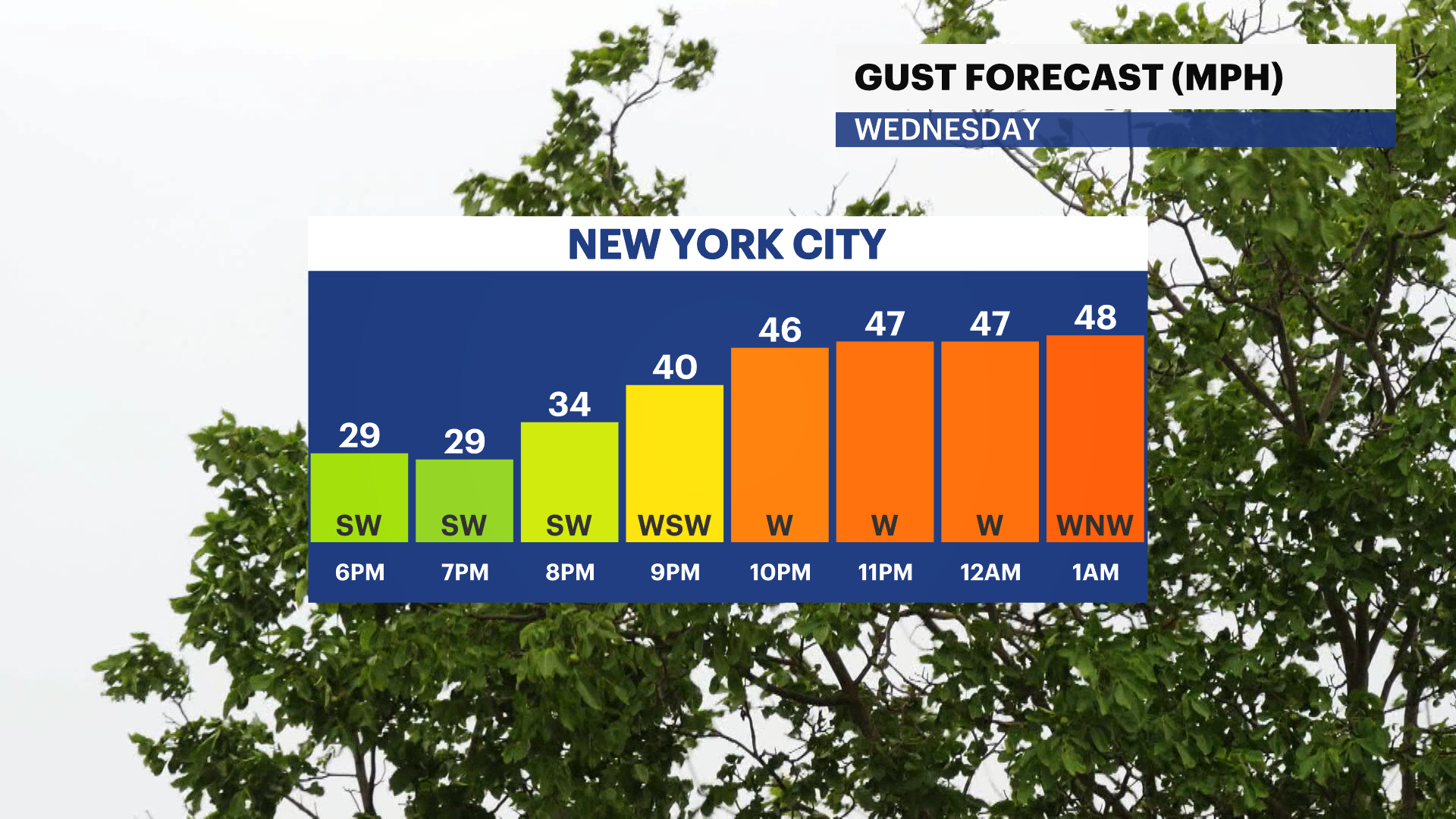
A HIGH WIND WATCH is in effect 9 p.m. tonight through 8 a.m. tomorrow. Damaging wind gusts up to 60 mph are possible tonight.
It’s mostly sunny, chilly and breezy this morning with wake-up temperatures in the mid to upper 40s.
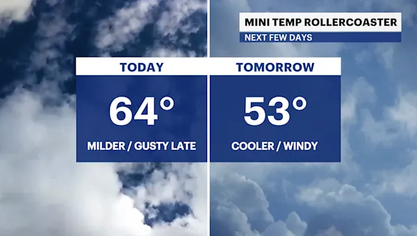
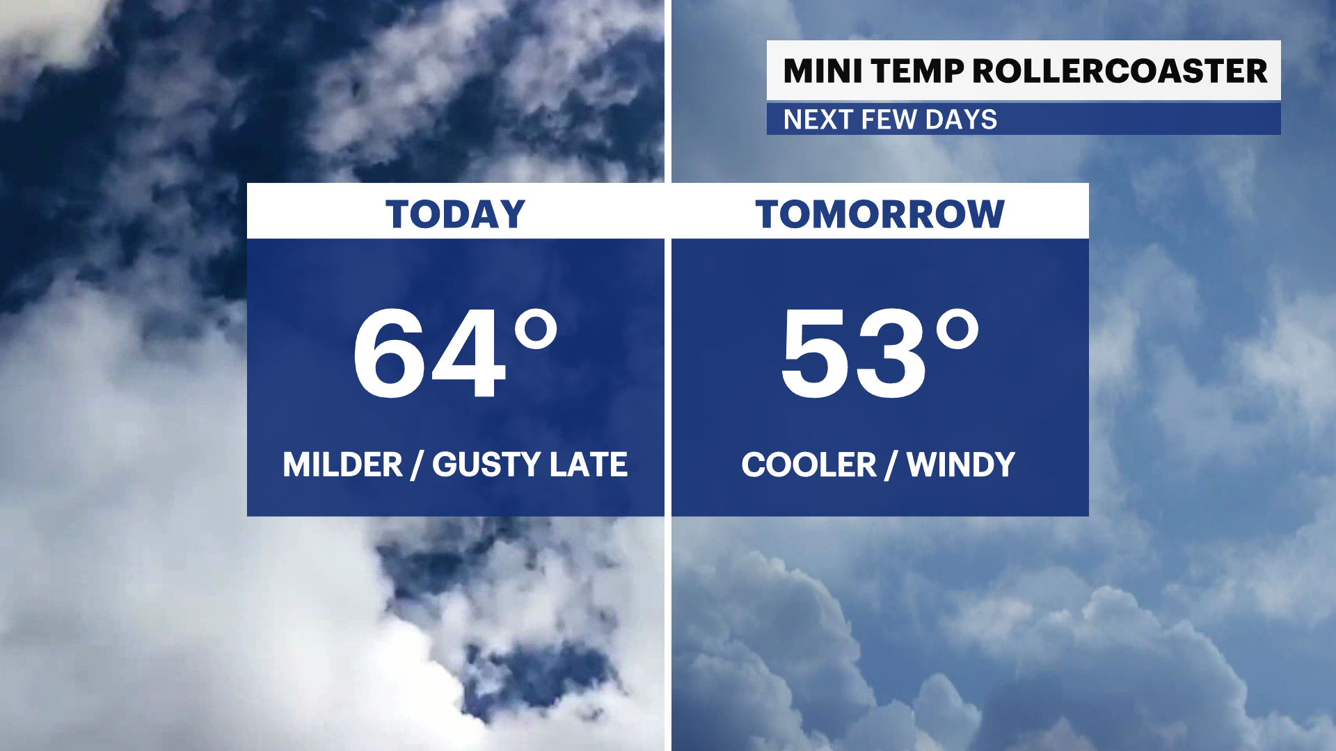
Today will be slightly milder with a mix of sun and clouds and breezy conditions. Gusts will reach up to 30 mph this afternoon.
A cold front will move through our area tonight bringing a passing shower and damaging wind gusts. Downed trees and power outages are possible through tomorrow afternoon.
It stays mainly dry and cool through Friday. A cold front will move into the city Friday night into Saturday morning. Steady showers and breezy conditions are likely through Saturday morning. Another storm system brings a chance of rain on Sunday. Stay tuned for updates.
The latest drought monitor comes out on Thursday. We’ll likely see some improvements to drought conditions thanks to last week’s soaker.
There’s a signal for a little taste of Winter next week. A very cold shot of air arrives with highs stuck in the 40s. Stay tuned for updates!
TRACKING THE TROPICS: There are currently no tropical disturbances in the Atlantic over the next 7 days. Hurricane season doesn’t officially end until Nov. 30. Stay tuned for updates!
Today: Partly sunny, milder and noticeably breezy. Highs near 65.
Tonight: Mostly cloudy, cool and gusty. Chance of a passing shower. Lows near 49.
Thursday: Brighter, much cooler and breezy. Highs near 53. Lows near 41.
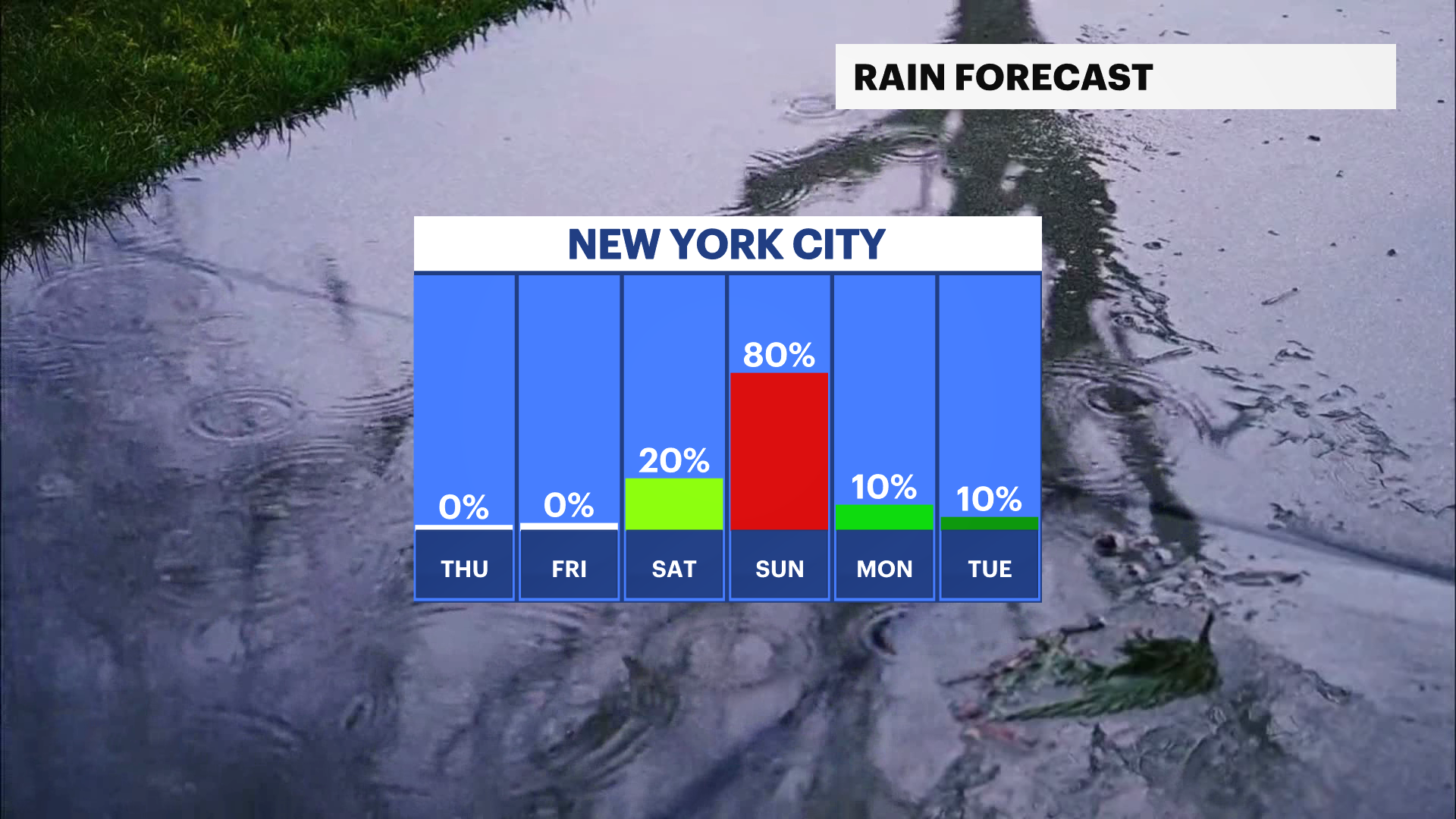
Friday: Cool and partly sunny. Chance of late showers. Highs near 58. Lows near 51.
Saturday: Chance of morning rain. Sun and clouds, milder and breezy. Highs near 64. Lows near 46.
Sunday: Mostly cloudy and cool. Chance of rain. Highs near 60. Lows near 44.
Monday: Chilly, mostly sunny and breezy. Highs near 46. Lows near 35.
Tuesday: Bright with a Winter chill. Highs near 44. Lows near 34.