
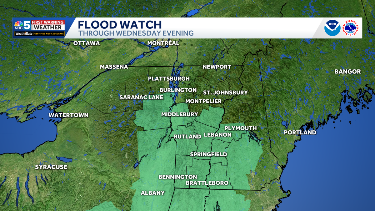
Flood alerts issued as locally heavy rain impacts Vermont, New York Wednesday
A few towns may pick up over 4 inches of rain by Wednesday evening

Waves of rain will continue across Vermont and northern New York through Wednesday night, with locally heavy rainfall creating a risk for isolated to scattered flash flooding.
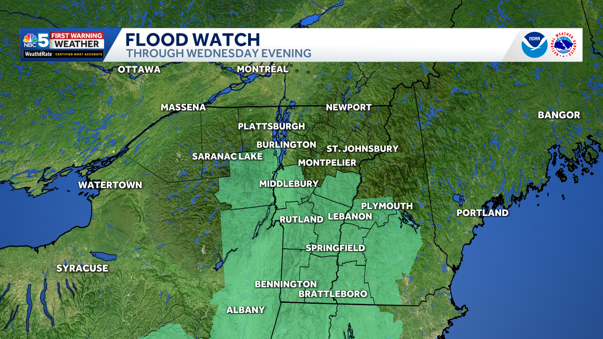
Flood watch (green) through Wednesday evening.
A Flood Watch remains in effect for parts of southern and central Vermont and Essex County, New York.
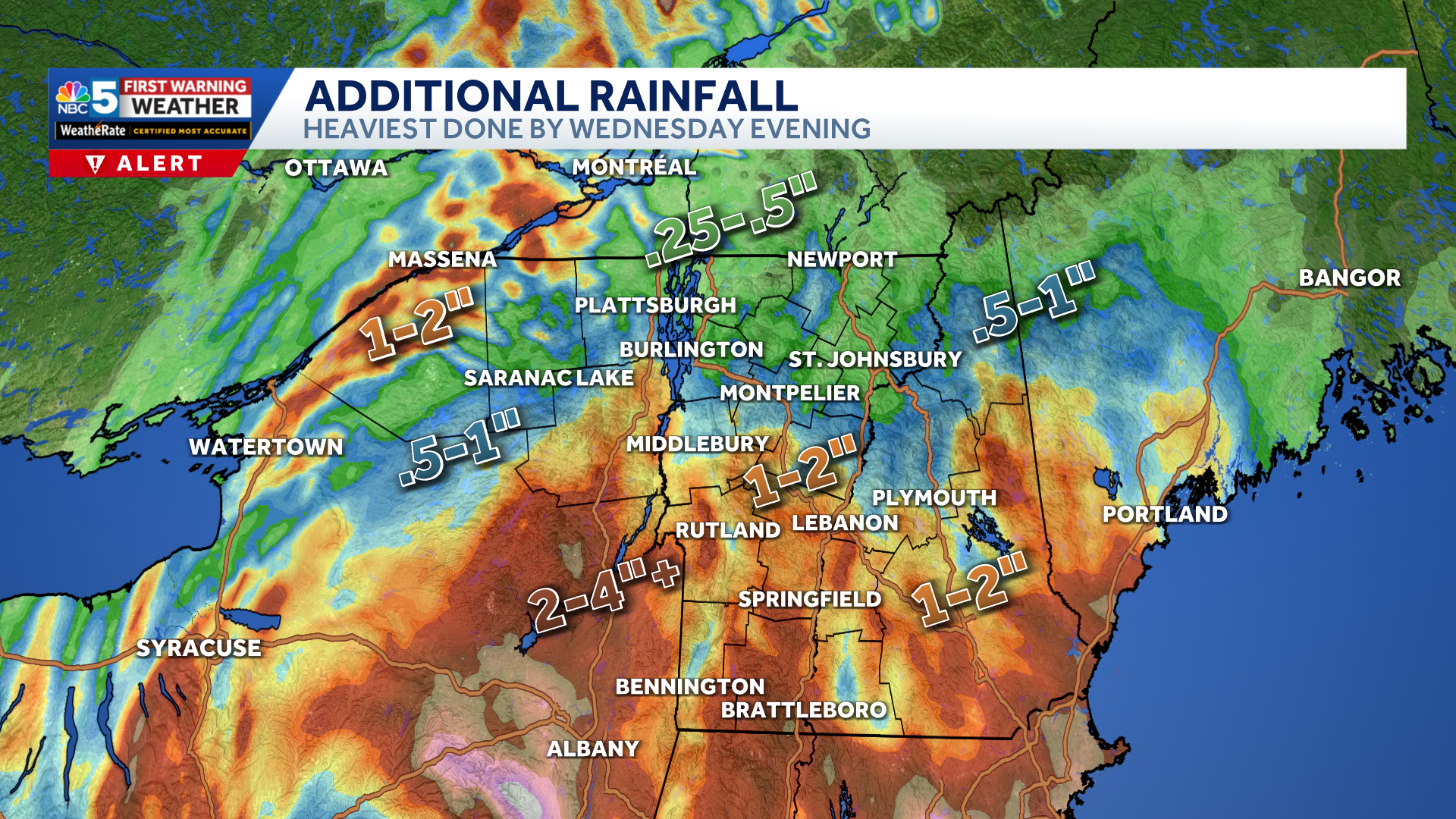
Additional rainfall through Thursday morning (map updated early Wed. morning).
Another 1 to 3 inches could fall through Wednesday night across portions of southern and central Vermont and along the eastern slopes of the northern Adirondacks. Localized totals of 3 to 4 additional inches cannot be ruled out in the higher elevations of the southern Green Mountains.
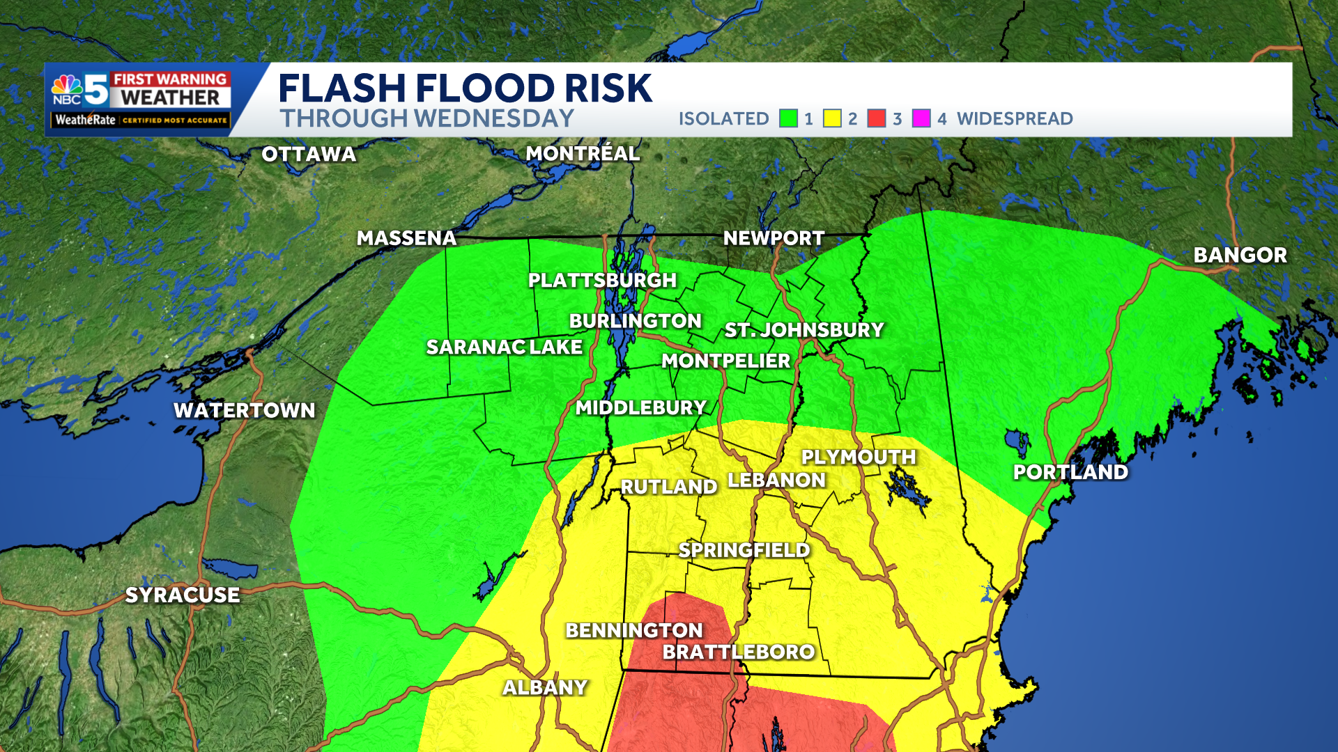
Flash flood risk for Wednesday, red denotes highest risk (Level 3 of 4 in far southern Vermont).
The greatest concern is across southern Vermont, where repeated rounds of rain could cause small streams to rise quickly and lead to flooding in poor-drainage or low-lying areas. Larger rivers are generally expected to remain within their banks, and widespread flooding is not anticipated.
The heaviest rain is expected from Wednesday morning through the middle of the afternoon. The flood threat will gradually decrease Wednesday night as the storm system begins moving east.
Showers will become lighter and less widespread Thursday before ending Thursday night.