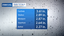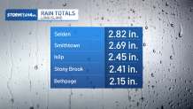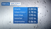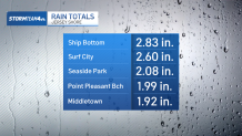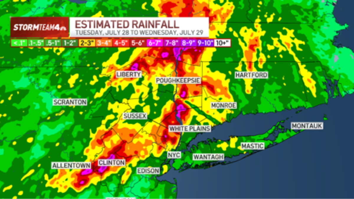
Rain totals are in from potent storm system that rotated through the tri-state Tuesday into Wednesday morning, some of them are eye-popping.
New York City didn’t get walloped, but areas of the Hudson Valley and northern New Jersey, in particular, were hit hard.
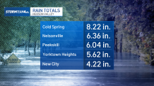
One of the highest rain totals was in Cold Spring, in Putnam County, where the town picked up 8.22 inches. Nelsonville and Peekskill, also in the Hudson Valley, collected over 6 inches.
Exactly how impressive are these totals? In a word, very. This part of the Hudson Valley picks up an average of 4.3 inches of rain in a typical July. These locations got roughly 1.5 to 2 times that amount in a matter of hours.
Central and northeastern New Jersey got some impressive rain totals, too. New Milford and River Edge, both in Bergen County, got over six inches of rain Tuesday afternoon and evening. Bergen County averages about 4.5 inches total rainfall in July, which means these places, too, got over a month’s worth of rain within a single day.
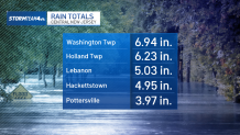
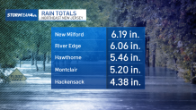
In Central Jersey, specifically western Hunterdon and southern Warren Counties, there was another bull’s eye of extreme rainfall that measured over 6 inches – more examples of over a month’s worth of rain in a single event.
These extreme amounts are eye-popping, for sure. But they were very isolated. Most of the tri-state area did not get a half foot of rain on Tuesday. Rather, 1-3 inches was much more common. In and around New York City and eastward toward Long island are good examples of these more moderate totals.
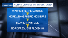
Weather events like this week’s are still relatively rare in the tri-state, but they’re becoming more common thanks to climate change and a warming atmosphere. Warm air holds more moisture than cooler air. The added moisture translates to heavier rain and more severe flooding events.
Rainfall totals across the tri-state
Here are rainfall totals from around the New York City metro area: