
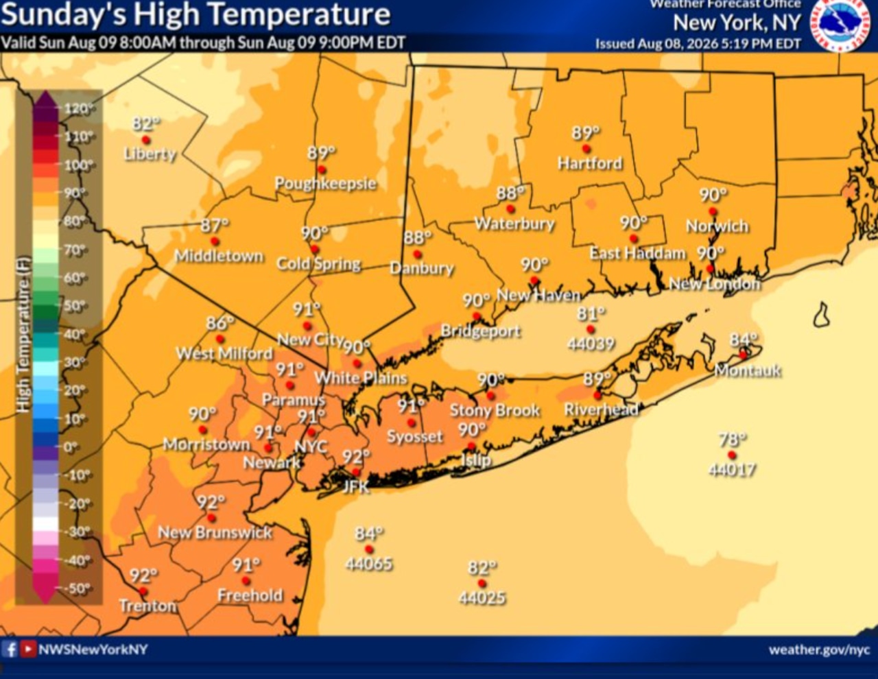
A heat advisory is currently in effect for much of the New York City area and surrounding regions through 7 p.m. Sunday, with heat indices expected to reach 90 to 100 degrees, according to the National Weather Service in Upton.
A separate round of strong to severe thunderstorms is possible for New York City and Capital Region late Monday.
The National Weather Service has issued a Heat Advisory covering most of the New York City area through 7 p.m. Sunday night.
Heat index values are forecast to reach approximately 95 degrees across most of the affected area, with slightly cooler conditions to the northwest and slightly hotter conditions to the south. Orange and Putnam counties are excluded from the advisory.
In contrast, western New York around Buffalo and central New York around Binghamton are experiencing a notably more comfortable Sunday.
A cold front has already moved through those regions, dropping dewpoints and bringing drier, less humid air. Highs in the Buffalo and Binghamton areas will climb into the 80s Sunday, with dewpoints in the 50s to mid-60s, making conditions feel considerably more comfortable than downstate.
A warm front is expected to return northward through the New York City area Monday morning, followed by an approaching cold front from the west late in the day.
These can cause parts of the New York City area to face significant severe weather. The primary threats include strong winds, with the timing of the system described as critical to the overall impact.
The Capital Region around Albany also faces a severe weather threat Monday afternoon and evening. Strong to damaging wind gusts are the main hazard expected. Isolated flash flooding cannot be ruled out across the southeastern Catskills and mid-Hudson Valley region, where some thunderstorms could linger over the same areas.
In western New York, the Buffalo-area National Weather Service noted a marginal risk of severe weather from the western Southern Tier, with strong winds as the primary threat.
A slight risk of excessive rainfall has been issued by the Weather Prediction Center for portions of the Southern Tier, with a marginal risk for the remainder of the western New York region.