
One of the attractions of walking through the Financial District is realizing how many of these mostly nonconforming, cow path-like streets got their start 400 years ago in the colonial outpost of New Amsterdam.
Broadway, Broad Street, Maiden Lane, Wall Street—these are their anglicized names, but they all date back to the four decades in the 17th century when the tip of Lower Manhattan was a Dutch-owned settlement with canals, windmills, and about 1,500 people.
Then the British sailed into New York Bay in 1664 and seized the settlement without much of a fight. (The Dutch took it back briefly in 1673, but the British quickly regained control.)
They renamed the colony New York in honor of the Duke of York, set up a new governmental framework, and established 24 articles of capitulation that guaranteed property rights and other liberties to existing citizens.
The British also began tinkering with the map, erasing many of the street names associated with Dutch rule.

Pearl Street, or Paerlstraet as the Dutch knew it, became Queen Street, or Great Queen Street, according to the Downtown Alliance.
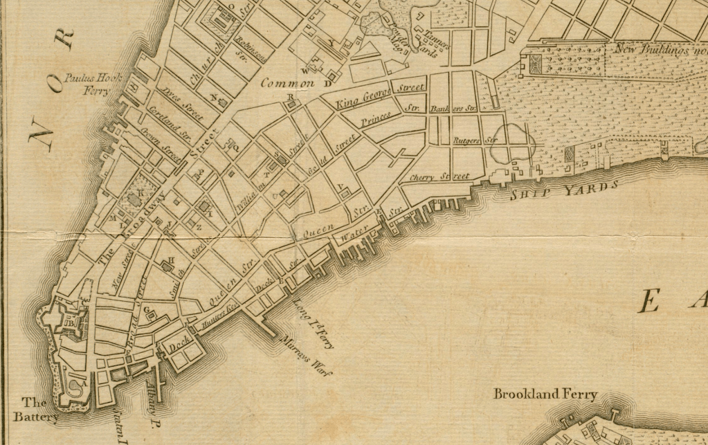
King George Street “was the former name of William Street from Frankfort Street easterly to Pearl Street,” explains John Thorn at Gotham History. Princes Street was the brief name for Beaver Street, per the Downtown Alliance.
The two maps in this post, the first from 1776 and the second from 1771, detail other British names, such as Little Queen Street, King Street, and Prince (not Princes) Street.
Of course, the names harkening back to merry old England didn’t last. Once the British evacuated New York for good in 1783, city officials changed these street names back to their original (anglicized) Dutch names.
Roads built by the British and given very royal names were also changed. Crown Street, for example, was appropriately renamed Liberty Street—considering that liberty is a foundational principle of the newly independent nation of America.
[Top image: Norman B. Leventhal Map and Education Center at the Boston Public Library; second image: Tribeca Trib/Robert Augustyn Rare Maps and Prints]