
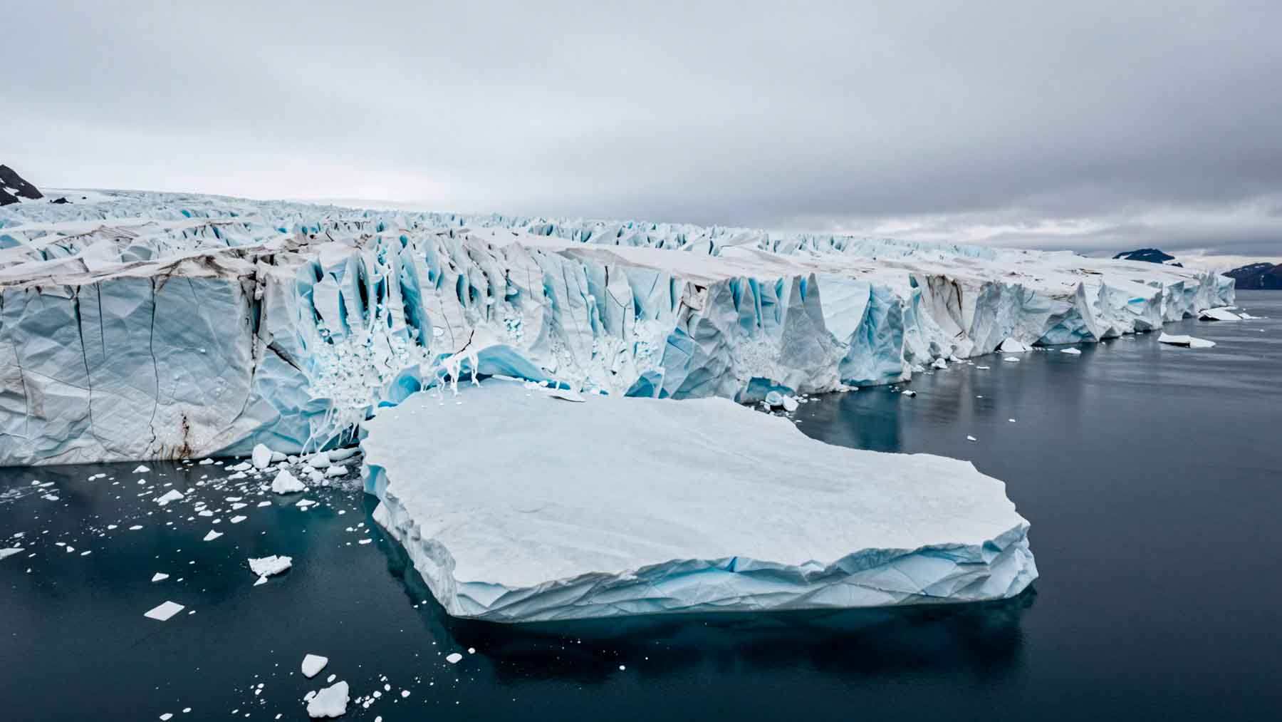
On August 4, 2026, advanced satellite radar orbiting Earth recorded a quiet shift high above the frozen coastline of northwest Greenland. A massive section of shelf ice detached from Petermann Glacier, releasing a floating slab measuring roughly 29 square miles—nearly the footprint of Manhattan—and standing almost 490 feet thick, equivalent to a 50-story skyscraper. It marked the Arctic’s largest single loss of floating ice in over a decade, setting off immediate alarms among polar monitoring agencies.
A glacier that had held steady for over a decade suddenly let go
Petermann Glacier stands as one of northwest Greenland’s most vital marine outlets. Following major calving events in 2008, 2010, and 2012, its floating tongue entered a period of relative calm, exhibiting only minor surface loss for 14 years. That quiet era ended abruptly on August 4.
The sudden loss of this 29-square-mile shelf, towering nearly 490 feet thick, caught the attention of glaciologists who had tracked subtle stresses since 2019. Joint teams from the University of Ottawa, the Canadian Ice Service, and the UK Universities of Stirling, Lancaster, and Leeds had anticipated structural failure. Yet, the rapid speed of separation stunned observers. As University of Ottawa researcher Adam Garbo noted, the event serves as a stark warning of how quickly polar ice systems can change.
On August 3, radar imagery from Europe’s Copernicus Sentinel-1 constellation detected severe structural deterioration spreading through the central ice tongue.
Satellites watched the fractures spread in near-real time
The break arrived with advance warning for space-borne sensors. On August 3, radar imagery from Europe’s Copernicus Sentinel-1 constellation detected severe structural deterioration spreading through the central ice tongue. Less than 24 hours later, the entire slab snapped free.
Because Sentinel-1 utilizes synthetic aperture radar, it operates through Arctic darkness and cloud cover. The observation benefited from an operational overlap: the tandem phase between Sentinel-1C and the newly launched Sentinel-1D during its commissioning phase. This tight window provided rare single-day repeat data, letting scientists map crack propagation across the shelf alongside tidal shifts. Interferometric data from April 2026 had already revealed deep subsurface deformation. Leeds University researcher Molly Hammond emphasized that tracking these expanding fractures in near-real time vividly demonstrated the power of high-frequency satellite radar.
Related
What makes an Arctic ice island different—and why scientists are paying close attention
While massive tabular icebergs calve regularly from Antarctic ice shelves, giant ice islands remain far rarer in northern waters. That rarity makes the Petermann event scientifically crucial.
Stirling University researcher Dr. Anna Crawford noted that studying how these northern ice masses fragment transfers critical insights across polar regions—knowledge essential for modeling glacier dynamics, ocean interaction, and sea-level rise. Furthermore, the event reveals a concerning pattern: major breakups at Petermann in 2008, 2010, 2012, and 2026 suggest that quiet periods between calving events may be shortening.
Supported partly by the European Space Agency’s FutureEO ARCTEX project, the international research team continues investigating the deep ocean thermal drivers behind these structural failures.
Two more large pieces may be next
The August breakup may be only the start of Petermann’s ongoing instability. Satellite imagery reveals two additional giant rifts traversing the remaining ice tongue. If those fractures continue spreading, two secondary ice islands—estimated at 37 square miles and 34 square miles, each larger than the recent block—will eventually detach.
Researchers continue monitoring the glacier using satellite imagery, aerial observations, and tracking data. Following the newly formed 29-square-mile ice island as it drifts and fragments offers a rare chance to observe large Arctic ice dynamics in motion, providing critical empirical parameters for predicting future ice stability.
Related
A drifting hazard with real-world consequences
Beyond pure climate research, a 29-square-mile block of ice moving through Arctic waterways carries urgent practical risks. Environment and Climate Change Canada is tracking the iceberg’s trajectory to assess potential threats to commercial shipping routes and northern industrial infrastructure.
Ice masses this massive persist for years, breaking down into thousands of smaller, hard-to-detect fragments that endanger maritime vessels. As Arctic shipping traffic expands, effective monitoring becomes critical. Yet, the most significant revelation isn’t just the floating hazard itself, but the underlying climax scientists have now confirmed: Petermann Glacier has permanently lost its structural anchor, unlocking its vast inland ice reserve to accelerate directly into warming oceans and redefine global sea-level rise timelines forever.
Staff Writer
Kelly is an experienced writer with 15 years of experience exploring the big stories that shape our world, from tech breakthroughs and space exploration to climate, energy, and the fascinating quirks of science. She has a talent for turning complex ideas into sharp, memorable insights that stay with readers long after they’ve finished reading.

Kelly is an experienced writer with 15 years of experience exploring the big stories that shape our world, from tech breakthroughs and space exploration to climate, energy, and the fascinating quirks of science. She has a talent for turning complex ideas into sharp, memorable insights that stay with readers long after they’ve finished reading.