
NEW YORK (WABC) — A strong storm is expected to develop offshore this week and could impact the Jersey Shore and Long Island, bringing some rain to the Tri-State area this weekend.
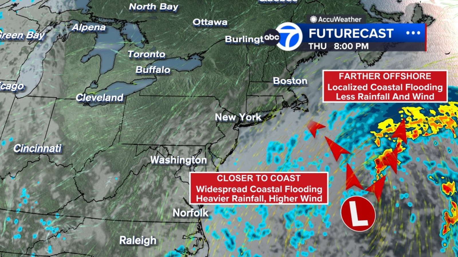
The potential nor’easter is expected to form off the Carolina coast on Wednesday.
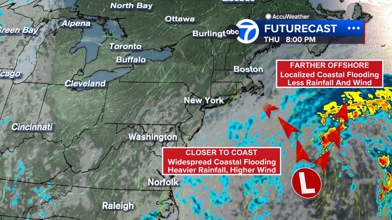
The closer to the coast that the storm forms and strengthens into a nor’easter, the greater the risk of damaging winds, storm surge and beach erosion. Pockets of drenching rain may exacerbate coastal flooding.
The extent of the impact on our area depends on the track and whether the system gets “captured” by an upper-level low and drawn westward toward the coast or remains farther offshore.
Confidence is high that strong northeast winds will continue for several days, raising the risk of beach erosion, dangerous surf and coastal flooding. The setup is being driven by a strong area of high pressure over eastern Canada and developing low pressure off the southeastern United States. The pressure difference between the two systems is expected to maintain a steady flow of ocean air into the region through at least the weekend.
The exact direction of the wind will play a major role in determining where the worst flooding occurs. A stronger northeast wind would increase concerns along the Jersey Shore and the south shore of Long Island, while a more northerly wind could shift impacts toward Long Island’s north shore and other vulnerable coastal areas.
RELATED | Visit National Water Prediction Service for water level, flood impact information
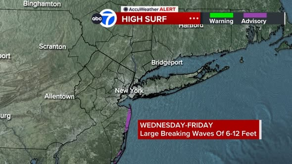
Coastal flood advisories have already been issued for parts of Ocean County, New Jersey, and additional alerts are expected elsewhere along the coast. A coastal flood watch is scheduled to begin Wednesday afternoon, with multiple high tide cycles likely bringing widespread minor coastal flooding and the potential for moderate flooding in some locations. A high surf advisory is also in effect, with waves ranging from 6 to 12 feet expected along portions of the shoreline.
The rough surf will also create a high rip current risk for several days. At the Jersey Shore on Wednesday, northeast winds could gust as high as 35 mph, with waves reaching 6 to 10 feet. Water temperatures remain in the low to mid-70s.
RELATED: What to know about nor’easters
Rain is expected to remain mostly south of the area through Thursday, but clouds will gradually increase Friday as the offshore storm system becomes better organized. Some showers could reach eastern Long Island late Friday, although much of the region should stay dry for most of the day.
The biggest question remains the track. Current forecasts suggest it will no longer remain entirely offshore, but uncertainty continues regarding how close it will move to the coast. A track closer to the tri-state area would increase the threat of heavier rain, stronger winds and additional coastal flooding.
Bottom line: Plan for a cloudy, windy weekend, with the strongest impacts along the coast.
Stay with the Eyewitness News AccuWeather team for continuing updates.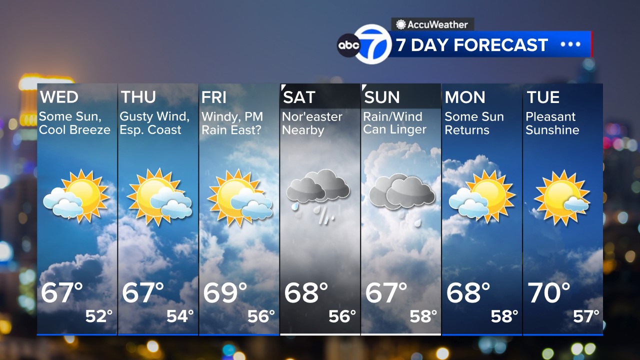 Follow the Weather or Not podcast with Lee Goldberg
Please fill out the form below to submit weather photos and videos.
MORE ACCUWEATHER RESOURCES
Check AccuTrack Radar
Air Quality Tracker
NWS Advisories, Watches and Warnings
School closings and delays
For weather updates wherever you go, please download the AccuWeather app.
Follow chief meteorologist Lee Goldberg, Sam Champion, meteorologist Brittany Bell, meteorologist Jeff Smith, and meteorologist Dani Beckstrom on social media.
Copyright © 2026 WABC-TV. All Rights Reserved.