

NEW YORK (WABC) — A powerful and long-lasting nor’easter is beginning to take shape across the Tri-State area, bringing the threat of damaging winds, significant coastal flooding, heavy rain, travel disruptions and potential power outages through the weekend.
Conditions will steadily deteriorate as the storm strengthens, with its peak impact expected from Saturday into early Sunday before slowly weakening. Even then, hazardous conditions are expected to linger into Monday.
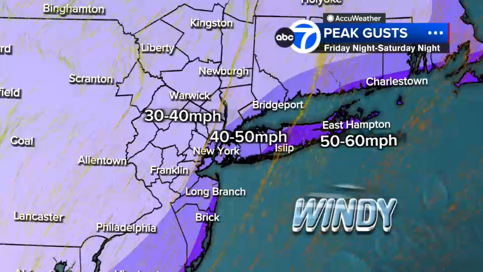
The biggest concerns with this storm are strong winds and coastal flooding. Widespread wind gusts of 30 to 50 mph are expected across the region, while coastal communities could see gusts exceeding 60 mph. Those winds may be strong enough to bring down tree limbs, topple vulnerable trees and cause scattered power outages. Travel conditions are also expected to worsen, with delays and cancellations already beginning at area airports as the storm approaches.
Along the shoreline, expect widespread moderate coastal flooding with several locations likely to experience major flooding during high tide cycles. Breaking waves could exceed 12 feet, causing beach erosion and damaging coastal infrastructure. Areas along the South Shore of Long Island, portions of Staten Island, Queens and other vulnerable waterfront communities face some of the greatest flood risks as repeated high tides coincide with the storm’s strongest winds.
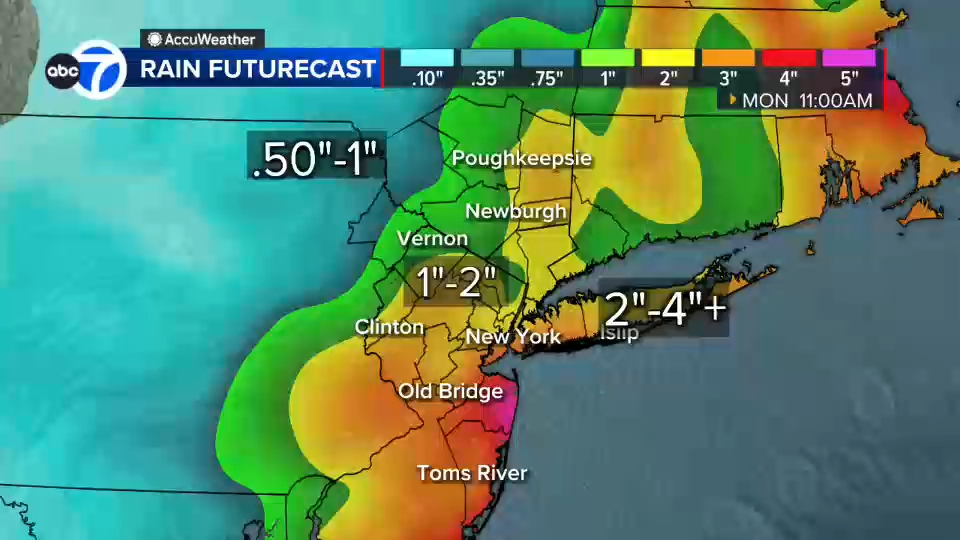
Rainfall will add to the storm’s impact, although it is not the primary threat. Periods of rain will move through the area in waves, with the heaviest downpours expected Saturday night into early Sunday. Most locations are forecast to receive 2 to 4 inches of rain, with isolated spots potentially seeing higher totals. While widespread river flooding is not expected, localized street flooding and ponding on roadways are likely, especially during heavier bursts of rain.
This will not be a storm that delivers constant heavy rain every hour. Instead, conditions will fluctuate with bands of rain and occasional breaks. However, even during lulls, gusty winds and hazardous coastal conditions will remain in place, making outdoor activities difficult and potentially dangerous.
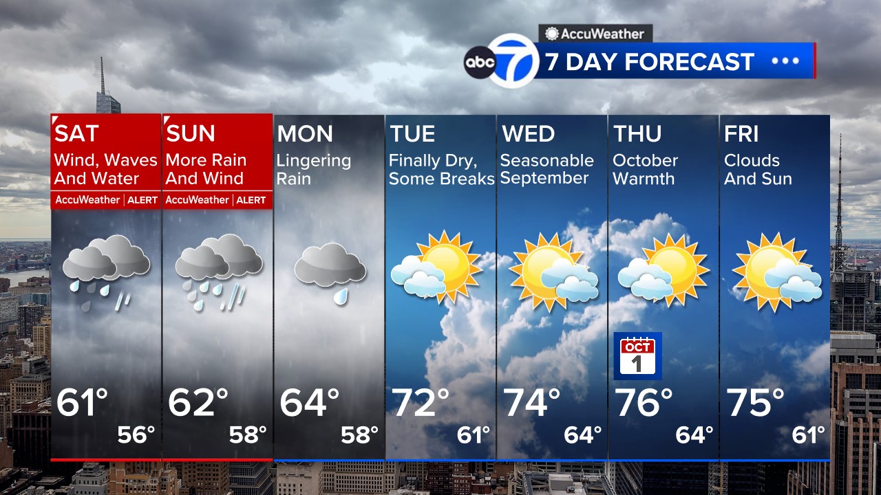
Saturday is expected to be the most impactful day, featuring windswept rain, damaging coastal winds and increasing coastal flooding. Conditions may worsen Saturday night as the storm delivers its heaviest rainfall and strongest impacts. By Sunday, the system will begin to slowly unwind, but periods of rain, gusty winds and continued coastal flooding are still expected.
The storm’s influence should finally begin to fade on Monday, although lingering light rain and cloudy skies may persist through part of the day. Drier weather is expected to return Tuesday, with a more pleasant pattern developing later next week. Forecasters say temperatures could climb back above 70 degrees as September transitions into October, bringing a stretch of quieter weather after a turbulent weekend.
Officials are urging residents in flood-prone areas to monitor high tide schedules, stay informed of local emergency management recommendations and prepare for the possibility of coastal flooding, power outages and hazardous travel conditions as the nor’easter moves through the region.
Stay with the Eyewitness News AccuWeather team for continuing updates on the nor’easter.RELATED | Watches, warnings and advisories from the National Weather Service
Please fill out the form below to submit weather photos and videos.
MORE ACCUWEATHER RESOURCES
Check AccuTrack Radar
NWS Advisories, Watches and Warnings
School closings and delays
Follow chief meteorologist Lee Goldberg, Sam Champion, meteorologist Brittany Bell, meteorologist Jeff Smith, and meteorologist Dani Beckstrom on social media.