
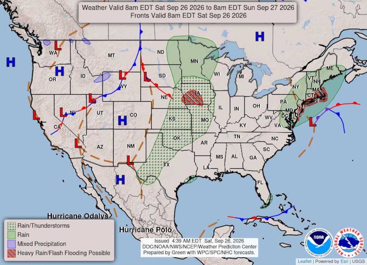
STATEN ISLAND, N.Y. — New Yorkers can expect rain, strong wind gusts and coastal flooding to continue through the weekend as a nor’easter makes its way through the tristate area, an AccuWeather meteorologist reported early Saturday afternoon.
AccuWeather meteorologist Bill Deger said the center of the storm is currently a few hundred miles east of Delmarva, a peninsula occupied by most of Delaware and parts of the eastern shores of Maryland and Virginia. It is “continuing to work its way off to the north and west,” he said.
Deger noted that since the storm arrived in New York on Friday evening, rounds of rain have moved through the region, with wind gusts reaching as high as 40 mph. The storm has caused downed trees and power outages on Staten Island Friday night and Saturday morning. It has also caused coastal flooding in other areas of the state and in southern states.
“There’s been some coastal flooding impacts, including with the tide cycle earlier this morning, and it’s going to be more of the same here,” Deger said.
Flooding appears to be at a minimum on Staten Island as of 12:30 p.m. Saturday, with intersections typically prone to flooding appearing unaffected by the rain.
Coastal flooding is expected to continue around times of high tide, while total rainfall could reach 2 to 4 inches as the storm progresses.
While some of the worst conditions may have occurred Saturday morning, Deger cautioned that the storm could bring additional impacts Saturday evening into Sunday morning.
“I think probably the worst of it was earlier this (Saturday) morning, but that’s not to say it will be impactful again later today and then tomorrow (Sunday) morning again,” Deger added.
Despite the persistent rain, showers are expected to become lighter and more intermittent Sunday evening and into Monday before the storm finally pulls away Monday night.