
The nor’easter will pummel the East Coast through Sunday night — with the storm bringing as much as 8 inches of total rainfall and 80mph wind gusts along with coastal flooding, a weather expert predicted.
The storm will soak Long Island and the Jersey Shore with between 4 and 8 inches of total rainfall, Senior AccuWeather Meteorologist Mike Doll told The Post.
Follow live updates on the powerful nor’easter set to bring dangerous winds, flooding to the East Coast
Those areas will also be battered by ripping wind gusts between 60 and 80 mph, Doll predicted.
Over 13,000 Long Islanders and more than 25,000 Garden Staters are currently without power, according to Poweroutage.us.
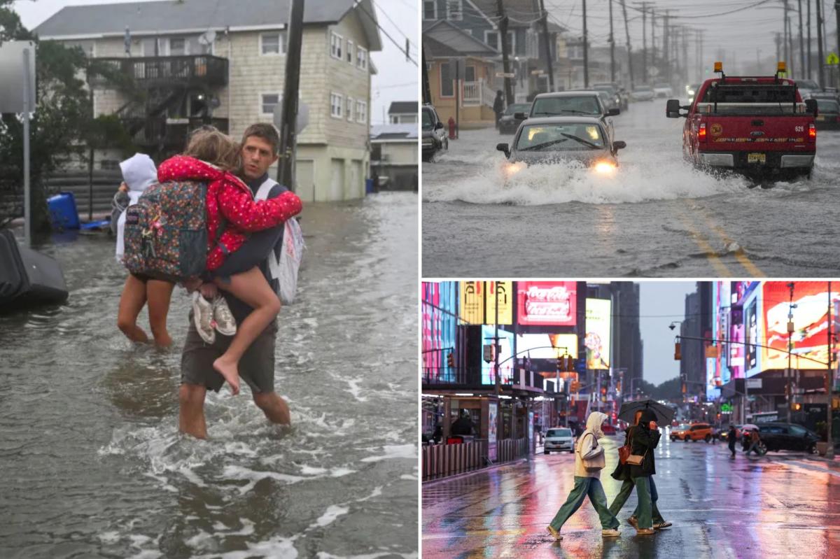
Andy Carreno carries Amelia, a family member, in a flooded area after heavy rain from a nor’easter fell as a strong coastal storm batters the US northeast coast, in Surf City, New Jersey, on Saturday, Sept. 26, 2026. REUTERS
Cars attempting to drive through flooded streets in Point Pleasant, NJ during the nor’easter. Getty Images
Several seaside towns in New Jersey were already flooded as of Saturday afternoon, with wild images showing residents wading through the streets.
The nor’easter is also expected to drench the Big Apple with between 2 and 4 inches of total rainfall, according to Doll.
“In addition to the rain, significant coastal hazards will persist along the East Coast as the strong northeast winds coincide with high astronomical tides into early next week,” he added.
“Due to the prolonged nature of the northeasterly winds, water levels from coastal flooding may be the highest for some locations in several years. Severe beach erosion has already occurred in some areas and will continue to be a problem through the weekend.”
But the possible problems are not limited to just coastal areas, he explained.
People walk near Times Square as a nor’easter affects New York, on Saturday, Sept. 26, 2026. REUTERS
A flooded street seen in Far Rockaway, Queens on Saturday. Brigitte Stelzer
“Trees are still full of leaves and the ground is saturated from recent heavy rain. This can lead to down trees. Power lines may also come down leading to power outages that could last into early next week for some communities,” stated Doll.
The wind, rain and coastal flooding “will continue to be problems” through Sunday night, with conditions beginning to ease up on Monday, he added.
Start your day with all you need to know
Morning Report delivers the latest news, videos, photos and more.
Thanks for signing up!
Gov. Kathy Hochul warned Gothamites at a news conference Saturday morning that they could expect up to 5 inches of rain across the entire weekend.
She also warned that the full moon on Saturday night could drastically worsen the flooding.
A downed tree on a road in Huntington on Sept. 25, 2026. Getty Images
Weather-related travel problems cropped up around the boroughs by Saturday morning.
Four Queens bus lines were diverted due to flooding, downed power lines and fallen trees, while streets in Far Rockaway were hit with coastal flooding — leading drivers to push their vehicles through knee-deep water in search of dry land.
Mayor Mamdani had warned New Yorkers, “Don’t travel if you don’t have to. Never drive or walk through floodwater.”
NJ Transit partially suspended its River Line, citing weather-related issues, while the Long Island Rail Road partially suspended both the Port Jefferson and Long Branch lines.
However the Tri-State will get some relief with slightly warmer temperatures next week.
“Tuesday, Wednesday and Thursday look nicer,” Doll revealed. “High temperatures for most places in the Tri-State area will be in the low to middle 70s with nighttime temperatures dipping into the 50s to lower 60s. Sun and clouds all three days.”
Doll warned there could still be some rain, but those chances are only 15 to 20 percent.