

NEW YORK (WABC) — A powerful nor’easter continued to batter the Tri-State area Sunday, bringing coastal flooding, beach erosion and damaging wind gusts as the center of the storm moved onto the New Jersey shoreline.
Wind gusts topped 50 mph in some coastal communities, including Belmar, while many inland locations recorded gusts between 35 and 40 mph. The strongest winds occured during the morning hours, coinciding with high tide along the Jersey Shore and Long Island. The onshore flow pushed water toward the coastline, increasing concerns about flooding and erosion.
There is some improvement ahead. As the storm’s center moves inland and begins to weaken, wind speeds are expected to gradually diminish. Gusts that reached 40 to 50 mph during the morning should fall below 35 mph during the afternoon, allowing wind advisories and high wind warnings to expire. Even so, breezy conditions will persist through the rest of the day.
Despite the easing winds, the threat of falling trees remains elevated because of saturated ground conditions. Days of heavy rainfall, combined with coastal flooding, have left soil unstable across the region.
Coastal flood warnings remain in effect through the afternoon, with the greatest concern centered on the morning high tide cycle. Conditions are expected to improve by evening, when any lingering coastal flooding should be limited to minor impacts.
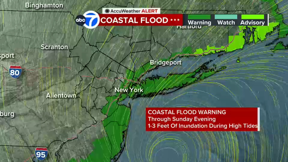
The weather will not stay dry for long. While a temporary lull in the rain is expected during the afternoon, additional bands of rain are forecast to redevelop late in the day and continue into the overnight hours. Several inches of rain have already fallen across parts of the area, and another one to two inches may be possible where the heaviest rain bands set up.
With the ground already saturated, any additional heavy rain could quickly trigger urban flooding, poor-drainage flooding and rises on small streams. Flooding concerns will continue through Sunday night as the storm slowly pulls away.
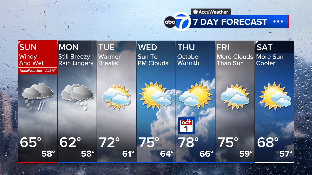
Conditions are expected to improve gradually Monday. Showers and breezy weather will linger as the departing storm wraps moisture back across the region, but neither the wind nor rainfall should be as intense as what was experienced over the weekend.
Rain chances should finally wind down by Tuesday. After that, a stretch of quieter weather is expected, with temperatures climbing into the 70s and brighter skies arriving during the second half of the week.
Stay with the Eyewitness News AccuWeather team for continuing updates on the nor’easter.RELATED | Watches, warnings and advisories from the National Weather Service
Please fill out the form below to submit weather photos and videos.
NWS Advisories, Watches and Warnings
School closings and delays
Follow chief meteorologist Lee Goldberg, Sam Champion, meteorologist Brittany Bell, meteorologist Jeff Smith, and meteorologist Dani Beckstrom on social media.