
NEW YORK (WABC) — The slow-moving coastal storm that has soaked the Tri-State area will continue bringing periods of rain through Monday, with some locations facing additional flooding concerns before conditions finally improve.
Rainfall totals continued to climb Sunday, with 1.46 inches recorded in Central Park during the day and a combined 2.44 inches from the storm so far. Parts of eastern Long Island have already picked up close to 4 inches of rain, and another 1 to 2.5 inches could fall before the system moves away. Some communities could ultimately receive more than 5 inches of rain from the event.
Sunday remained damp and unseasonably cool, with a high temperature of 63 degrees, nine degrees below the seasonal average. While winds were noticeably weaker than they had been earlier in the weekend, gusts continued as moisture streamed inland from the Atlantic.
The heaviest rain Sunday evening was concentrated across Monmouth County, New Jersey, and portions of western Suffolk County. Bands of moisture wrapping around the offshore storm continued feeding steady rain into the region and are expected to persist overnight.
Periods of moderate to heavy rain are likely through Monday morning and midday, with additional ponding on roadways and localized flooding possible, especially in low-lying and poor-drainage areas. Areas north of New York City, including parts of the Hudson Valley, could receive another 2 to 2.5 inches of rainfall before the storm departs.
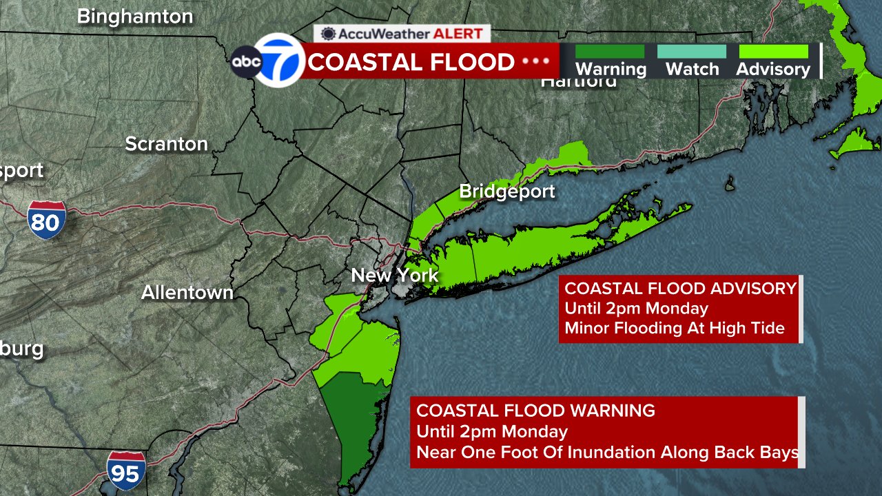
The storm’s circulation center must move north and east of the area before conditions can improve. As a result, rain may linger through much of Monday, with the last showers potentially not ending until late afternoon or early evening.
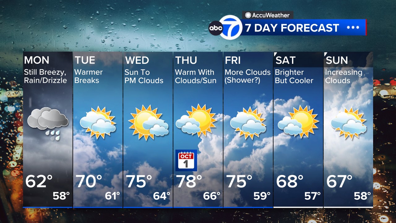
Monday will stay cloudy, breezy and cool, with periods of rain and drizzle and temperatures topping out near 62 degrees. Skies should begin to clear Monday night as the storm finally pulls away.
The weather pattern turns more favorable beginning Tuesday, when a few breaks of sunshine are expected and temperatures rebound to around 70 degrees. More sunshine arrives Wednesday with highs in the mid-70s, followed by a warm and mostly sunny Thursday with temperatures near 80 degrees.
Stay with the Eyewitness News AccuWeather team for continuing updates on the nor’easter.RELATED | Watches, warnings and advisories from the National Weather Service
Please fill out the form below to submit weather photos and videos.
MORE ACCUWEATHER RESOURCES
NWS Advisories, Watches and Warnings
School closings and delays
Follow chief meteorologist Lee Goldberg, Sam Champion, meteorologist Brittany Bell, meteorologist Jeff Smith, and meteorologist Dani Beckstrom on social media.