
NEW YORK (WABC) — An AccuWeather Alert is in effect for this evening as a cold front moves through the region, bringing the threat of strong to severe thunderstorms just in time for the evening commute and dinner hour.
While conditions are mild and muggy now, much colder air will arrive behind the front, setting the stage for a blustery and significantly cooler weekend.
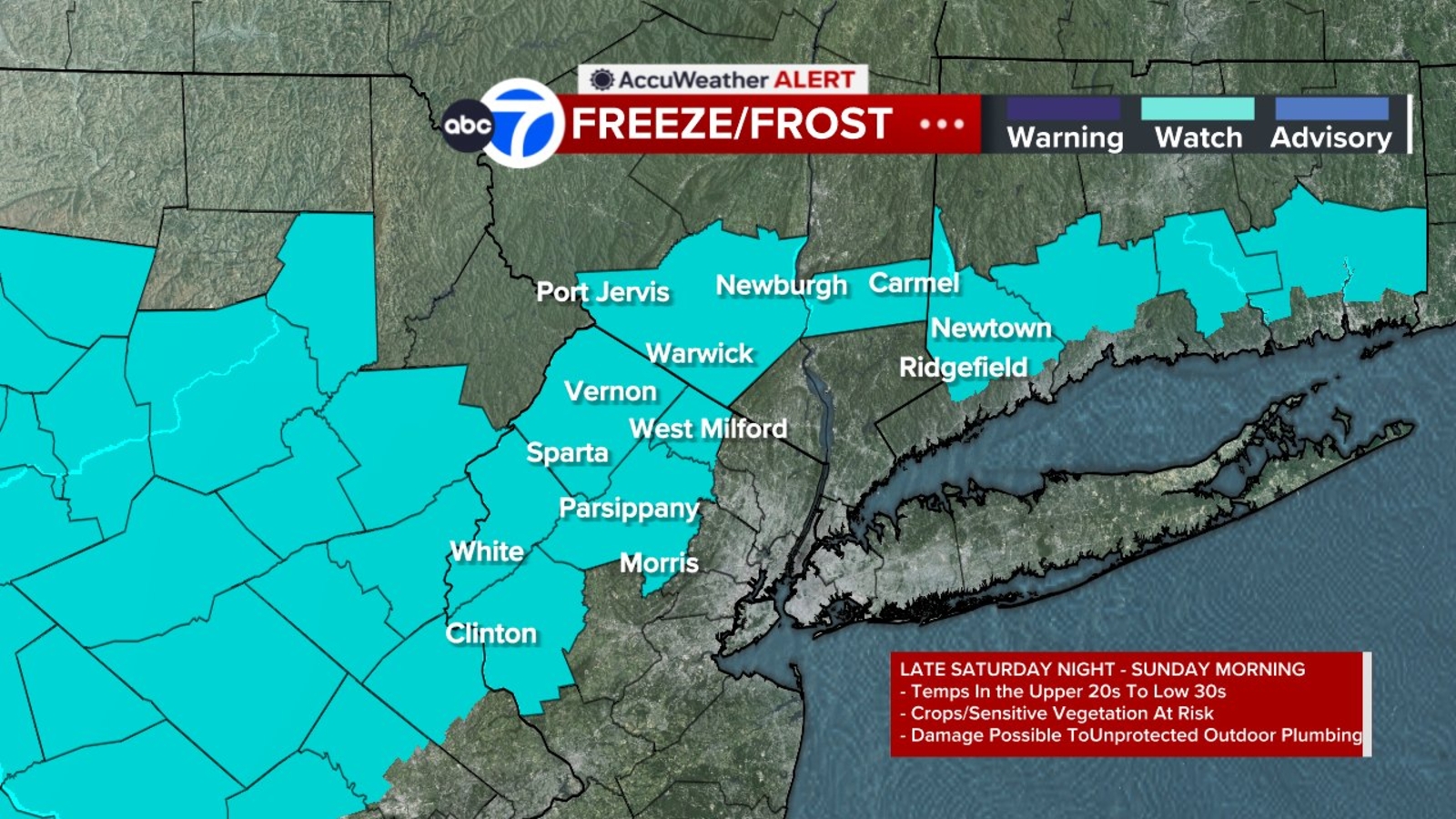
A Freeze Watch has been issued for parts of the Tri-State area from Saturday night into Sunday morning.
By Saturday morning, the weather will be dramatically different. A few showers may linger, especially south and east of the city, but colder and drier air will steadily filter into the area as the front pulls away. Temperatures will struggle to move through the day, with afternoon highs remaining in the 50s.
The wind will make the biggest difference in how the air feels. Conditions turn breezy Friday, become downright windy on Saturday, and help drive a temperature drop of more than 20 degrees in just 24 hours.
After running more than 10 degrees above average today, temperatures will fall to roughly 10 degrees below normal by Saturday.
Anyone heading outdoors Saturday morning will want to dress in layers. The chill will be especially noticeable for events taking place early in the day, with the coolest air of the season arriving across the area.
Sunday remains cool, with highs again in the 50s, but it will be a more comfortable day overall. Winds will ease, sunshine will increase, and despite temperatures remaining below normal, conditions will not feel as harsh as they will on Saturday.
The weekend will mark the most significant taste of fall weather so far this season.
———-
* Download the abc7NY app for breaking news alerts
Submit Weather Photos and Videos
Have weather photos or videos to share? Send to Eyewitness News using this form. Terms of use apply.
Copyright © 2026 WABC-TV. All Rights Reserved.