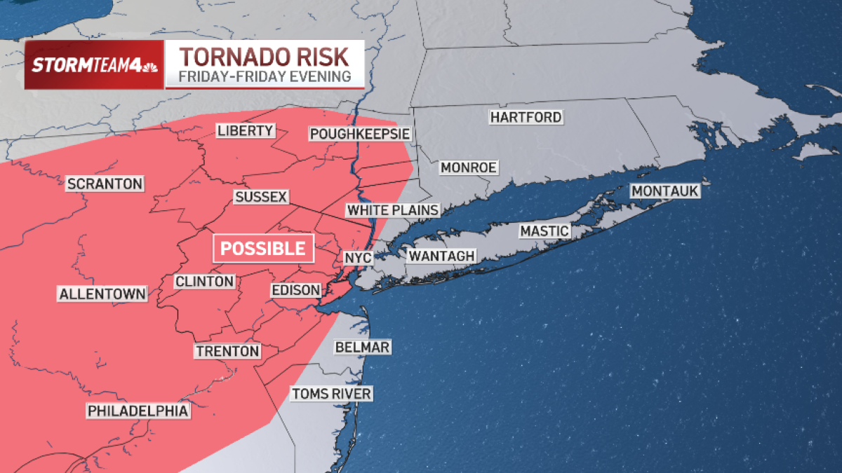
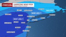
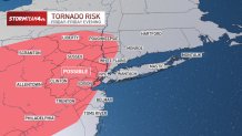
The New York City area faces the threat of strong to severe thunderstorms Friday evening, with damaging winds and possible tornadoes ahead of a powerful cold front that will usher in some of the coldest air of the season.
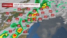
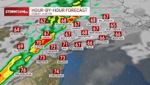
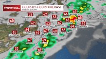
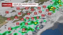
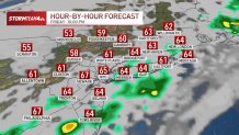
Storm Team 4 is tracking a line of thunderstorms expected to develop and move across the region between 5 p.m. and 10 p.m. Friday.
While damaging wind gusts are the primary concern, isolated tornadoes cannot be ruled out.
The storms are expected to move quickly, reducing the overall threat of flooding.
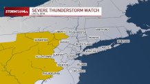
Severe thunderstorm watch issued for parts of the region
A severe thunderstorm watch is in effect until 8 p.m. Friday for areas generally west of the New York City metropolitan area, including Sullivan County, New York, and Pike County, Pennsylvania.
Click here to see the latest weather alerts
NBC10NBC10
The National Weather Service could issue additional watches for areas closer to New York City, depending on how atmospheric conditions develop throughout the afternoon.
Storm Team 4 say the severity of the storms will depend heavily on cloud cover and afternoon temperatures.
If skies clear and temperatures climb well into the 70s, increased atmospheric instability could fuel stronger thunderstorms.
However, if clouds persist and temperatures remain cooler, the storms could weaken significantly before reaching the city.
The National Weather Service is expected to reassess conditions later Friday afternoon.
What time will severe storms arrive?
Friday began with warm, muggy conditions and scattered morning showers.
A relative lull in precipitation is expected through much of the afternoon before stronger thunderstorms develop during the evening.
The greatest window of concern is between 5 p.m. and 10 p.m., when storms could produce:
Damaging winds: The primary threat, with gusts potentially strong enough to cause localized damage.
Isolated tornadoes: Possible if atmospheric conditions become favorable.
Heavy downpours: Brief periods of intense rainfall, although the overall flooding threat is lower because the storms should move quickly.
Residents should monitor weather alerts and be prepared to seek shelter if severe thunderstorm or tornado warnings are issued.
Saturday brings sharp temperature drop and gusty winds
Once the storms move through Friday night, a surge of much colder air will sweep across the region.
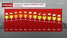
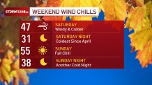
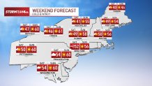
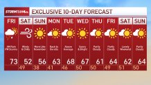
Saturday will be windy and noticeably colder, with afternoon temperatures struggling to climb out of the low 50s.
Gusty winds will make it feel more like the 40s throughout much of the day.
The dramatic change will follow Friday’s warm, humid conditions, making for a distinctly different start to the weekend.
When will temperatures warm up again?
Sunday will bring a welcome improvement, with sunny skies, crisp air and cool temperatures.
The chilly conditions won’t last long.
By early next week, temperatures are expected to rebound into the 60s, with dry weather returning to the New York City area.
Stay with Storm Team 4 for the latest severe weather watches, warnings and live updates as Friday evening’s storms approach.
Here’s the hour-by-hour forecast