
Mayor Eric Adams’ office announced last week that New York City would spend $10 million on a digital map unifying all the tubes, pipes and other infrastructure sitting under the streets. When launched in 2028, the “3D Underground” program should let public agencies and their partners better respond to emergencies or prepare for construction by seeing what hazards might lurk about six to nine feet below the surface.
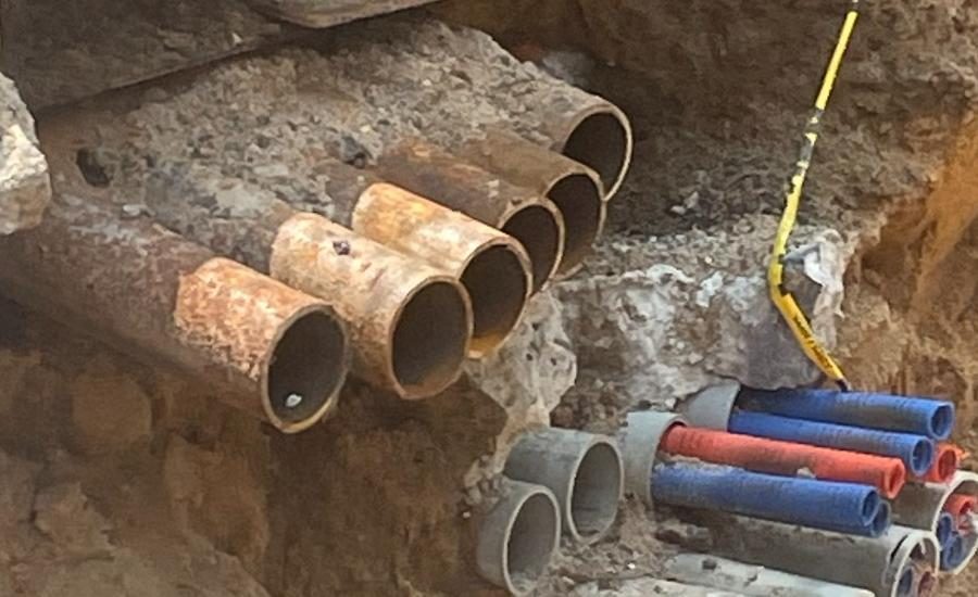
“We’ve been putting stuff in the ground since literally Aaron Burr,” said Debra Laefer, a professor of civil and urban engineering at New York University. Information about where the additions are has stayed siloed in different public and private agencies. “My understanding is that a lot of companies know where their assets are, but don’t know what else is in the trench with them.”
Not only are there centuries of tubes, pipes and wires under the pavement, but the city grants roughly 100,000 permit requests to cut streets or sidewalks for utility maintenance every year. Instead of having utility representatives mark each site, 3D Underground would let project planners work more independently. Emergency response teams could also tap into the resource. Firefighters, for example, could see where gas lines run into the building on 3D Underground and avoid parking their trucks above the safety hazard.
Users of the new platform will be able to call up integrated maps for a single location in the city at a time. The data itself won’t be stored in one perpetual, city-wide map as security and business concerns ruled out the idea of a merged database early on, said Laefer, who headed the pilot projects and workshops that led to 3D Underground. A combined system also would have become the city’s responsibility to maintain.
Instead, each company or agency with underground assets will create and store their own maps. A filter provided by 3D Underground will integrate the inputs into one usable interface. Before the project was in the works, mapping software choices ran such a wide range that linking two sources into a compatible visual could take weeks, Laefer said.
Contracting opportunities could come up for equipment, live or not, that still needs to be mapped.
“The city has not yet finalized its procurement plans, though it may issue a Request for Information to better understand options for deploying ground-scanning technologies,” said a city hall spokesperson.
Radar, electromagnetic induction and other technologies can only pick up on so much. Concrete and pavement might interfere or plastic could go unnoticed, Laefer said.
Some work will likely have to reverse engineer where the infrastructure lies based on historic records or above-ground remnants.
The assembly of one aspect of 3D Underground—city-wide soil modeling—will be led by George Deodatis, a professor of earth and environmental engineering at Columbia University. The resulting data layer could become an OpenData resource, Laefer said, like city maps of catch basins and fire hydrants.
The $10 million for 3D Underground came from the U.S. Housing and Urban Development Community Development Block Grant for Disaster Recovery after Hurricane Ida. Much of the work Laefer and her team did leading up to the program was funded by a $1.2-million National Science Foundation grant called the Civic Innovation Challenge, which was meant to bring researchers and public agencies together to solve civil problems.