
Powerful winds, snow, and ice unleashed chaos on western New York on Thanksgiving, and the wild weather is far from over with another dump of heavy snow on its way to the region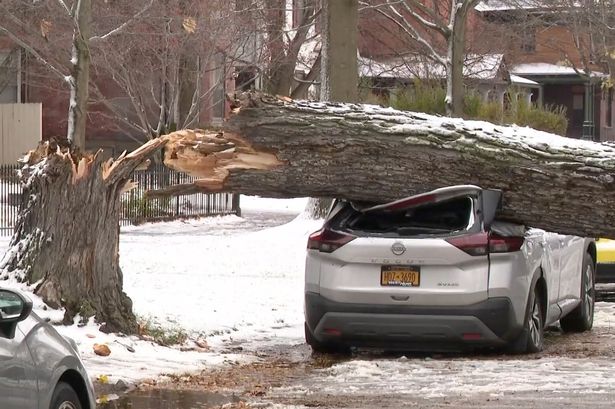 Powerful winds downed trees while snow blanketed roads (Image: WGRZ)
Western New York experienced a wild weather day on Thanksgiving with snow, wind, and ice wreaking havoc in the region.
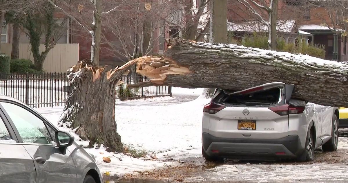
Wind is what had the most significant impact on Thursday, with gusts downing trees and snapping utility poles. A car on Lynwood Avenue in Buffalo was crushed when the powerful winds sent an enormous tree toppling over.
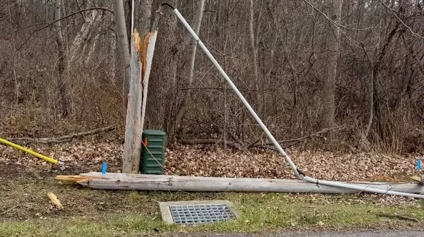
Icy roads also created travel chaos. One utility pole on Austin Street in Black Rock was knocked over when a vehicle slid into it amid the slippery conditions. The severe holiday weather is far from over, however, as a powerful snowstorm is set to hit the region on Friday, dropping up to 36 inches on some areas.
READ MORE: FDNY Commissioner explains ’emotional’ resignation over Mamdani’s mayoral winREAD MORE: Trump rages as he’s accused of displaying ‘fatigue’ and eating McDonald’s by ‘sackful’Powerful winds cause Thanksgiving power outages in New York
The National Grid reported that 49,000 customers had been impacted by the brutal Thanksgiving storm.
Services were mostly recovered by Thursday evening, with the number of impacted customers dropping to 300 in all of western New York. The last of the outages were in neighborhoods in Buffalo and Cheektowaga.
 Thousands were left without power during the storm(Image: WGRZ)
“We were ready for this, we had crews staged across western New York. We had brought crews in from outside the company, we brought some in from Syracuse,” a utility worker told WGRZ-TV.
Snow blankets parts of western New York on Thanksgiving
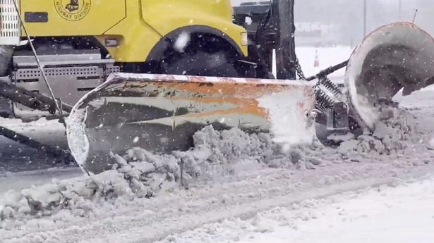
Buffalo and Hamburg didn’t experience much snow on Thanksgiving but just slightly farther south was an entirely different story. Springville, also located in Eerie County, was blanketed by snow.
 Heavy snow was plowed from the roads in Springville(Image: WGRZ)
Roads were covered in a thick layer of snow as trucks and heavy machinery were deployed to plow through the snowpack so that people could still reach their families over the holiday. “It wouldn’t be Thanksgiving if it weren’t snowing in Springville, New York,” Joe Steven, who was in the area visiting relatives, said.
Another round of snow to fall on western New York
Forecasters warn that snow could continue to impact travel during the post-Thanksgiving period with another snowstorm on the way.
Powerful winds are set to persist while temperatures will plummet as snowflakes pile up around the Great Lakes through Friday. AccuWeather predicts significant impacts, including snow-clogged roads, sporadic downed trees and more power outages.
“This will be the most widespread lake-effect snow event of the season so far,” AccuWeather Vice President of Forecast Operations Dan DePodwin warned. Snow could fall at a rate of two inches an hour or more in the most persistent bands of lake-effect snow.
 More lake-effect snow is on the way(Image: WGRZ)
In the heaviest snow areas downwind of lakes Superior and Erie, including parts of northern Michigan, northwestern Pennsylvania and western New York, AccuWeather predicts maximum snowfall of 36 inches. The heaviest snow is set to fall in the eastern Great Lakes, northern New York and the towns just between Buffalo, New York, and Erie, Pennsylvania.
Snow showers will extend well beyond the lakes, moving into parts of northeastern Indiana, northwestern Ohio, southeastern Michigan, western and northern Pennsylvania, northern New Jersey, southeastern New York and western New England.
“Some highways may close due to the heavy snowfall rate and perhaps chain-reaction accidents,” AccuWeather Meteorologist Elizabeth Danco said.
“Strong winds will cause water to pile up on one side of each of the Great Lakes while lowering levels on the opposite shore,” AccuWeather Meteorologist Brandon Buckingham added. “Lake Erie, due to its orientation towards the anticipated winds and shallow depth, will be most susceptible to this condition.”