
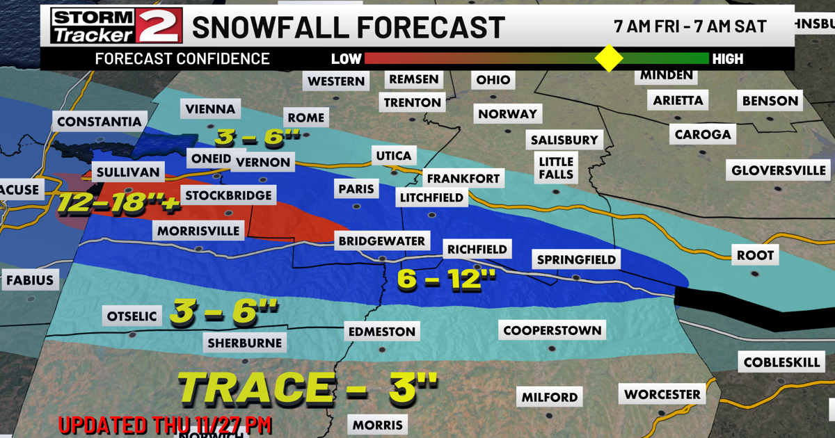

Heavy snowfall is set to move into Central New York on Friday, bringing reduced visibility and difficult travel. Lake Effect Snow Warnings remain in effect for Oneida, Madison, Herkimer, Hamilton, and Lewis Counties. The most intense snow is expected to reach the Thruway corridor Friday morning, then shift south toward the Route 20 corridor by afternoon. This is where the heaviest accumulations are likely, with totals potentially exceeding 12 inches. Areas outside the main lake effect band will see breezy conditions, with highs in the low 30s.
The heavy lake effect snow continues Friday night before tapering off early Saturday. A few breaks of sunshine are expected later in the day, with temperatures holding in the low 30s. Another low-pressure system arrives Sunday, bringing widespread rain and light snow, with highs in the mid 30s.
Monday stays mostly cloudy, with highs in the low 30s. We’re also watching a system expected to track south of the region on Tuesday, which could bring widespread light snow. Highs remain in the low 30s. Wednesday looks mostly cloudy, with another chance of snow on Thursday.