
Upslope snow continues through Saturday morning
Separate system brings few inches of elevation snow on Sunday
WEATHER WITH TYLER NOW. TYLER. YEAH, WE’VE GOT SOME FLURRIES STILL COMING ON DOWN HERE AT CHURCH STREET. WE’RE OUTSIDE OF BEN AND JERRY’S LOOKING AT THE S.D. IRELAND MIXER AND WATCHING THE CROWD FILL IN. WE’VE GOT A COUPLE OF DOZEN PEOPLE UP THERE, AND THE SHOW GETS UNDERWAY AT 530. SO WE’RE GETTING CLOSER AND CLOSER. IT IS COLD, IT’S WINDY, THERE’S A WIND CHILL, BUT IF YOU HAVE THE LAYERS AND MAYBE A WARM DRINK, IT WILL BE JUST FINE. THERE’S ACTUALLY MORE SNOW ON THE WAY. WE’LL SHOW YOU WHAT’S GOING ON WITH THE WEATHER MAPS RIGHT NOW. THESE SNOW SHOWERS ARE NOT VERY HEAVY IN NORTHERN AREAS. AT THIS SECOND, THE HEAVIER BAND HAS GONE TO THE SOUTH. IT CAUSED ALL KINDS OF ISSUES ON THE ROADS THIS MORNING, WHICH IS WHAT WE’VE BEEN EXPECTING FOR A COUPLE OF DAYS NOW. YOU’LL SEE HERE AS WE MOVE FORWARD. TEMPERATURES, 20S AND 30S DOESN’T RALLY FEEL LIKE THAT, THOUGH. WITH THE WIND CHILL IN THE TEENS, IN A LOT OF CASES, GUSTS 20 TO 30MPH. WE’LL STILL HAVE THOSE OVERNIGHT. THEY’LL STILL BE A LITTLE MOUNTAIN SNOW AS WE GO THROUGH THIS EVENING AND TOMORROW MORNING. BUT THEN THE SUN COMES OUT. IT LOOKS LIKE A REALLY, REALLY NICE AFTERNOON. AS YOU KNOW, IT’S SO HARD TO HAVE THAT FULL SUN THIS TIME OF YEAR, AND I THINK WE’LL HAVE IT IN THE AFTERNOON TOMORROW. THEN BY SUNDAY, A MESSY MIX. IT’S A HEAVY, WET SNOW. THERE’S SOME RAIN MIXED IN AND ROADS WITH SOME ELEVATION WILL BE REAL SLICK ON SUNDAY. THAT GOES MOST OF THE DAY, SO BE AWARE OF THAT. WE’VE GOT A SNOWFALL MAP HERE. THIS IS REALLY JUST SHOWING WHAT HAPPENS ON SUNDAY. NOT EXPECTING ACCUMULATION IN BURLINGTON, BUT A GOOD SWATH OF 2 TO 4IN. A COUPLE OF HIGHER AMOUNTS, BUT MOSTLY 2 TO 4IN IN THE MOUNTAINS UP AND DOWN THE GREEN MOUNTAIN SPINE TOWARDS THE UPPER VALLEY. EVEN A LOT OF ESSEX COUNTY IN NEW YORK. THEN, AS WE MOVE TO TUESDAY, THERE’S A BIG OCEAN STORM. I DON’T THINK IT COMES CLOSE ENOUGH TO REALLY SEND THE HEAVIEST SNOW OVER THE CHAMPLAIN VALLEY. BUT IF YOU’RE IN SOUTHERN VERMONT, YOU’RE LIKELY TO GET SEVERAL INCHES OF ACCUMULATION. IT MAY BE MORE LIKE 6 TO 12IN IN SOUTHERN AND CENTRAL NEW ENGLAND. THE CLOSER YOU GET TO BOSTON, REALLY. AND THAT MIX LINE WILL BE DETERMINED AS WE GET A LITTLE BIT CLOSER. IT’S STILL A WAYS OUT TO REALLY HAVE SPECIFIC AMOUNTS, BUT JUST AS A BROAD MAP, YOU SEE MORE SOUTH, LESS NORTH, PROBABLY NO ACCUMULATION. ON TUESDAY ON THE CANADIAN BORDER. IT’S ABOUT BEING SOUTH. SO HERE’S THE EXTENDED FORECAST KIND OF BACK AND FORTH A BEAUTIFUL AFTERNOON TOMORROW SUNDAY WE’VE GOT THE WINTRY MIX WITH A HIGH OF 39. COLDER IN THE MOUNTAINS. MONDAY THE SUN TRIES TO COME OUT. AND THEN TUESDAY THAT GLANCING BLOW FROM THE OCEAN STORM. LOOK HOW COLD IT GETS LATE NEXT WEEK INTO THE WEEKEND. WE’RE TALKING ABOUT HIGHS IN THE 20S AND AT TIMES IT’LL BE WINDY. SO JUST LIKE WE’
NBC5 First Warning Chief Meteorologist
Upslope snow showers continue to impact the Adirondacks, Green Mountains and White Mountains through Friday night, wrapping up Saturday morning.Several inches of additional snow are likely in the mountains through midday Saturday.A separate system brings a few inches of snow on Sunday, mainly over the higher elevations. A light accumulation is also possible in the Champlain Valley.Watch the video for more.Want more local news? Download our NBC5 mobile app for iOS and Android. STAY WEATHER-AWAREFor the latest weather coverage for your area, click here. Stay updated with alerts in the myNBC5 app, which you can download here.For the best weather information and Vermont and northern New York’s Certified Most Accurate forecast, watch NBC5 News by streaming at this link.Don’t forget to follow NBC5 News on Facebook, X (formerly Twitter), and Instagram.Follow the NBC5 First Warning Weather team on social media:Chief Meteorologist Tyler Jankoski Facebook | X | InstagramMeteorologist Ben Frechette Facebook | X | InstagramMeteorologist Matt DiLoreto Facebook | XMeteorologist Andrew Grautski Facebook | XMeteorologist Marissa Vigevani Facebook | X
SOUTH BURLINGTON, Vt. —
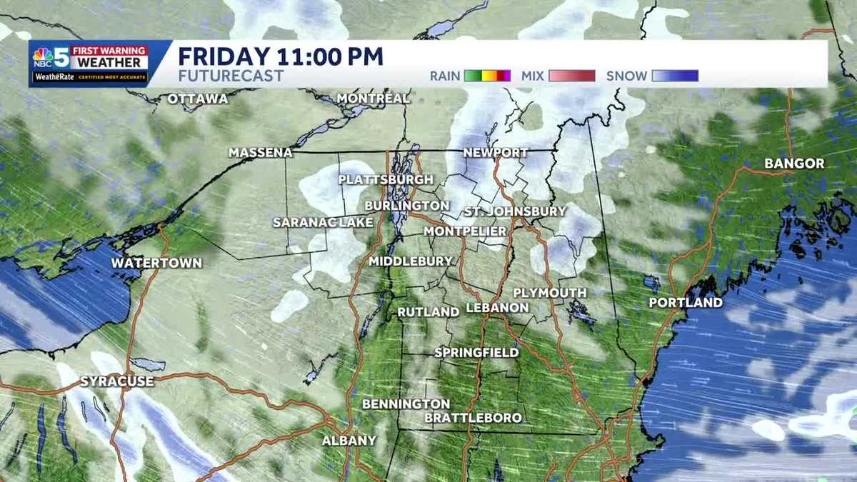
Upslope snow showers continue to impact the Adirondacks, Green Mountains and White Mountains through Friday night, wrapping up Saturday morning.
Several inches of additional snow are likely in the mountains through midday Saturday.
A separate system brings a few inches of snow on Sunday, mainly over the higher elevations. A light accumulation is also possible in the Champlain Valley.
Watch the video for more.
Want more local news? Download our NBC5 mobile app for iOS and Android.
STAY WEATHER-AWARE
For the latest weather coverage for your area, click here. Stay updated with alerts in the myNBC5 app, which you can download here.
For the best weather information and Vermont and northern New York’s Certified Most Accurate forecast, watch NBC5 News by streaming at this link.
Don’t forget to follow NBC5 News on Facebook, X (formerly Twitter), and Instagram.
Follow the NBC5 First Warning Weather team on social media: