
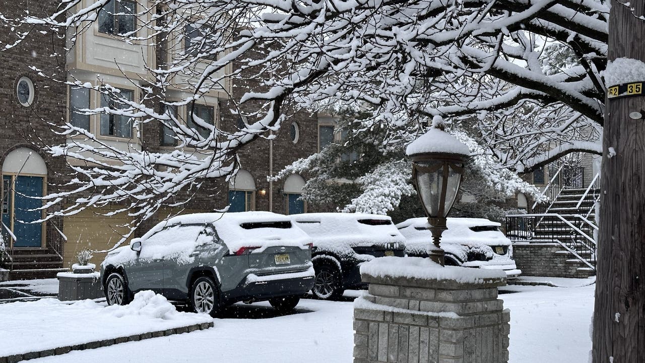
NEW YORK – Governor Phil Murphy has declared a state of emergency for Northwestern New Jersey due to a significant winter storm that will hit tomorrow.
What we know:
The National Weather Service (NWS) reports that certain areas of New York and New Jersey could see anywhere from 3–6 inches of snow tomorrow, Dec. 2.
JUMP TO: TIMELINE l TOTALS l LIVE UPDATES
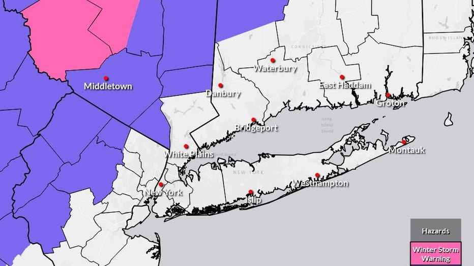
A winter weather advisory is in place for Orange, Putnam, Rockland and Western Passaic Counties for almost the entire day tomorrow.
Timeline:
The NWS predicted the most likely shift from snow to a wintry mix and then rain on Tuesday:
4 a.m.: Widespread snow inland, with a wintry mix of rain and snow near the coast. 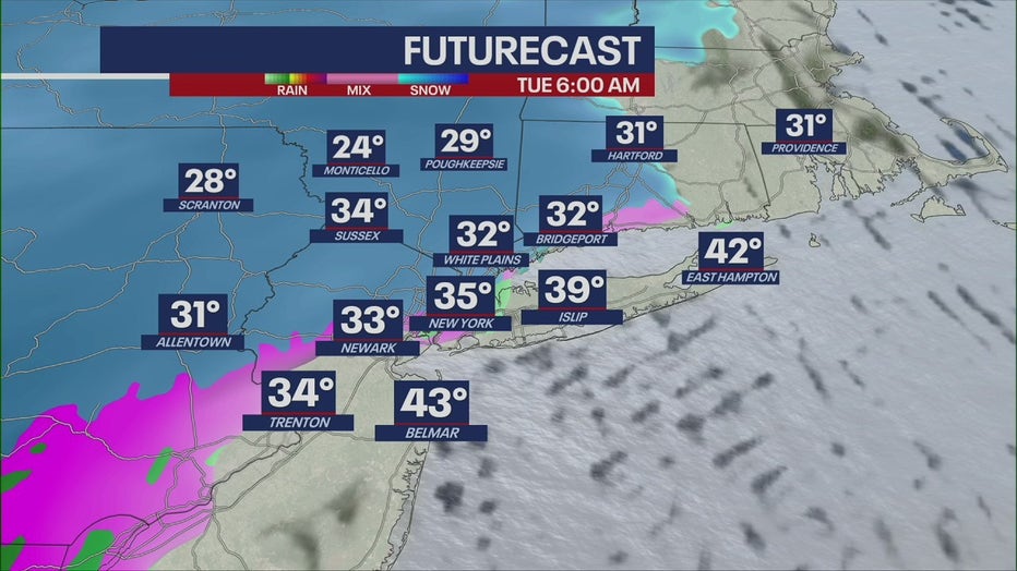 7 a.m.: Snow continues inland as New York City transitions toward a mix.10 a.m.: Rain moves into the city while the mixing continues northward.1–4 p.m.: Most of the region will experience rainfall, except pockets of lingering snow northwest.
 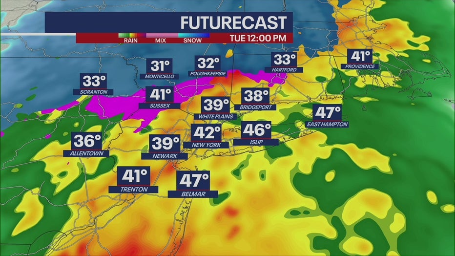 7 p.m.: Precipitation tapers, ending as a light mix inland. NJ weather: State of emergency due to snow
Gov. Murphy declared that New Jersey will enter a state of emergency effective at 5 a.m. tomorrow due to the winter storm causing hazardous weather conditions including heavy snow, sleet and freezing rain.
“I urge all drivers in these areas to exercise caution, remain alert, and follow all safety protocols.”
— Gov. Phil Murphy
The state of emergency encompasses Hunterdon, Morris, Passaic, Sussex and Warren Counties.
By the numbers:
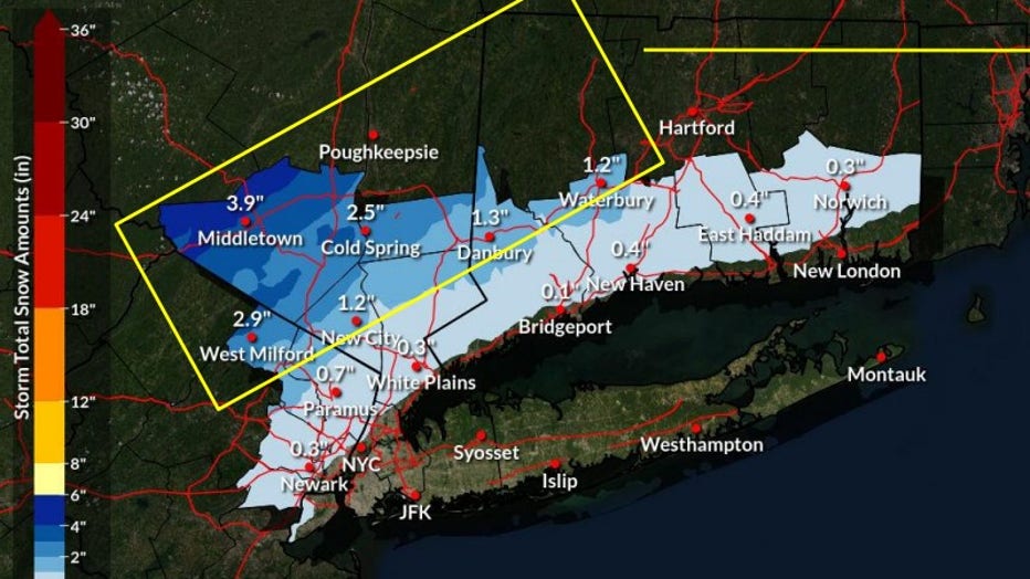
New York City and the immediate coast may see little to no snow, but parts of the Hudson Valley, northern New Jersey and Connecticut are in line for several inches before the changeover to rain.
According to NWS, snowfall projections have increased for some counties:
Highest predicted totals Orange County: 3 to 6 inches possibleWestern Passaic (N.J.), Putnam (N.Y.): 3 to 5 inches Moderate totals Rest of the Lower Hudson Valley, much of N.J.: 1 to 3 inches before mixing and changing to rain Tuesday morning Lowest totals New York City: Little or no snowLong Island: No snow currently expected
A map from the latest NWS briefing highlighted a corridor from northern New Jersey through the Hudson Valley and into interior Connecticut with the greatest potential for several inches of snow before the changeover.
By Tuesday afternoon, most lower-elevation areas will see plain rain before precipitation tapers off as a light rain/snow mix.
What we don’t know:
Forecasters still note uncertainty in the exact track of the low-pressure system.
A shift south and east could keep colder air in place longer — bringing higher totals farther south into coastal CT and possibly closer to NYC. A warmer track would sharply reduce totals along I-95.
NYC weather radar
Click here for more information.
The Source: This article includes information provided by the National Weather Serice and New Jersey Governor Phil Murphy.