An arctic blast spreads across the city today with light snow.
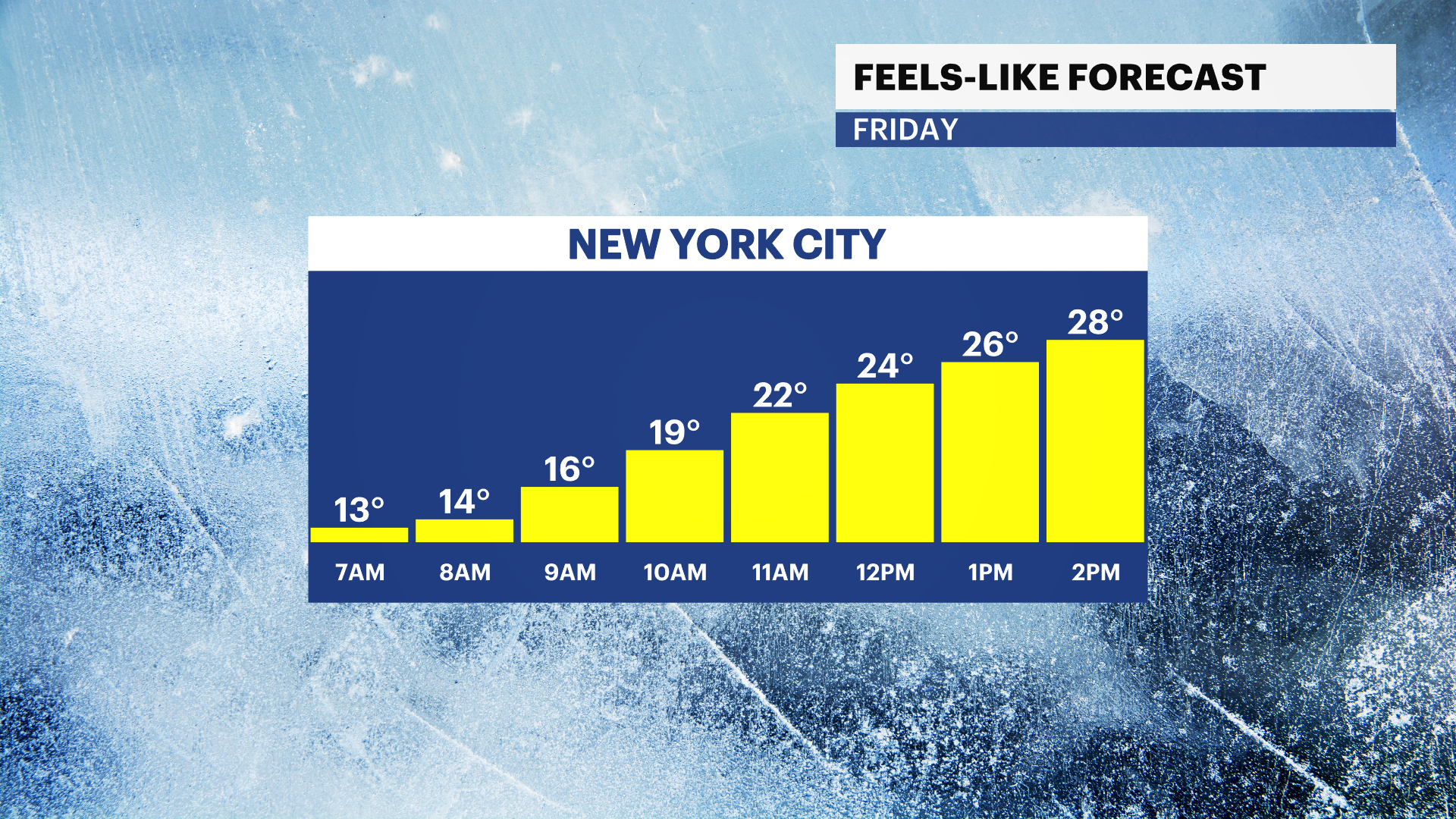
It’s a bitterly cold and bright start to the day. Morning temperatures are in the 20s with wind chills in the teens. This is the coldest air so far this season.
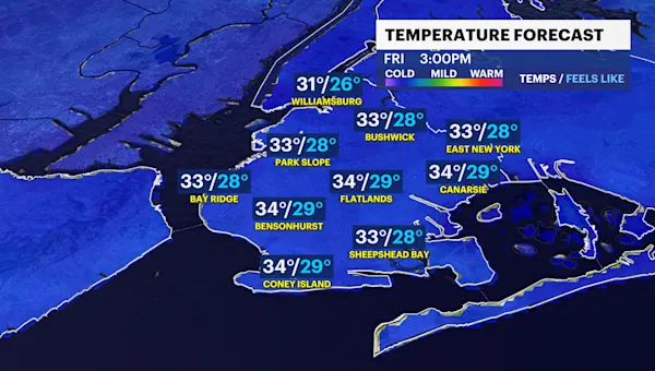
Today will be freezing with highs in the low-30s. Clouds build throughout the day as light snow moves across our area after midnight through 6 a.m. A light dusting of snow will bring some slick spots on untreated sidewalks and side streets.
Thankfully, the brutal cold eases into the weekend as temperatures stay below normal in the low-40s. It won’t feel as intense as today, but expect a mix of clouds and sun, cold temperatures in the 40s with light winds.
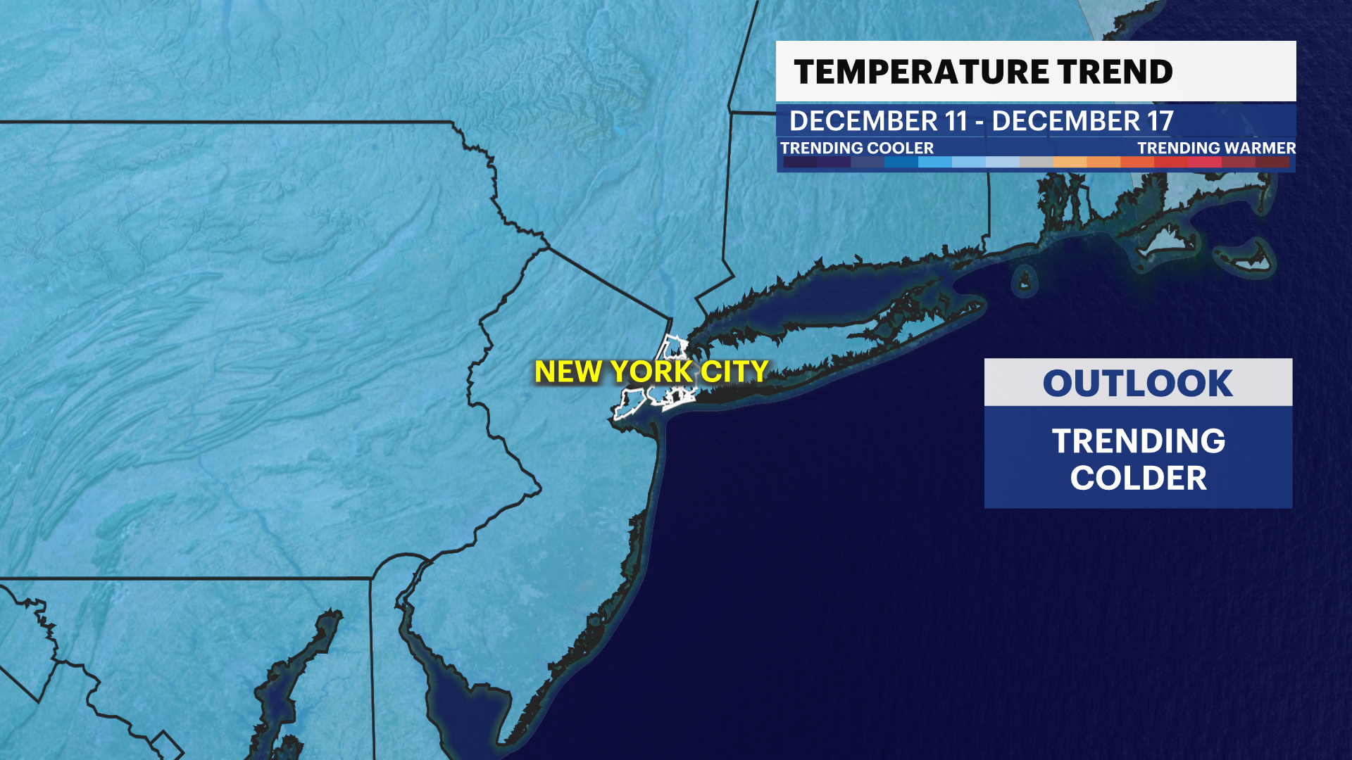
Temperatures remain colder than normal through next week with highs in the 30s and 40s. Our next chance of rain is during the midweek. Stay tuned for updates!
Today: Frigid start! Increasing clouds and freezing. PM light snow. Highs near 32.

Tonight: Light snow early, cloudy late and still very cold. Lows near 30.
Saturday: Slick spots early. Afternoon thaw under a mostly cloudy sky. Not as frigid. Highs near 40. Lows near 33.
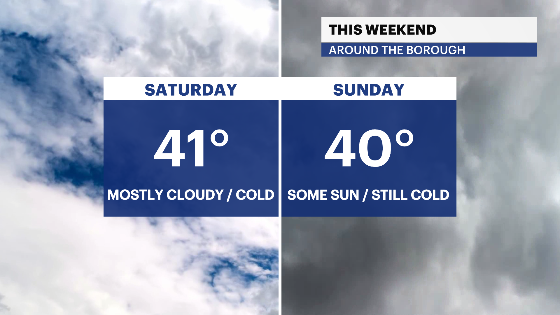
Sunday: Clouds and sun, cold. Highs near 41. Lows near 25.
Monday: Mostly sunny and brutally cold again. Highs near 32. Lows near 21.
Tuesday: Partly sunny and still very cold. Highs near 35. Lows near 32.
Wednesday: Partly sunny and not as cold. Chance of rain. Highs near 42. Lows near 34.
Thursday: Hints of sun and cold. Chance of rain. Highs near 43. Lows near 31.