
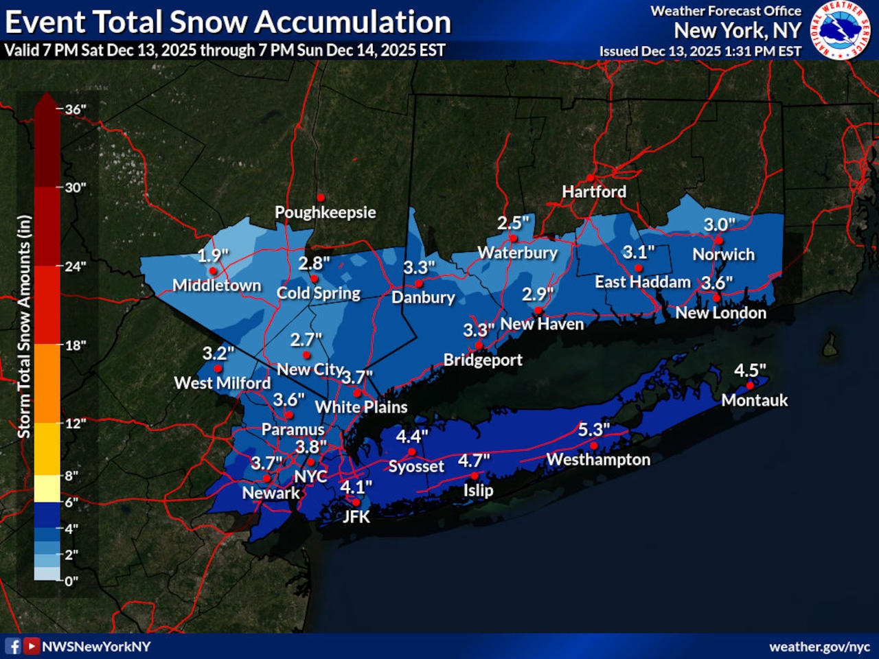
STATEN ISLAND, N.Y. — New York City is forecast to receive anywhere between two and four inches of snow by Sunday afternoon. Staten Island itself is expected to receive anywhere between three and four inches.
But just when will the heaviest snow come down?
According to Joe Pollina, a meteorologist with the National Weather Service, precipitation may begin to fall on city streets as early as Saturday afternoon.
Before the precipitation turns over to snow, there is a chance it could start out as rainfall.
There is a 20% chance or less that rain could start off before 7 p.m., those precipitation odds increase to 30-40% around 7 p.m. At that point, the rain is expected to transition to a rain/snow mix before becoming all snow around 8 p.m, Pollina explained.
The snow will “really be starting to get under way after like 8 (p.m.) or 9 (p.m.), but the bulk of the precipitation falls between midnight and Sunday morning,” Pollina told the Advance/SILive.com.
As indicated by the weather service, snowfall rates overnight could reach half-an-inch per hour.
The snow will begin to taper off around 7 a.m. Sunday, but will not fully clear until the late morning or early afternoon, according to Pollina.
“The winter season is in full swing, including all the winter weather that comes with it,” said Mayor Eric Adams. “All New York City agencies are prepared for this system, and we continue to monitor conditions closely. New Yorkers should all prepare too — avoid driving and give yourself extra travel time with public transit if you do need to travel, stay alert to changing conditions, and sign up for Notify NYC for real-time information updates.”
In anticipation of the fast-moving coastal storm, New York City Emergency Management has issued a weather alert that will remain in effect from Saturday through Sunday.
In addition to tracking the storm, the weather service has also issued a winter weather advisory. The advisory will remain in effect from 10 p.m. Saturday through 1 p.m. Sunday.