
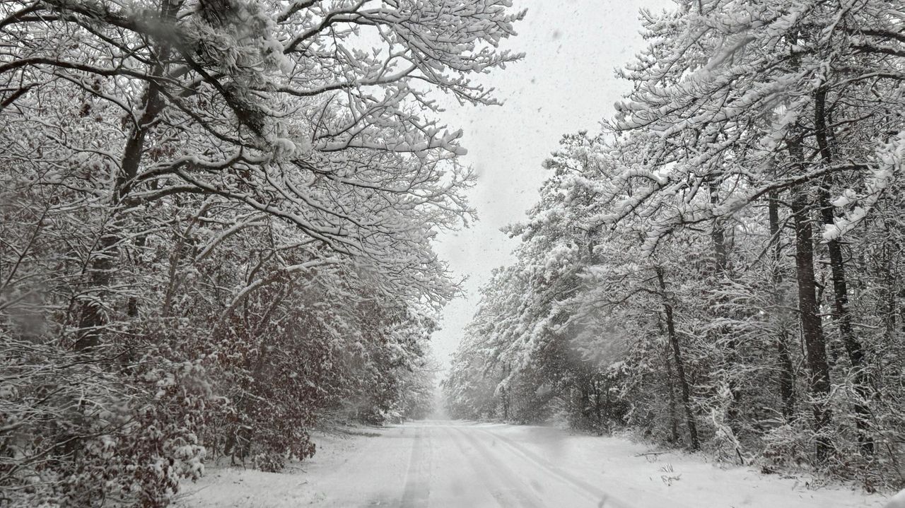
Long Island’s first snowstorm of the season had dumped more than 7 inches so far in certain locations by Sunday afternoon, spurring flight delays at area airports and warnings to stay home and off the roads amid icy fog and overall treacherous conditions.
The snow began across Long Island at about 10 p.m. Saturday, continued overnight and past dawn, and appeared to be reduced to flurries by Sunday afternoon with blue skies briefly visible in some areas amid otherwise thick clouds. A winter weather advisory ended at 3 p.m.
The snow is the result of a quick-moving low-pressure system crossing the region and expected to pass generally from west to east, forecasters said.
Levittown was reporting the most snow in Nassau — 7.2 inches, with Center Moriches and North Patchogue leading the way in Suffolk with 7 inches each.
“Steady snow coming to and end through 3 pm, with scattered snow showers into early this evening,” said a post on the weather service’s website Sunday afternoon. “Additional snow accumulations of a dusting to 1/2 inch, highest east. 4 to 7 inches, locally 8 inches, storm total snow accumulation.”
Roads across Long Island were wet and slippery, and authorities warned that travel Sunday could be hazardous.
“Please, if you don’t have to go out, stay home. Watch Netflix. Watch a good movie, watch the football games,” Nassau County Executive Bruce Blakeman said in a statement. “Take it easy if you have to go out, if there’s a Christmas party or a Hanukkah party, go slow. Go very slow. Plan on having a longer commute to wherever you’re going, because if you take it nice and slow, you can get there safely, and we’ll have the roads cleaned up as soon as possible.”
Snow and freezing fog was reported at Republic Airport in East Farmingdale and Long Island MacArthur Airport in Islip. Temperatures were hovering around the freezing mark at both airports, with lows in the high 20s elsewhere, according to the weather service.
Snow amounts appeared noticeably higher north of Farmingdale into Sunday afternoon. A heavy blanket of snow shrouded the trees guarding the traffic circle at Bethpage State Park. A few miles north, the snow seemed slightly heavier in Plainview, where Central Park Road disappeared in snow behind Plainview Hospital.
Near Republic, New York State plows and sand trucks were seen making at least three passes at Route 109 in the three hours between 5 and 8 a.m. Sunday, clearing the slushy snow down to the road surface. Within each passing hour, snow would continue to fall and again obscure the roadway.
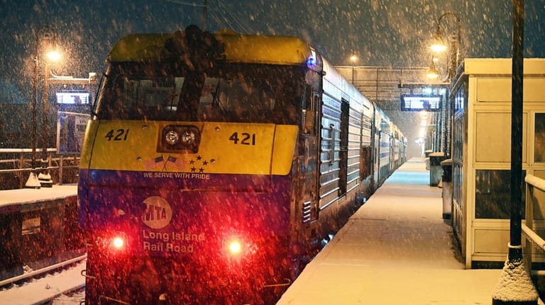
A LIRR train pulls into the Kings Park station Sunday morning as a blanket of snow forms on the platform. Credit: Joseph Sperber
Oyster Bay town supervisor Joe Saladino said that 150 of the town’s plows were clearing roads.
Meanwhile, the Long Island Rail Road reported most its service was on or close to schedule Sunday. The Nassau and Suffolk police department had no reports of weather-related crashes on roadways by the afternoon.
New York’s major airports announced full ground stops due the weather just before 8 a.m. then reported significant delays expected to last into the afternoon.
Inbound flights to Kennedy were being delayed “at their origin an average of 3 hours 16 minutes” Sunday afternoon, according to FlightAware.com. Departures were delayed by an average of 28 minutes, according to the website. At LaGuardia, departure delays were averaging 1 hour and 15 minutes with inbound flights delayed at their origin by an average of 5 hours and 51 minutes, FlightAware’s latest data shows.
Forecasters with the weather service Saturday had predicted at least 5 inches of snow would make it the highest level of accumulation on Long Island in a single storm since January 2022, when a blizzard pounded the region.
Temperatures on Long Island are colder than normal, said National Weather Service meteorologist Joe Pollina.
“Sunday, highs generally in the low 30s [are expected], maybe some mid-30s across the East End, Twin Forks areas,” he said.
Daytime temperatures are expected to remain at or below freezing on Monday, and increase to 34 degrees on Tuesday, according to the forecast.
The low temperatures mean the snow is likely to stay on the ground through the middle of the week, Pollina said.
Some relief is expected later in the week, with highs of 43 forecast for Wednesday and 51 for Thursday under partly sunny skies.
Newsday’s Sam Kmack, Tracy Tullis and Joseph Ostapiuk contributed to this story.