

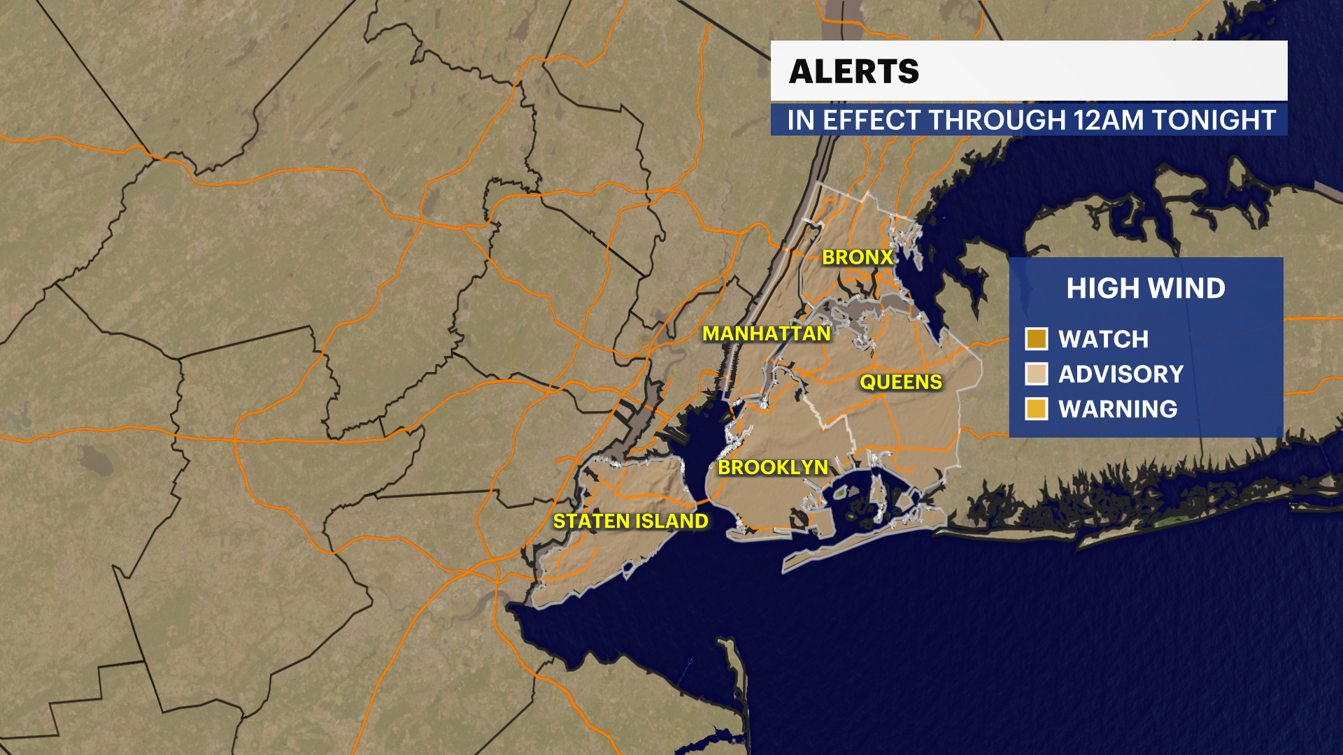
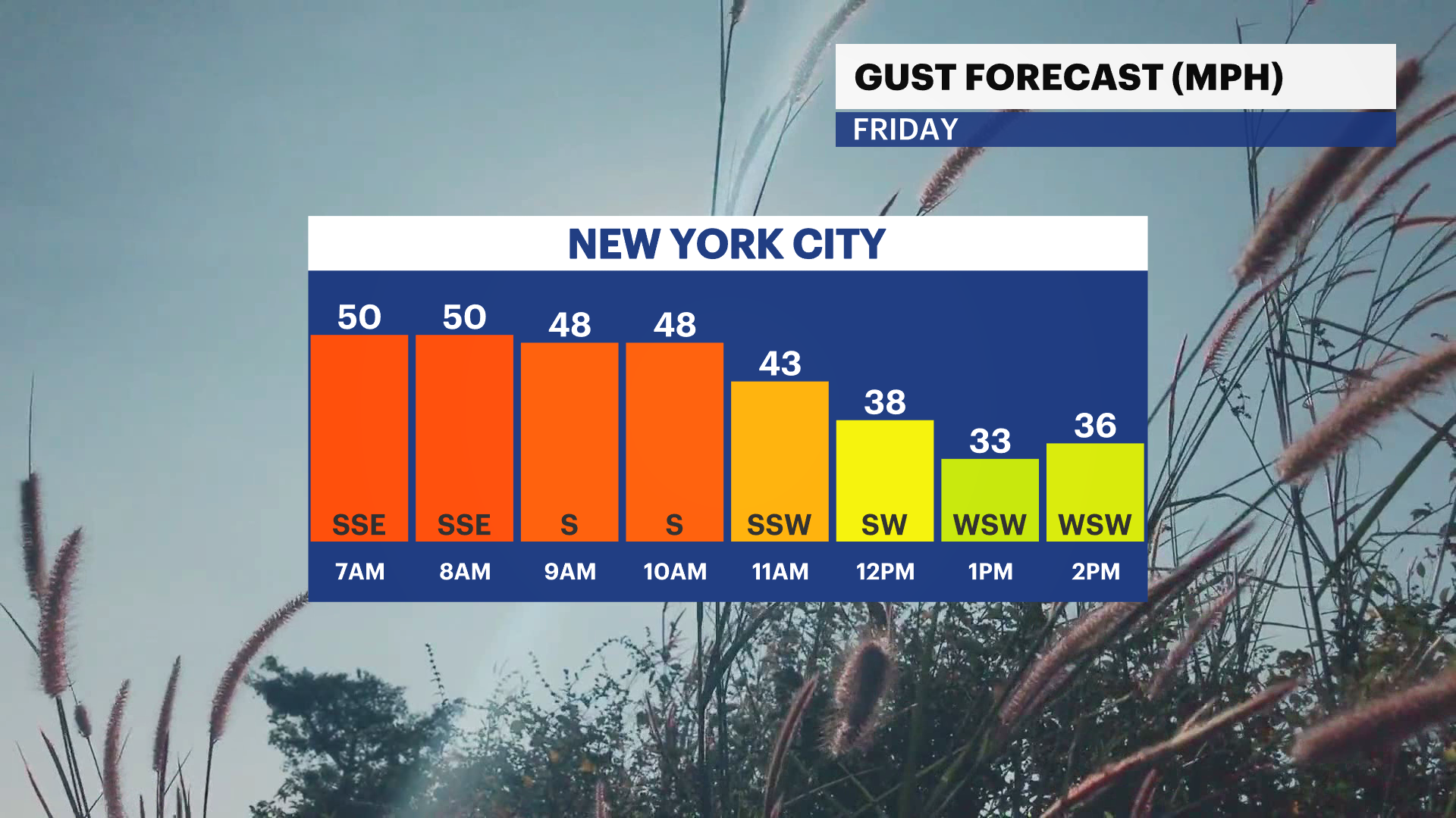
A wind advisory is in effect through 12 a.m. tonight. Gusts up to 55 mph is expected today. Isolated wind gusts near 60 mpg are possible with any thunderstorms.
A Coastal Flood Advisory is in effect in Brooklyn through 11 a.m. Minor flooding near the waterfront and low-lying areas is expected. Heavy rain during high tide may exacerbate flooding conditions.
Heavy rain and high winds is bringing treacherous travel for the morning commute. Temperatures will rapidly fall throughout the day with gusty winds.
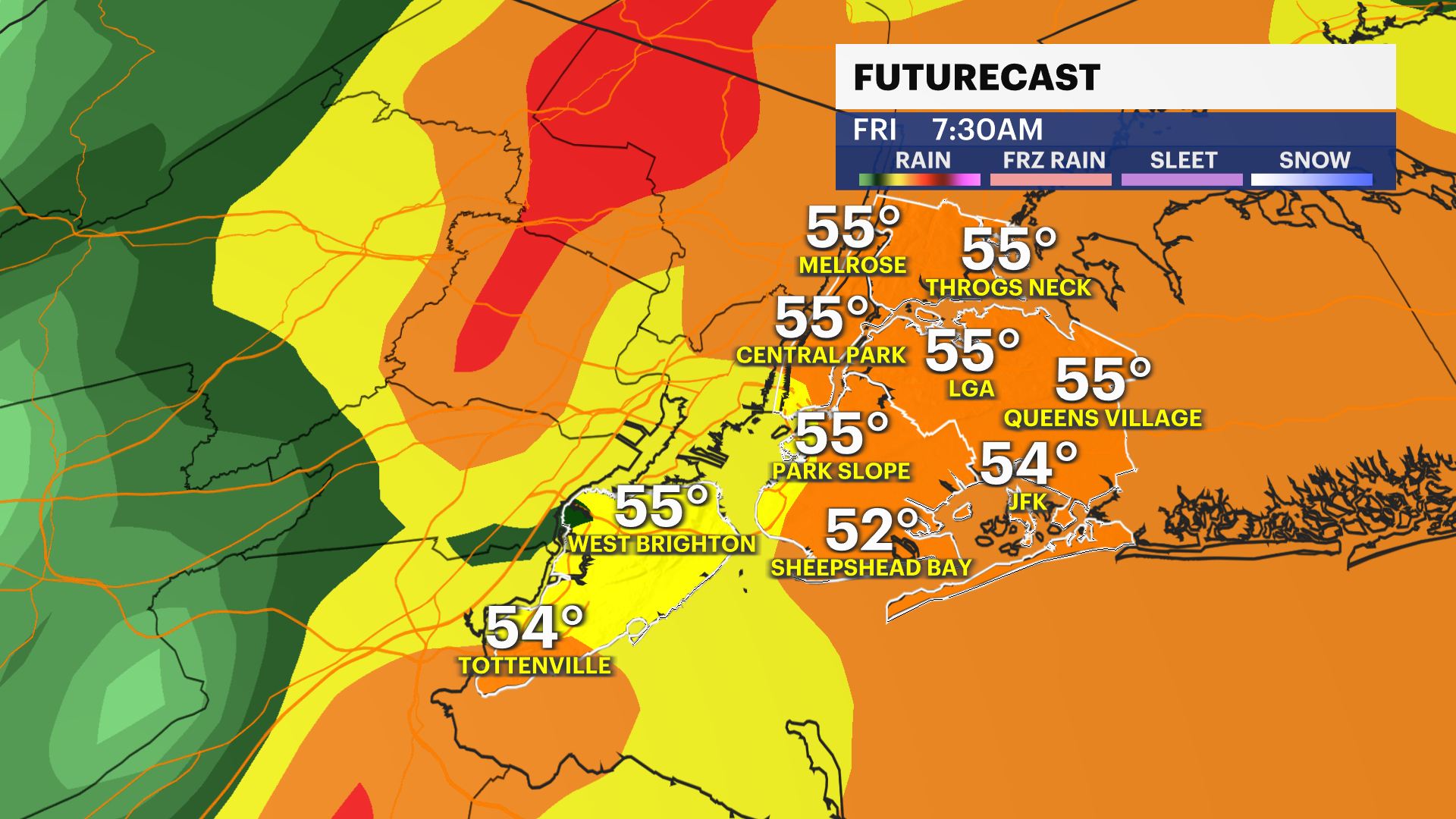
It’s a mild, wet and windy start to the day. Temperatures are in the 50s.
Expect widespread soaking rain and some snowmelt to cause poor visibility, localizing flooding and large ponding. 0.75-1″ of rainfall with locally higher amount with any downpours. Gusts 40 to isolated 60 mph will cause downed trees and a few power outages across the city.
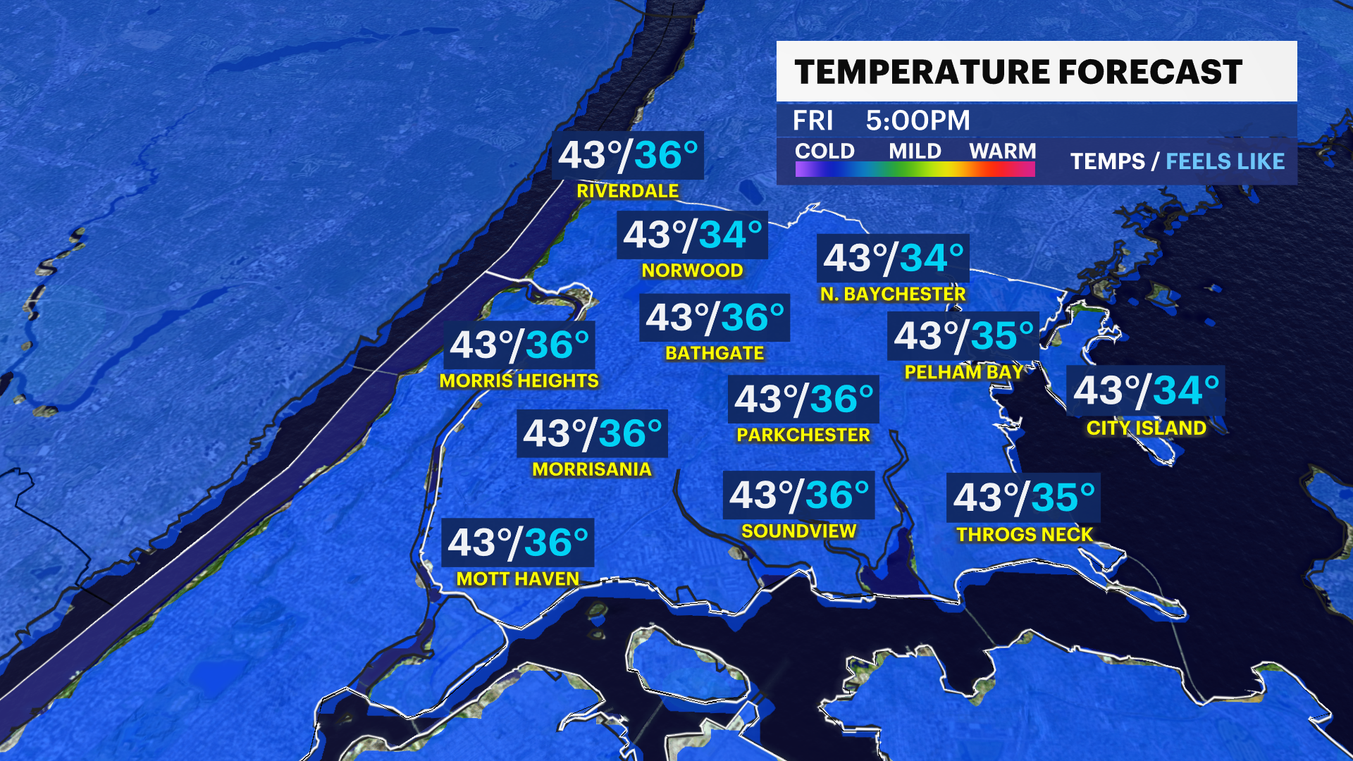
The storm exits around 1 p.m. Temperatures start off in the mid to upper-50s and quickly plummet to the low-40s by the evening commute. Lows will be in upper-20s m by Saturday morning. Any standing water or ponding will likely freeze over as temperatures fall below freezing. Record highs are possible this morning. The record is 58 degrees setback in 1931.
It gets colder on Saturday with highs in the 30s and breezy conditions.
The Winter Solstice officially starts on Sunday at 10:03 a.m.. Temperatures bounce back to the upper-40s with windy conditions on Sunday.
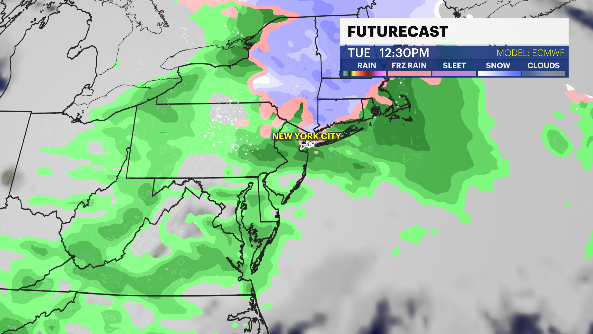
Our next chance of wintry weather is on Tuesday. A weak frontal system will bring a chance of rain/snow mix to the city. Stay tuned for updates!
Christmas is less than a week away and the likelihood of seeing a white Christmas is low. A white Christmas is categorized as having at least 1″ of snow on the ground by 7 a.m. on Christmas. The last time we had a white
Christmas was last year. A storm system will be nearby Thursday into Friday bringing a chance of rain. Temperatures are in the 40s. Stay tuned for updates.
Today: Windswept downpours. Afternoon clearing and windy. Falling temps. Highs near 57.
Tonight: A few clouds, cold and gusty. Lows near 29.
Saturday: Partly sunny and colder. Breezy at times. Highs near 39. Lows near 34.
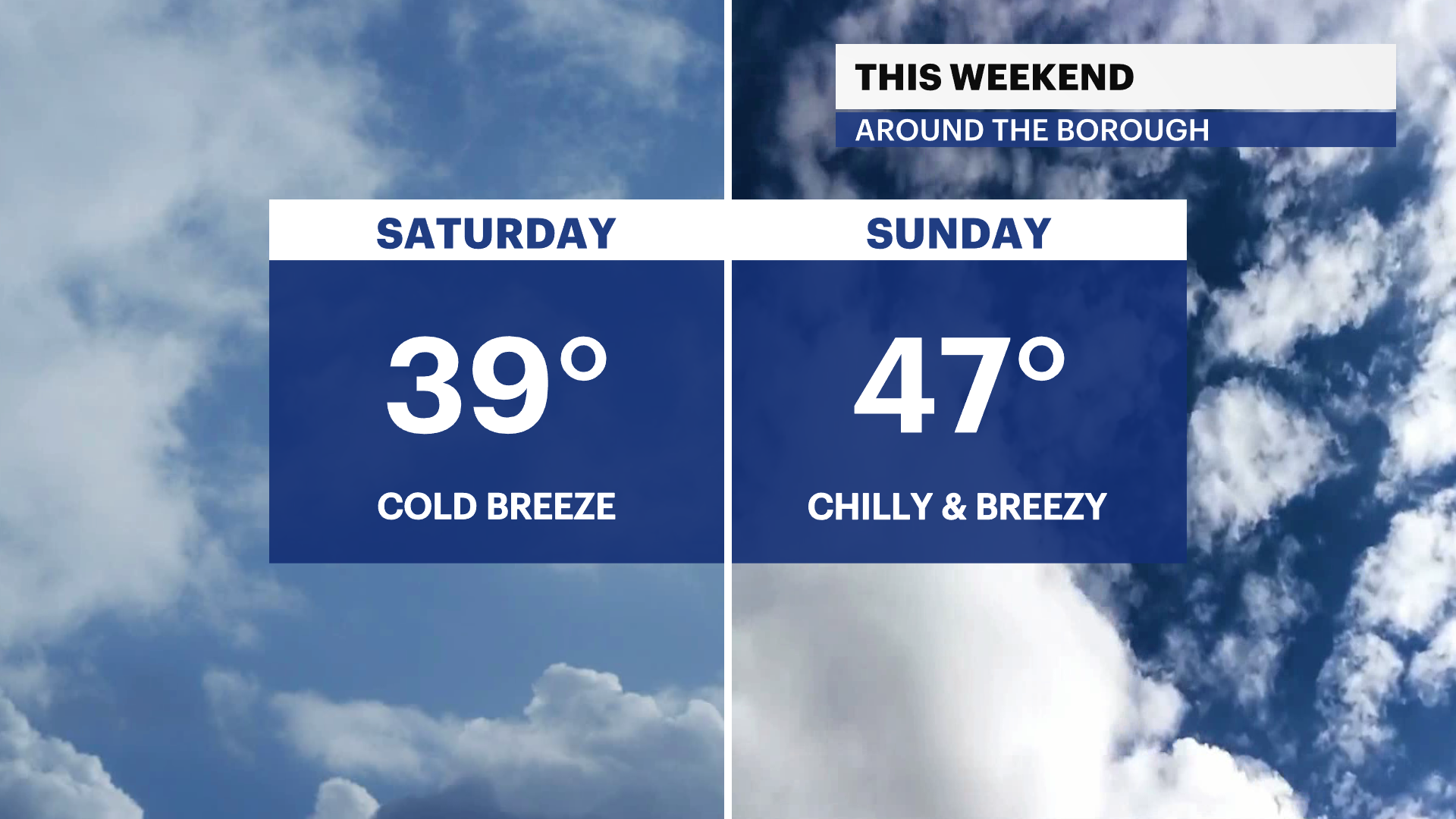
Sunday: Mostly sunny and chilly. Windy. Highs near 47. Lows near 29.
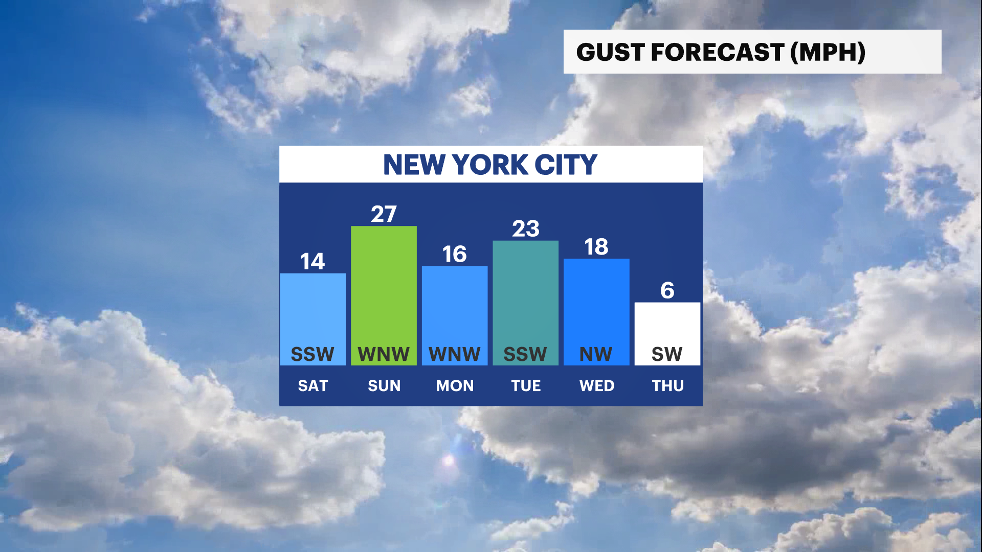
Monday: More sunshine, colder and breezy. Highs near 35. Lows near 28.
Tuesday: Mostly cloudy and cold. Chance of rain/snow mix. Highs near 39. Lows near 33.
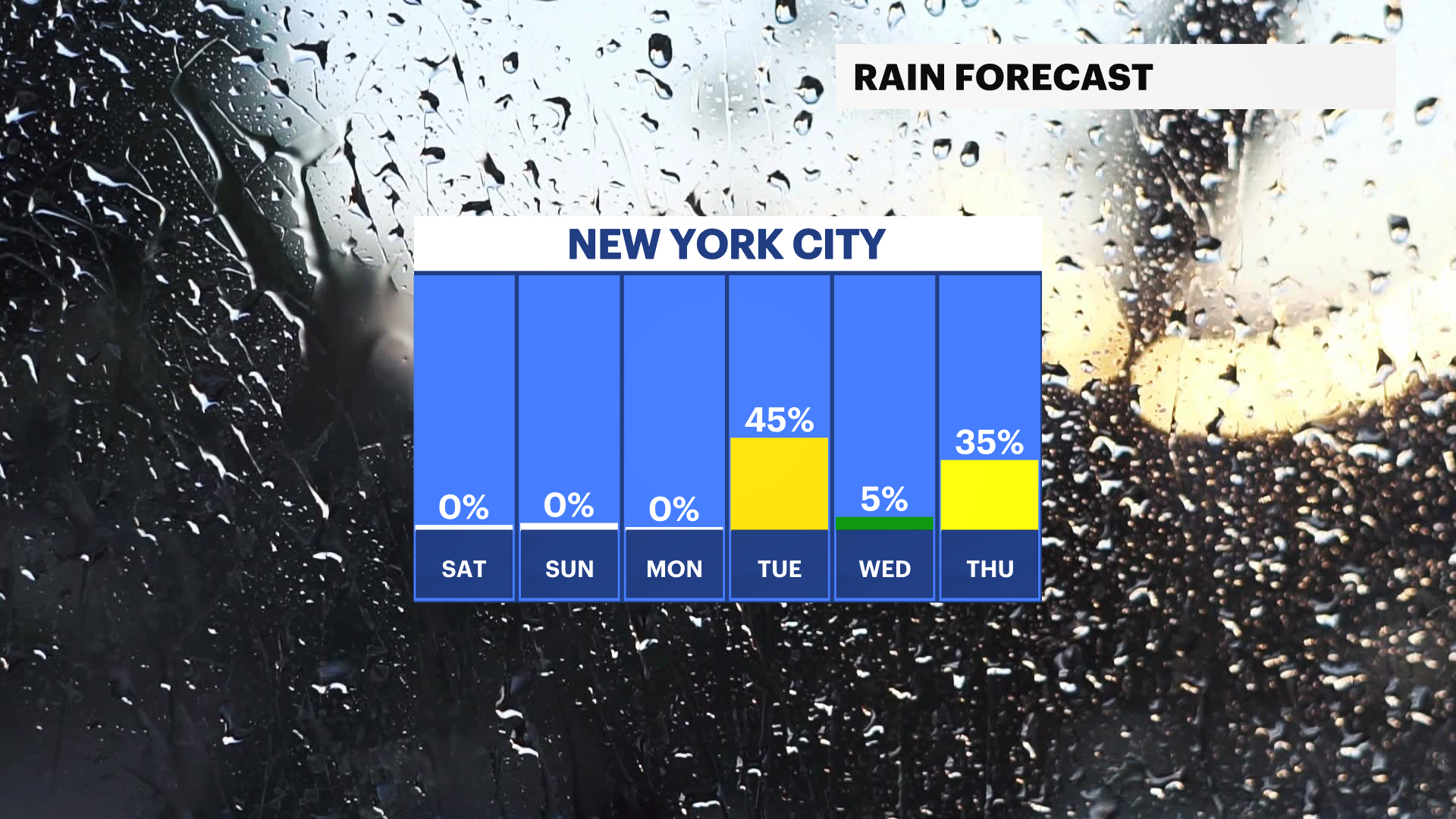
Christmas Eve: Sun and clouds and not as cold. Highs near 42. Lows near 32.
Christmas Day: Mostly cloudy and cold. Chance of rain. Highs near 43. Lows near 35.